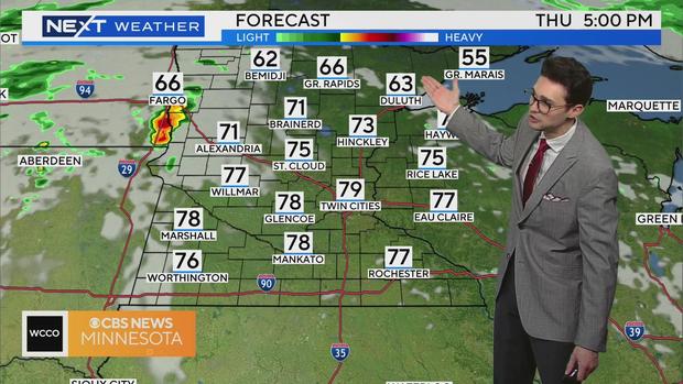
Brief warmup Thursday in the Twin Cities ahead of more rain


MINNEAPOLIS — Along with some sun, a warm front to the north will help heat up the Twin Cities close to 80 degrees on Thursday.
This may also throw a few showers across central and northern Minnesota on Thursday, with the rain and storms becoming more widespread into the night. Severe chances remain low with limited instability.
The trailing cold front will pass on Friday morning, bringing more showers and some thunder for everyone to start the day.
Most dry up by the afternoon, but the rain could linger a bit longer farther north. It'll be breezy and cooler behind the front with highs back near 70.
Saturday through Memorial Day won't be a washout, but keep an umbrella nearby with isolated shower-and-storm chances each day.
Several waves of energy aloft will pass through, but there won't be a lot of lift coming from the surface to help generate steady rain.
High temps stay on the cooler side, close to 70 all weekend.
High pressure returns Tuesday into mid-week ending the cool, unsettled pattern with sunshine and a warming trend.
Drought Update
As expected, drought conditions are improving across parts of northern Minnesota, but some moderate drought remains from Brainerd to Roseau.
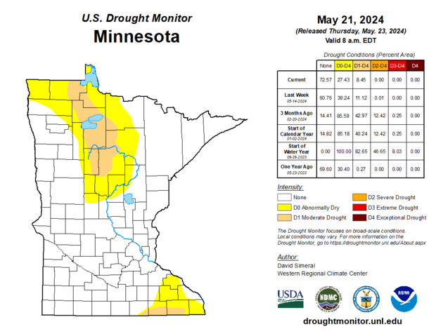
This update doesn't include Tuesday's rain, so this trend should continue in next week's map.
This is the first time since May 2023 that less than 10% of the state is in a moderate drought or worse.


