Boston Marathon Weather Forecast Update: Sunny And Warm
We are not expecting much if any shower activity on Marathon Monday.
Watch CBS News
We are not expecting much if any shower activity on Marathon Monday.

So will this year be another year for the weather record books for the Boston Marathon? It is possible.

So, what's the early forecast for the 2012 Boston Marathon? Warm.

Snow is in the forecast for the final day of March and the first day of April once again.

Local farmers say that fruit trees are about 3-4 weeks ahead of schedule and are now in danger of being killed.

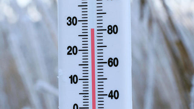
This afternoon Boston will top off in the low to mid 80's, again just about normal, if today were July 22nd instead of March 22nd!
If you liked this winter, it looks like you will love the start of spring.

Last week's two-day winter storm might just have been winter's last punch.

This winter, Boston came so close to a record-setting winter.

Cold air will make its way all the way into southernmost New England making for a snowy finale to this long duration storm.

The 1-3" we got from round one is just an appetizer and unfortunately the snow will likely stick to the roads much easier by round two.
For the first time this winter, we are in for a legitimate snow storm here in southern New England.

This is one event that meteorologists will be glad when it is over. There is certainly room for snow totals to increase and also for school closings on Thursday, so stick with us!

The most likely places to see any significant snow accumulation are the northern and western suburbs of Boston.
After dark, a fairly potent second wave of precipitation will arrive and bring some heavy rain with potentially some thunder as well.

Precipitation will start just before dawn on Friday and will be falling into marginally cold air near the ground making for an interesting forecast for Friday morning's commute.

If somehow we manage to go the rest of winter without any measureable snow (certainly possible) than this season would go down as the least snowy season ever!
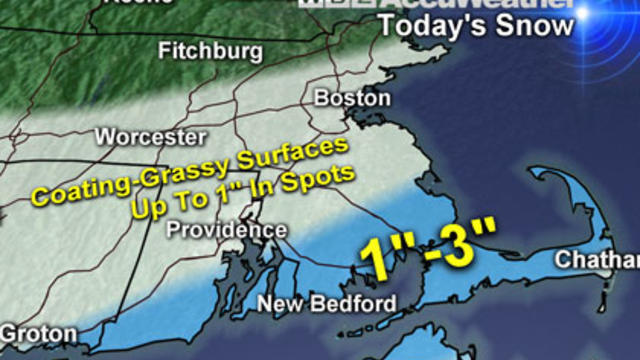
Today's storm will drop much less snow than previously expected.

This storm will truly be a daytime event, on average from 6-to-8 a.m to 4-to-6 p.m. Saturday.

Amounts are very tough to forecast this early, but it is likely that southeastern Massachusetts would be in line for the greatest snow accumulation, which could be in the 3-to-6 inch range.

There is plenty of winter left. Boston averages nearly 20 inches of total snow in the months of February and March.

Our next storm, which arrives this evening, will be much like all the others, with snow, but very little accumulation.

Our next storm, which arrives this evening, will be much like all the others, a wintry mix to mainly rain and no significant snow accumulation.
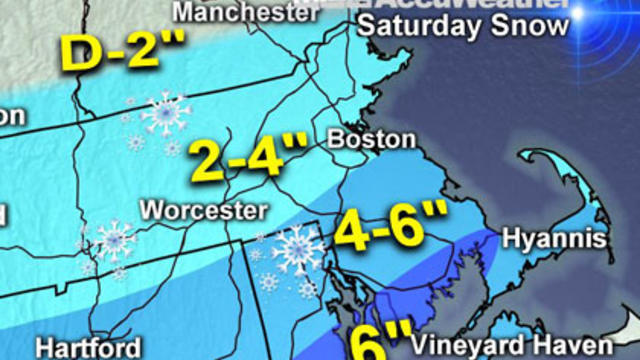
The snow has begun to fall across our area and for many this will end up being the biggest snowfall so far this season, including Boston!

The biggest snowfall of the season for many in eastern Massachusetts is on the way Saturday.