Hurricane Sandy's Peak In Southern New England Comes This Afternoon
The peak of Sandy for southern New England will come between noon and 8 p.m. Monday.
Watch CBS News
The peak of Sandy for southern New England will come between noon and 8 p.m. Monday.
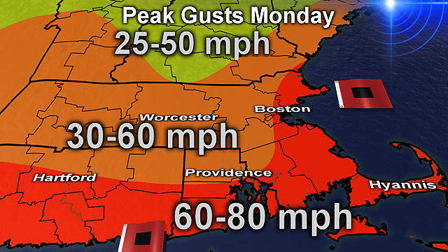
Hurricane Sandy is bearing down on the East Coast with maximum sustained winds at 85 mph Monday morning.

We've been talking about Sandy for a week now, and it's arrival is Monday.

Boston Public Schools will be closed Monday and all non-essential city employees have been advised to stay home.
The National Hurricane Center says this could be the largest tropical storm ever in the Atlantic Ocean.

As Sandy continues her path up the coast, Massachusetts Emergency Management is preparing state residents for power outages.

President Barack Obama has spent months trying to balance his re-election bid with running the government.

Massachusetts officials have opened the state emergency operations center in Framingham to get ready for Hurricane Sandy.

Confidence continues to increase for the track and severity of Sandy this morning. Nearly all weather models forecast a landfall in Central New Jersey Monday night.

A list of storm-related closings.
A calm Saturday did not reflect what Sandy has in store for the coming days.

This is going to be a powerful and damaging event but likely not be a catastrophic event.
It looks like Sandy is going to hit New England no matter what its track is at this point.
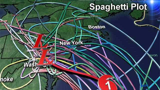
If we take a direct hit Sandy would go down in New England weather history joining some of the more memorable storms like the Blizzard of '78 and the Perfect Storm.

Our midday and afternoon models are pouring in and forecasting some significant changes in the ultimate track of Hurricane Sandy.
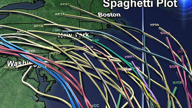
Some major developments in the past 24 hours with regards to Hurricane Sandy and its eventual track up the Coast…First of all, Sandy strengthened overnight into a category 2 hurricane.

The likelihood of New England feeling some effects from Sandy is increasing.

So you may have heard… meteorologists up and down the East Coast are all on heightened alert this week. What has all of our attention? A little storm currently located about 325 miles South of Jamaica.

The cold air is coming. You will feel it if you go outside this evening, pouring in from Northern Canada, a somewhat unusually cold air mass for this date in October.

The National Weather Service has issued a freeze watch for just about all the suburbs away from and along the coast Friday night into Saturday morning.

So the big question for many will be - does this mean that all the mosquitos will die off and EEE and West Nile fears will end?

The main weather action will occur at night, around midnight in western Massachusetts and near dawn on Wednesday in eastern Massachusetts.

Rainfall amounts will be 1-3 inches, leading to the potential for some localized street flooding just in time for Wednesday mornings commute.
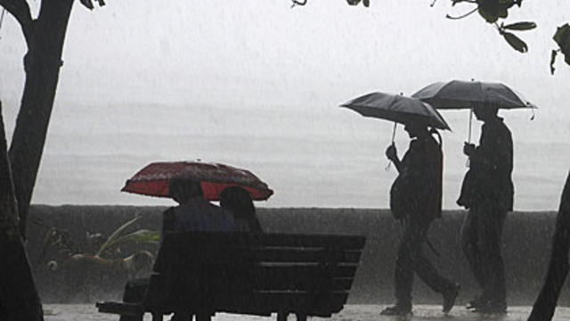
Expect to see a lot of rain showers over the next week.

The Storms Prediction Center has put much of southwestern New England in a moderate risk category for severe weather. Unfortunately, an isolated tornado cannot be ruled out later today.