Keep the umbrella handy, rainy weather in the forecast
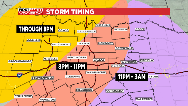
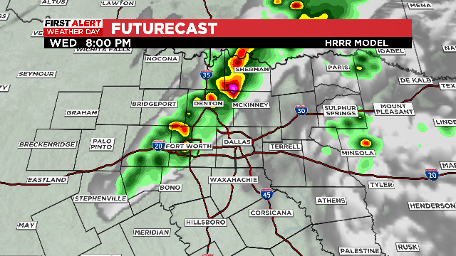
Storms are likely Tuesday night along the northern third of our area including the Metroplex. The main threat will be brief heavy rain along with hail.
Watch CBS News
Storms are likely Tuesday night along the northern third of our area including the Metroplex. The main threat will be brief heavy rain along with hail.
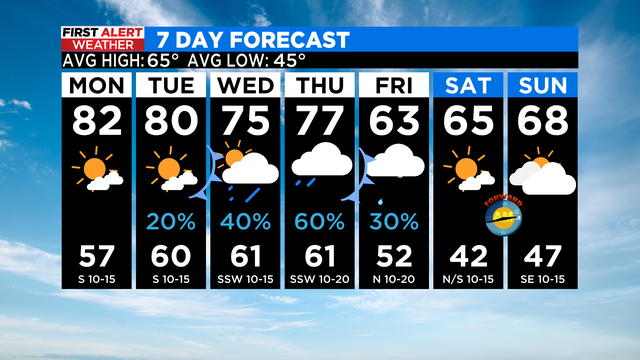
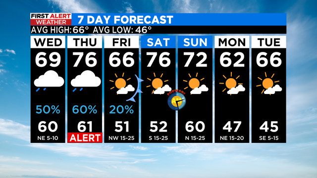
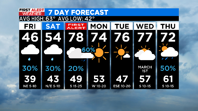
On Monday, we'll have more spring-like weather. For the rest of the week, our forecast will become a bit unsettled as a cold front stalls near North Texas.

More sunshine and highs in the upper 70s again today, but the middle of the week gets a bit trickier as rain chances return to the area.
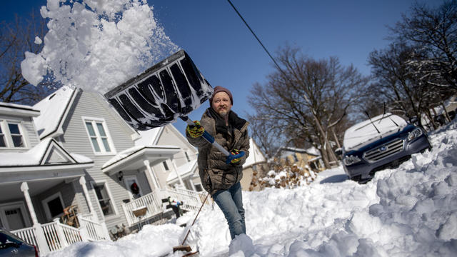
More than 466,000 utility customers in Kentucky and Michigan were without power Saturday night.
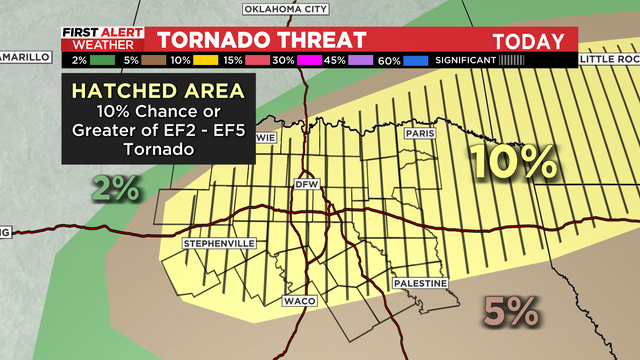
Most of North Texas is under a tornado watch until 10 p.m. Thursday.

Los meteorólogos de CBS News Texas han declarado una alerta del tiempo debido al riesgo de tormentas fuertes entre la tarde y la noche el jueves.
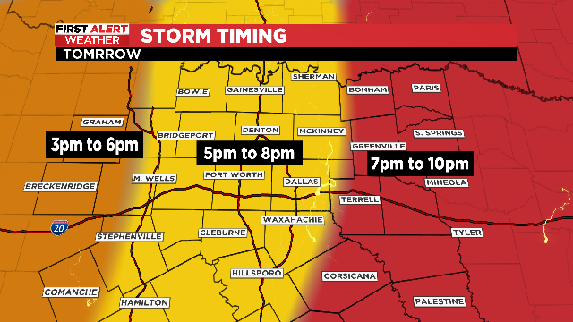
The higher risk of severe weather Thursday is on the east side of the I-35 corridor. Once the storm clears, be aware that very strong winds will move in behind the front.
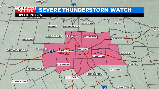
The First Alert Weather team has issued a weather alert until noon today for the potential of strong to severe storms.
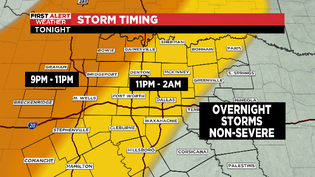
Storms will be out of the area in time for the Monday morning commute.
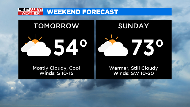
Not a lot changes with Saturday's forecast, but by Sunday our winds pick up out of the south and our temperatures jump back into the 70s.
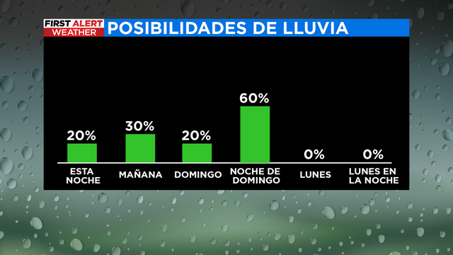
Nuestro equipo de meteorologos estan pronosticando tormentas fuertes a severas este domingo en partes del Norte de Texas durante la noche. Se sugiere que se mantengan alertos.
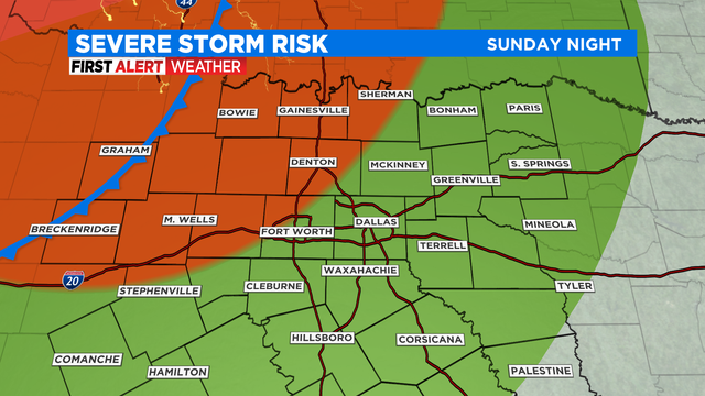
The threat for severe weather late Sunday extends into North Texas, so a First Alert Weather Day has been issued.
Our morning hours remain cold and brisk with northerly winds 5-15 mph. Winds subside through the day as temperatures warm to the low 50s under sunny skies.
There is still a strong CAP over a lot of North Texas – but there is a potential of strong to severe storms to develop.
Hoy tendremos la potencial de tormentas, granizo y tornados aislados en partes del metroplex.
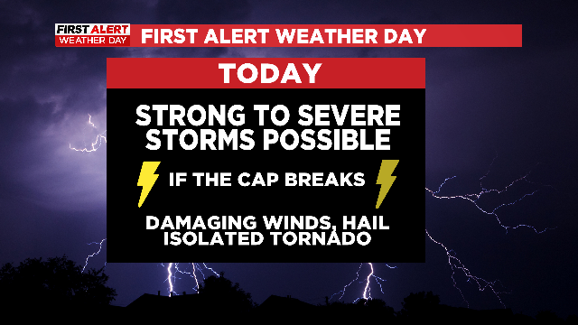
If the "cap" breaks, North Texas will have an active evening as damaging winds, isolated tornadoes and large hail will all be possible.
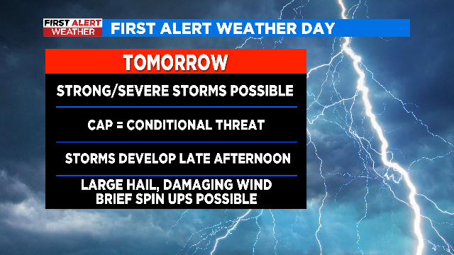
With a strong cold front approaching late Wednesday evening, there's the chance for some storm development in the afternoon and evening.
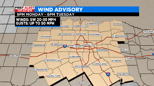
We start the work week mild with afternoon highs in the 60s and 70s through Wednesday, then the bottom drops out on Thursday.
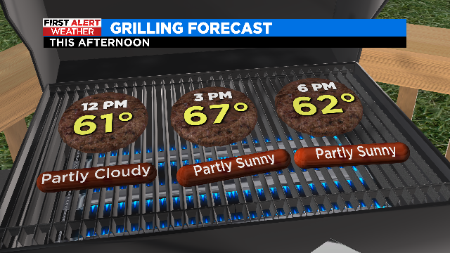
We are starting off cold, in the upper 20s in some spots, with partly cloudy skies before we warm up this afternoon.

While some North Texans woke up to a freezing fog advisory, others needed a warm coat.
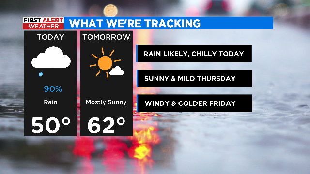
We'll likely have scattered rain and some thunderstorms in the region for the rest of the morning into at least the early to mid-afternoon.
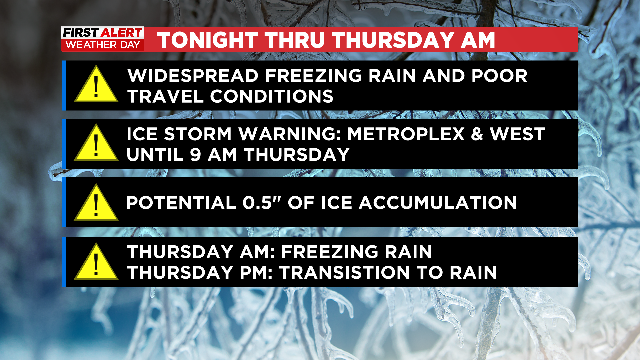
We finally warm above freezing Thursday afternoon and conditions improve heading towards the weekend.

Our stretch of First Alert Weather Days continues Wednesday and if we're being honest, Wednesday is likely going to be worse than what we saw Monday and Tuesday.
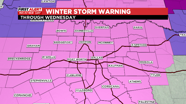
En los próximos días estamos vigilantes sobre las temperaturas bajo el punto de congelación, y esperamos una mezcla invernal en el metroplex.
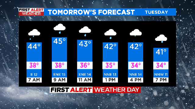
Everyone is expected to see rain, some will see a little snow mixing in, and breezy north winds will have us feeling like we're in the 30s on Tuesday.