Cooler temps, less wind expected for Dallas-Fort Worth
Cooler, closer to seasonable temperatures move in for the Spring Equinox Thursday.
Watch CBS News

Cooler, closer to seasonable temperatures move in for the Spring Equinox Thursday.
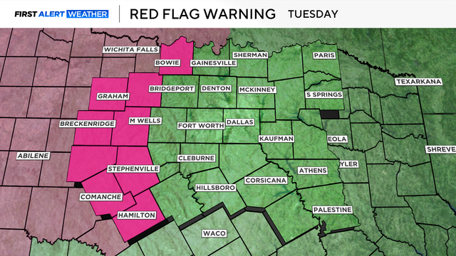
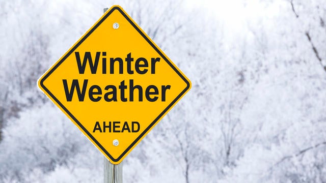
Outdoor burning is strongly discouraged, along with any activities that could generate a spark.
Wind gusts topped 80 mph for parts of West Texas.

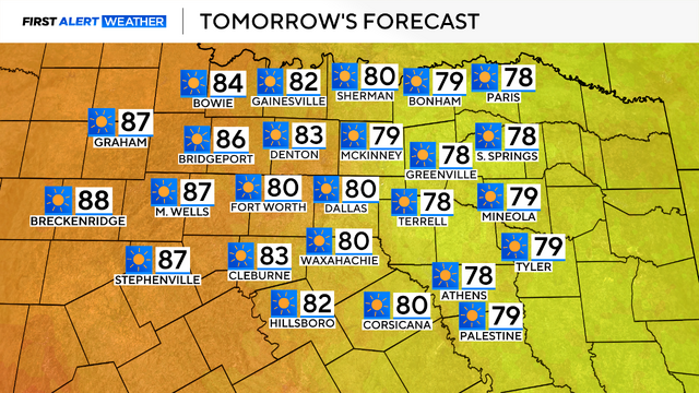
As we head into Thursday, it will be a dry day for the area, with highs in the middle 80s and breezy conditions.

The elevated fire threat turns critical Friday.
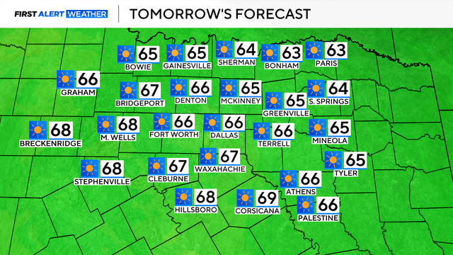
On Tuesday, highs are forecasted to reach the lower 80s, driven by a strong southerly wind.
There is heightened fire danger to the west and a chance of storms on Wednesday and Friday to the east.

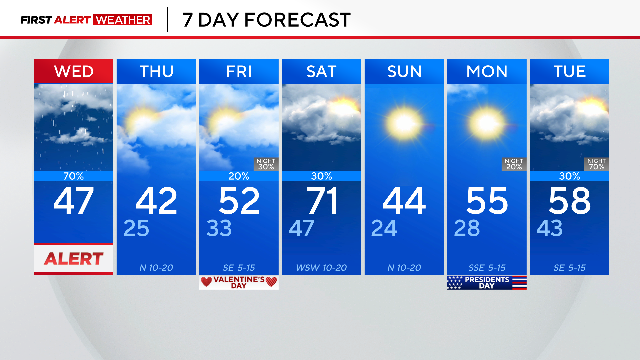
On Saturday, a cold front brings rain and an isolated strong-to-severe storm threat.
A weekend cold front will bring rain to the region on Saturday, with below-average temperatures for the weekend.

A weak disturbance brings morning rain to the Metroplex, but clearer skies and warmer temperatures are on the way.
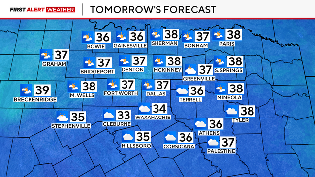
Today, we broke a record morning low, bottoming out at 12 degrees.
An extreme cold weather warning is in place from Tuesday night into Thursday morning for temperatures in the teens.
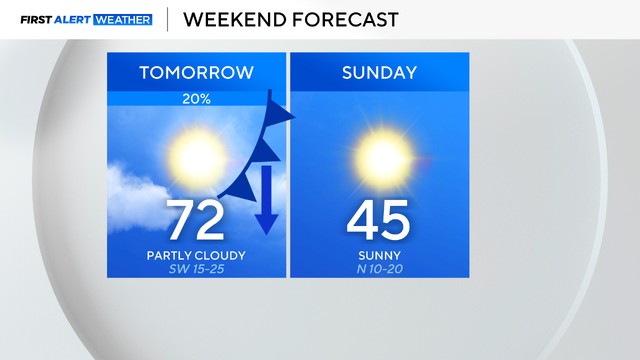
Spotty showers are expected overnight tonight, followed by a warm and breezy Saturday. A cool-down is anticipated on Sunday.

A cold front brings even colder temperatures overnight and into Thursday.
Rain will taper out by the end of the morning commute.