Chicago First Alert Weather: Clear skies with light winds
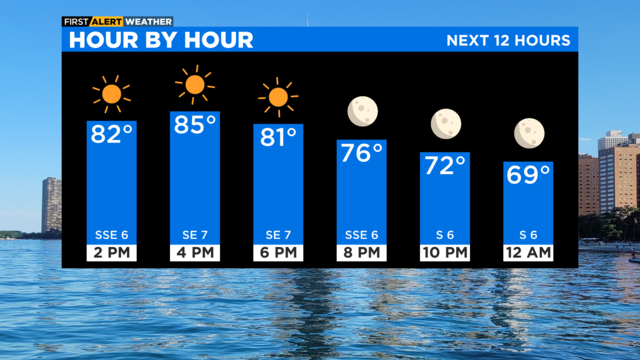
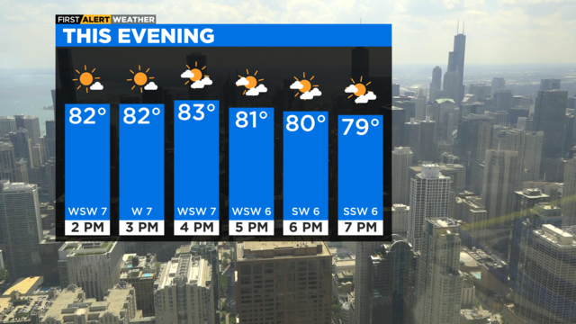
We can expect it to be clear and quiet tonight.
Watch CBS News

We can expect it to be clear and quiet tonight.
According to CBS 2 meteorologist Mary Kay Kleist, some patchy fog may drop visibility well inland overnight.
There's enough instability around for a few spotty sprinkles.
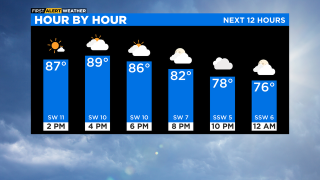
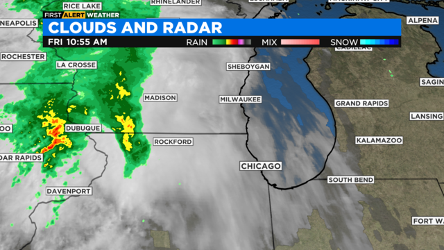
Cold front will pass Saturday, bringing a small chance of stray storms.
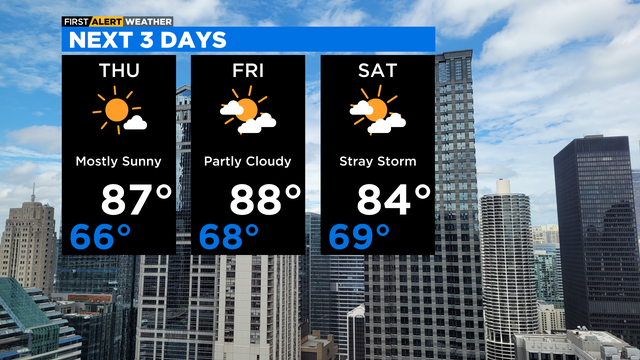
A cold front will cross our area Saturday midday bringing a spotty storm chance.
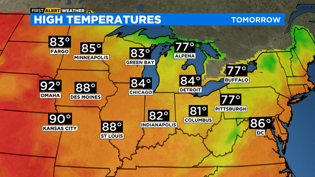
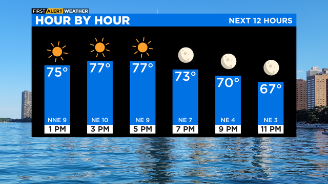
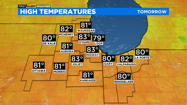
According to CBS 2 meteorologist Mary Kay Kleist, there will be a warming trend to finish the workweek.
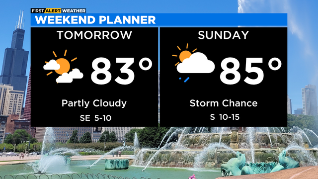
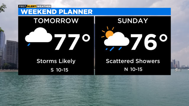
Rain chances return on Sunday with our next system.

Any heavy cells could bring wind gusts to 50 mph and downpours.
There is marginal risk for strong to severe storms.
Again a few pesky sprinkles far west this afternoon as our ridge of high pressure breaks down.
An active weather pattern takes shape this weekend with passing shower and storm chances both Saturday and Sunday.
There will still be plenty of sunshine to go along with the dry conditions throughout the week.
Scattered showers and an isolated rumble of thunder are possible Saturday evening and night
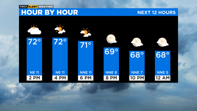
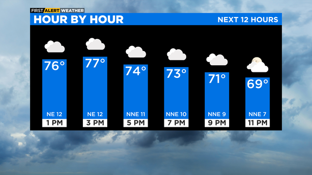
The cold front is to our south, allowing a cooler, northeast wind flow to continue.
High pressure settles overhead Saturday and Sunday allowing for plenty of sunshine.