
Heat advisory Tuesday in the Twin Cities, stormy Wednesday ahead
A heat advisory is in effect through 9 p.m. for the Twin Cities. Highs will be in the low 90, but the heat index is around 100 degrees.
Watch CBS News

A heat advisory is in effect through 9 p.m. for the Twin Cities. Highs will be in the low 90, but the heat index is around 100 degrees.

Storms are passing through northwest and northern Minnesota late Monday ahead of a hot Tuesday in store for the state.

More storms will develop Sunday evening in the Twin Cities as dangerous heat approaches.
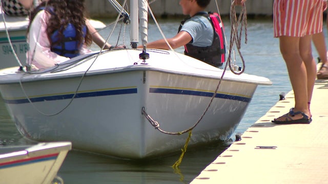
Invasive species like zebra mussels or Eurasian watermilfoil are at a much higher risk of spreading this time of year from used boating equipment.

After a morning of spotty showers, the Twin Cities is enjoying sunshine, a nice breeze and highs in the mid-70s Wednesday.

Showers and thunderstorms are likely Tuesday in the Twin Cities as a cold front moves through.

Monday is a #Top10WxDay in the Twin Cities, featuring a mix of sun and clouds and highs around 80 degrees.

Badly needed rain will return to the metro and southwestern Minnesota late Tuesday night, lingering into Wednesday.

A super El Niño could be in the forecast for the upcoming months. So what does that mean for Minnesota weather?
Tuesday will be hot and humid in the Twin Cities, with air quality concerns starting midday and storm chances arriving overnight.

Humid conditions in the Twin Cities on Monday night will be followed by an air quality alert, which will be in effect from 12 p.m. to 9 p.m. on Tuesday, according to the Minnesota Pollution Control Agency.
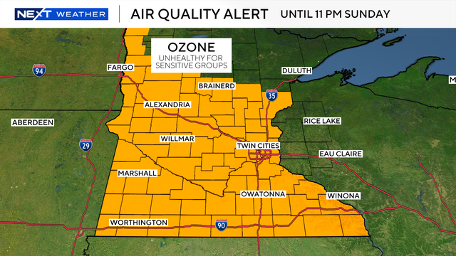
Sunday will be in the upper 80s with increasing humidity and an air quality alert in place.

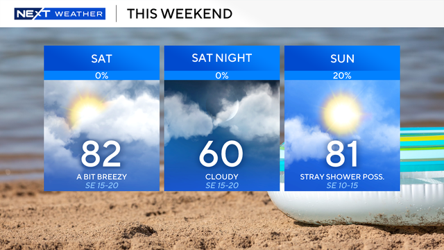
Conditions will be hot and dry on Saturday in the Twin Cities with high temperatures in the upper 80s.

The Twin Cities will enjoy a lovely first day of meteorological summer.
Our summer-like temperatures will continue through the weekend.