Cool mornings are followed by toasty afternoons this week in North Texas
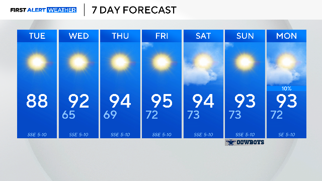
Tuesday morning was another crisp and cool one with the low temperatures dipping to 63 degrees.
Watch CBS News
Tuesday morning was another crisp and cool one with the low temperatures dipping to 63 degrees.
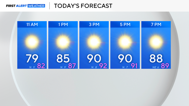
Mostly sunny skies, winds from the southeast around 5 to 10 mph and highs in the mid-80s are in the forecast today.
Take advantage of the mild weather and enjoy a long walk on the trail.
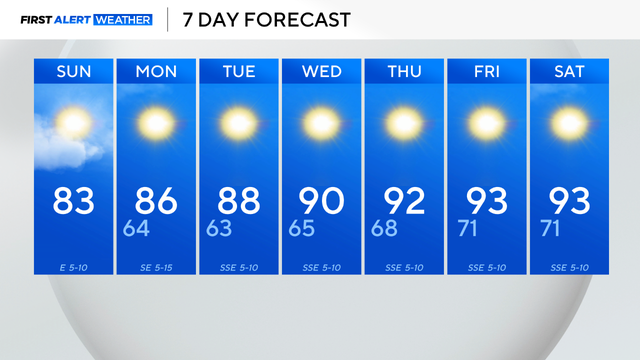
The cold front also brought a needed cooldown. It felt like fall Saturday morning; lows were in the lower to mid-60s.
Thursday will be even hotter with highs in the upper 90s and sunny skies.

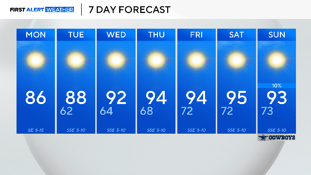
Wednesday morning will be beautiful with lows in the 60s and a light breeze from the northwest.

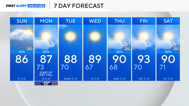
Scattered showers will continue through the first half of Labor Day with drier conditions by the afternoon.
Storms were expected but not forecasted to move as slowly as they have been, which is leading to flooding.

There will be a large spread in temperatures from north to south, with DFW looking to top out in the upper 80s.
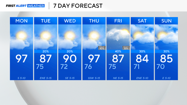
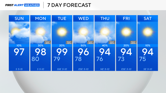
After a brief cooldown on Tuesday, temperatures will steadily rise back to the upper 90s.
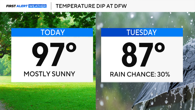
The cooler air is forecasted to settle in across North Texas on Tuesday, and highs are only expected to reach 87 degrees!

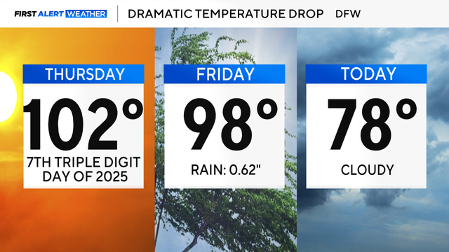
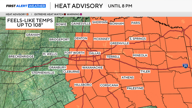
After the rain moves out, mosh of the region will be under a heat advisory until 7 p.m.
From the Metroplex to the east, a heat advisory is in place until 8 p.m. for feels-like temperatures as high as 107.
An active forecast is expected this next week with daily storm opportunities.
It's important to take precautions over the next several days.