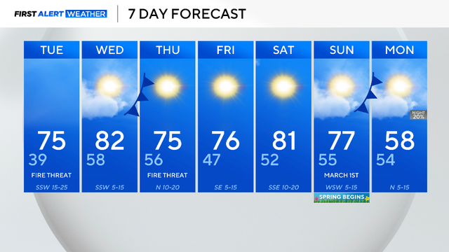
Cold start gives way to 70s, gusty winds raise fire risk in North Texas
The warming trend is expected throughout this week.
Watch CBS News
The warming trend is expected throughout this week.
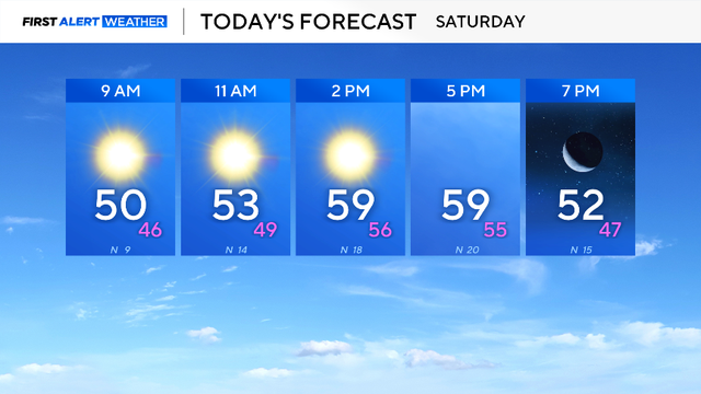
Grab the jacket because it will be chilly. Temperatures will climb into the low 50s by lunch and reach into the upper 50s by the late afternoon.
A cold front will be moving through the area, causing wind to gust up to 30 mph at times.
The main weather story over the next couple of days will be the elevated fire danger.
It will be partly cloudy at times throughout Tuesday, preventing DFW from reaching 80°.
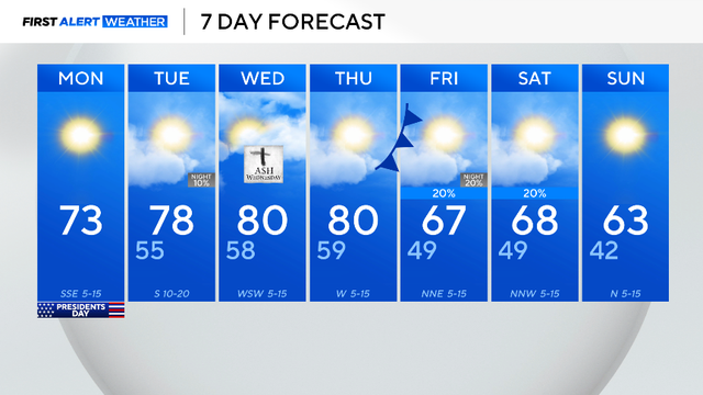
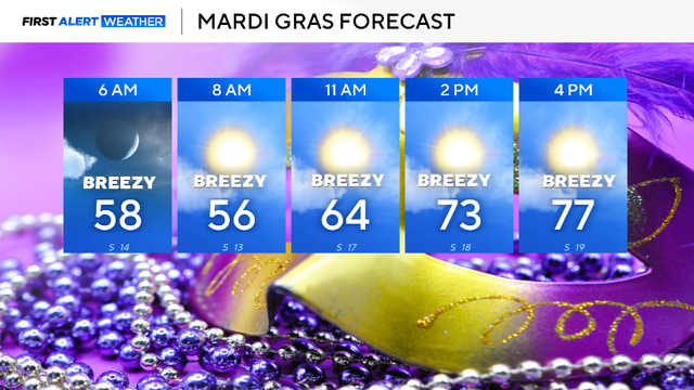
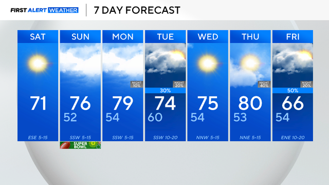
Mardi Gras, Tuesday, will start mild in the 50s and warm into the upper 70s by mid-afternoon.
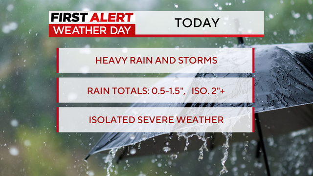
A First Alert Weather Day is in effect for disruptive rain and the chance of some isolated severe storms.

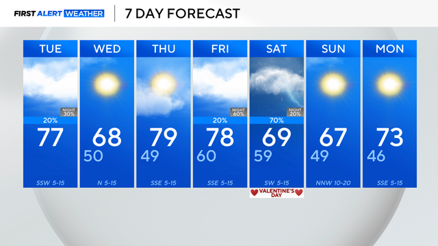
A First Alert Weather day is in effect for Saturday, for disruptive rain and the chance of some isolated severe storms.
Humidity has increased as an upper-level low sits to the west and a cold front approaches from the north.

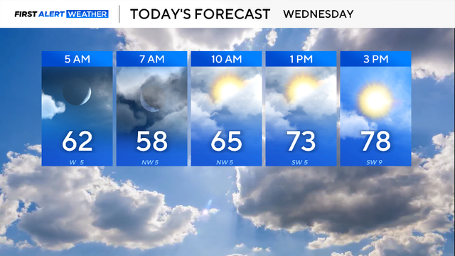
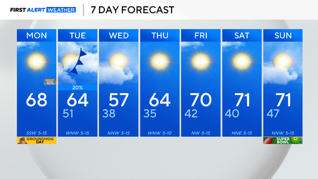
The high Monday will climb into the 70s by lunchtime and top out around 82 degrees by 4 p.m.

Well above average temperatures most of the week, with scattered rain chances midweek, and better rain chances into the start of the weekend.
The high will top out in the 70s with winds coming from the southeast around 5 mph.
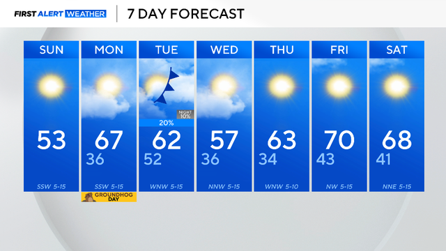
Following a cold weekend in North Texas, we kicked off the workweek on a warmer note, with highs near 70 for much of the metroplex.
The last month was interesting. January was considered average climatology-wise, but the month was riddled with temperature extremes.
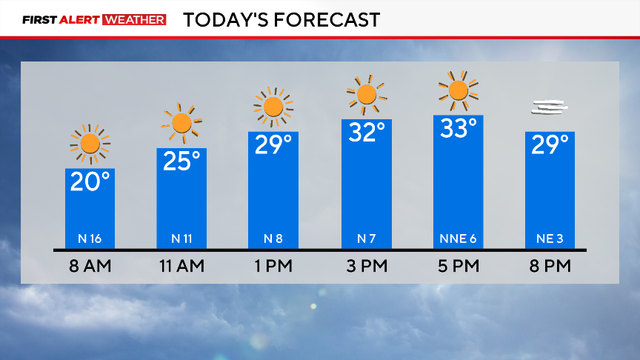
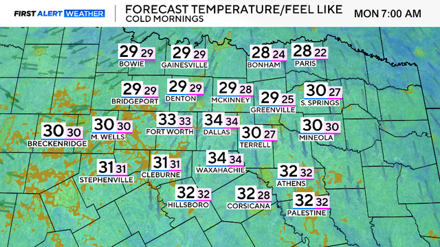
Bundle up! It will be cold all day long.