
Dangerously cold wind chills arrive, snow showers possible Thursday
True arctic air briefly returns to Chicago with dangerous wind chills by Thursday morning.
Watch CBS News

True arctic air briefly returns to Chicago with dangerous wind chills by Thursday morning.
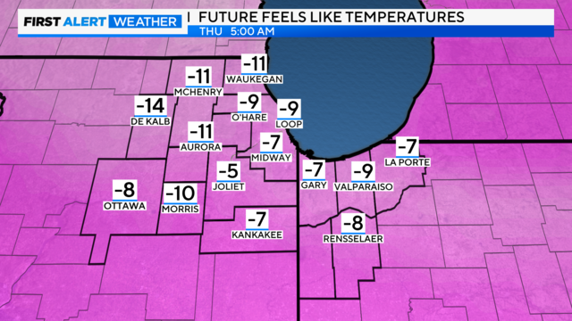
By Thursday morning, air temperatures are in the single-digits -- even near zero degrees in far western suburbs -- with wind chill temperatures approaching Cold Weather Advisory criteria, as low as -10 to -15 degrees.
After enjoying unseasonably mild weather Sunday and Monday, another cold snap blows in starting Tuesday bringing the coldest air of the season.
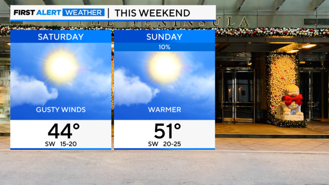
Temperatures climb to the low 50s on Sunday.
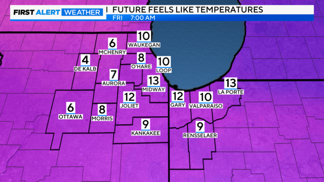
Winds will relax a bit Thursday night but remain breezy enough to keep wind chills in the single digits Friday morning with air temperatures in the 10s.
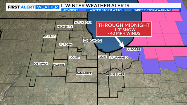
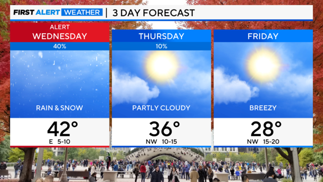
A weather alert took effect Wednesday evening for snow squalls that may bring damaging winds, low visibility, and slick roadways on your evening commute
A relatively quiet day is ahead on Tuesday with highs closer to freezing underneath a partly cloudy sky.
The cold stretch continues for a few more days.
We are tracking a very brief warm-up to near-normal temperatures Wednesday before another cold snap blows in.
Unseasonably cold weather continues to blow our way from Canada, with little changing in the temperature department until a brief "warm-up" next Wednesday.
After Chicago's coldest Thanksgiving Day in 10 years, temperatures get even colder through the holiday weekend.
A brief isolated shower is also in the forecast between 8 p.m. and midnight Tuesday night.
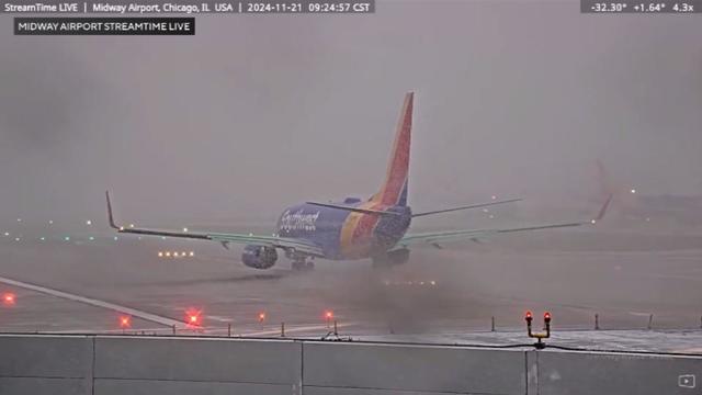
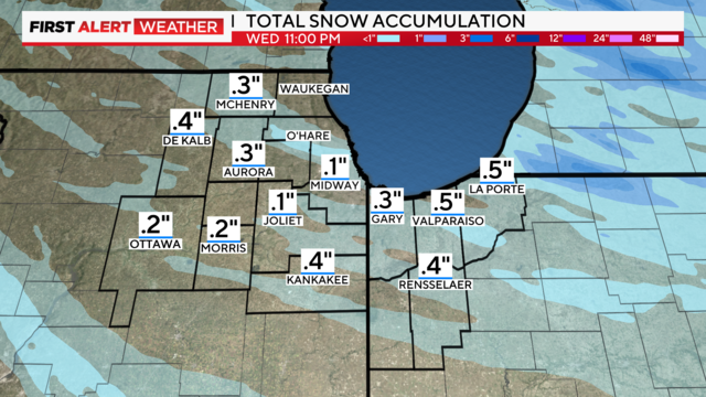
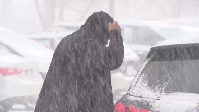
Periods of moderate to heavy snow are dropping visibility and leading to quick accumulations across the area.
This week brings the first significant snowfall of the season to the Chicago area. Snow is expected to fall at least through the early afternoon before changing over to cold November rain.
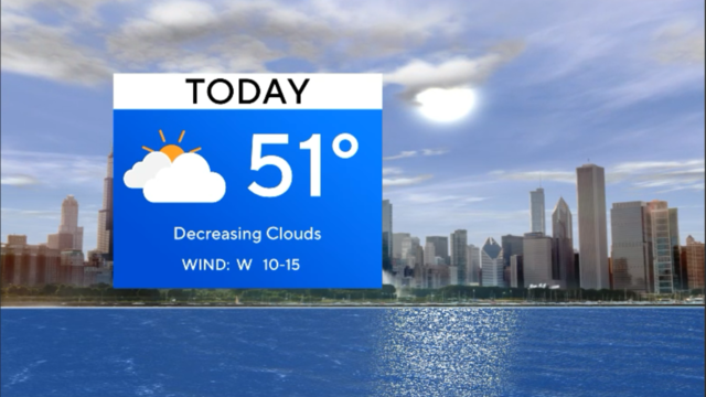
Temperatures rose above freezing areawide Thursday afternoon and will hold steady or even rise further overnight into Friday morning.