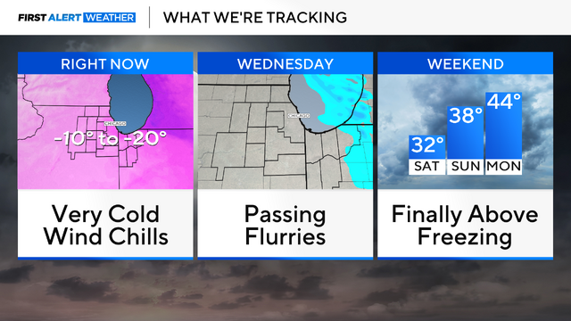
Another day with sub-zero wind chills before milder temperatures in Chicago
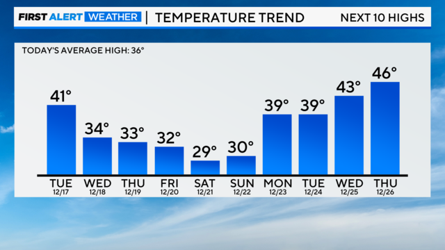
By next week, high temperatures rise to the mid-40s in Chicago for the first time in more than three weeks.
Watch CBS News

By next week, high temperatures rise to the mid-40s in Chicago for the first time in more than three weeks.

Bitterly cold conditions are in place again Tuesday morning.
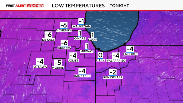
Actual air temperatures will fall below zero Monday night.
We are tracking the return of the polar vortex next week as a wavy jet stream brings a blast of Arctic air to the Great Lakes.
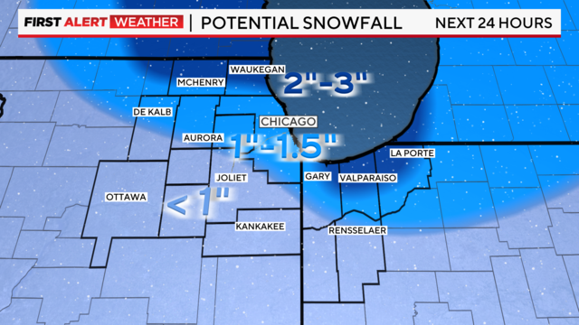
Snowfall reports as of 9 p.m. range from 1.5" to 4".
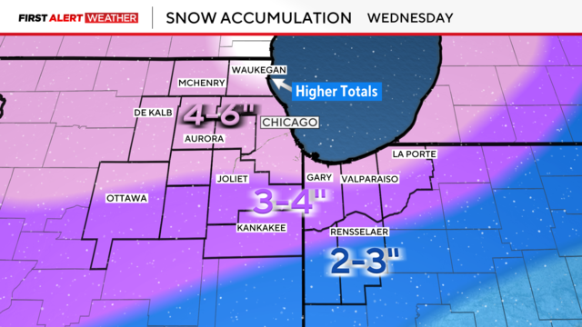
Widespread snowfall totaling 4 to 6 inches is expected through Wednesday, with isolated higher amounts along the North Shore.
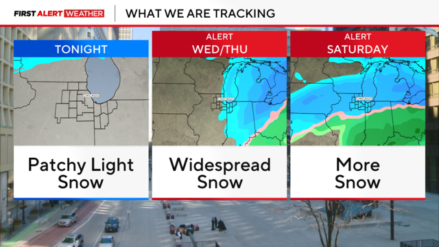
Our next winter storm approaches Chicago on Wednesday.
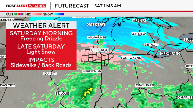
Light freezing drizzle and snow showers could make untreated roads and sidewalks slippery and dangerous.
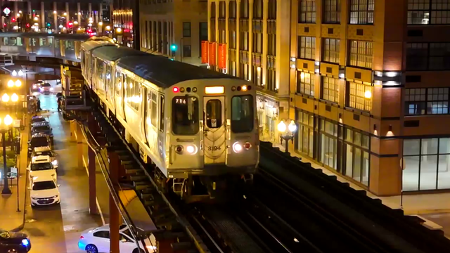
It turns out more of the electricity that powers the trains is generated by fossil fuels that warm the climate than by renewable sources like wind or solar power.
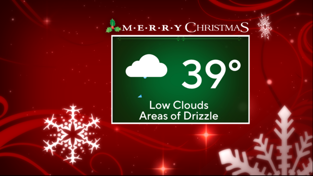
Cloudy skies with areas of drizzle are expected on Christmas Day, with high temperatures hovering in the upper 30s.
Temperatures are below freezing and precipitation will likely freeze.
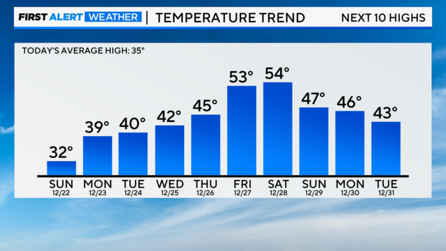
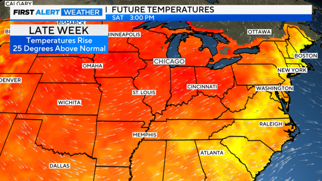
Temperatures keep rising through next weekend, eventually climbing to the 50s.
Accumulating snow will impact Chicago and surrounding areas Thursday night through Friday morning.
Expect a mix of clouds and sun on Tuesday with cooler west winds.
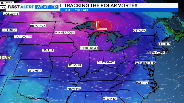
The polar vortex is an ever-present, large area of low-pressure and frigid air surrounding the Earth's poles.