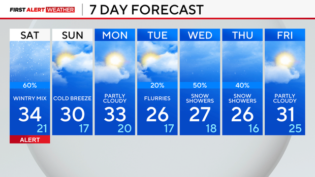
Expect slippery conditions as winter weather returns Saturday


CHICAGO (CBS) — As the next winter weather event approaches, a weather alert is in place for Saturday. Light freezing drizzle and snow showers could make untreated roads and sidewalks slippery and dangerous.
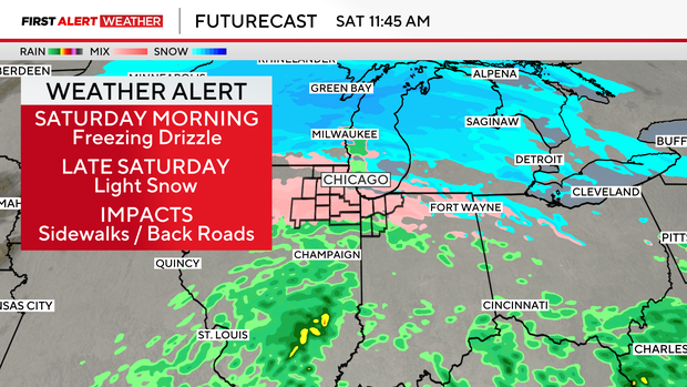
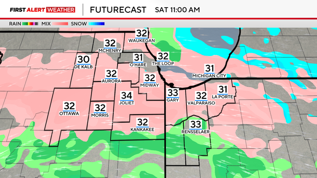
Clouds increase overnight tonight as the storm approaches from the west. As precipitation begins Saturday morning, it will be battling low-level dry air, so the exact onset of freezing rain is uncertain. By late morning, however, widespread, very light freezing drizzle is possible.
Areas of freezing mist will increase early Saturday morning, then freezing drizzle is expected after 10 a.m. Light icing is likely on untreated surfaces like roads, sidewalks and driveways.
The best chance for up to a tenth of an inch of ice accumulation will be in parts of Northwestern Indiana. By Saturday afternoon, some of the drizzle will transition to light snow. Up to a quarter of an inch of snowfall will be possible, but mainly for areas north of I-80. Moisture ends by the early evening hours.
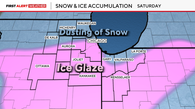
Most areas, including Chicago, could see a light glaze of ice on exposed surfaces. Northern counties and the typical lake-effect regions of northwest Indiana may see a light dusting of snow. Behind the storm system, cold wind chills and dry weather return on Sunday.
We are tracking a weather pattern change next week that is expected to lead to colder temperatures and more widespread snow accumulations. Stay tuned for forecast updates.