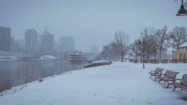
Foggy, cloudy Christmas Day with rain later this week
A foggy Christmas Day could lead to slick spots on the roads.
Watch CBS News
A foggy Christmas Day could lead to slick spots on the roads.
Fog will become more of a factor this evening, which could make for slick roads and hazardous travel conditions.
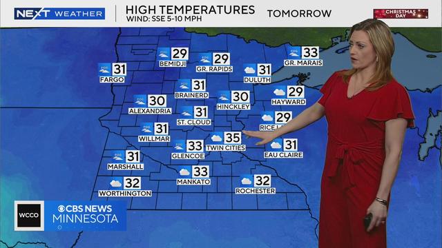
Meteorologist Lisa Meadows says high temperatures will be in the 30s for Christmas day, with patchy fog in the morning.
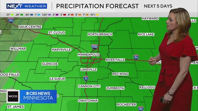
Meteorologist Lisa Meadows says we could see measurable rainfall over the next five days.
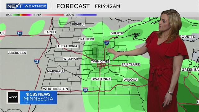
Meteorologist Lisa Meadows says rain and above average temperatures are expected towards the end of the week.
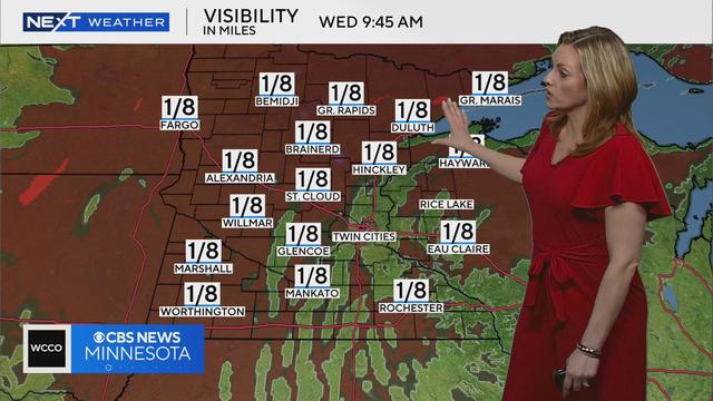
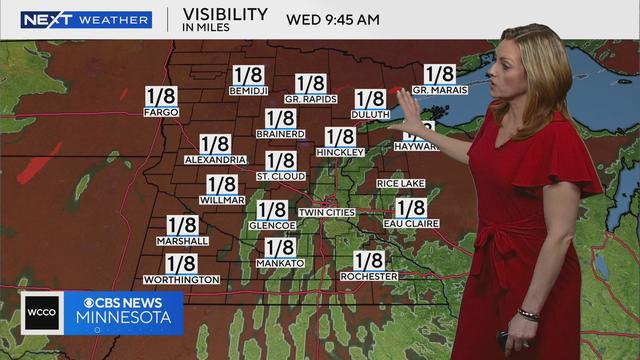
WCCO meteorologist Lisa Meadows says visibility may be below one mile for many areas of Minnesota Wednesday morning with patchy fog in the forecast.
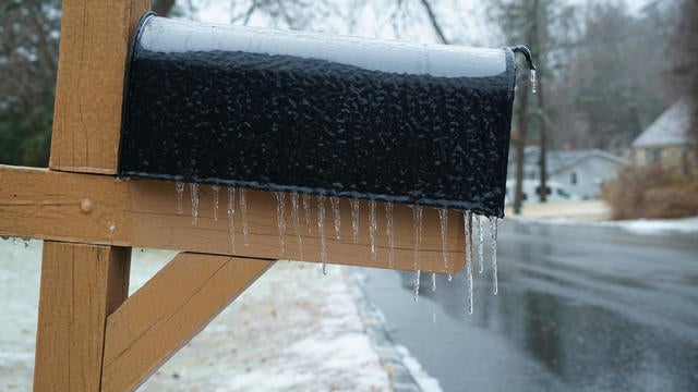
Highs will be just below freezing as the week begins, with freezing drizzle, freezing rain and snow possible across Minnesota and Wisconsin.
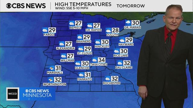
Meteorologist Chris Shaffer says Tuesday will feature mild temperatures with clouds in the sky.
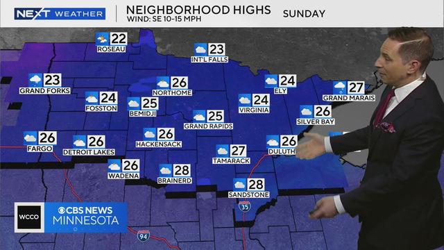
WCCO meteorologist Mike Augustyniak says this weekend will feature temperatures in the 20s and 30s, with warmer temps forecasted next week.
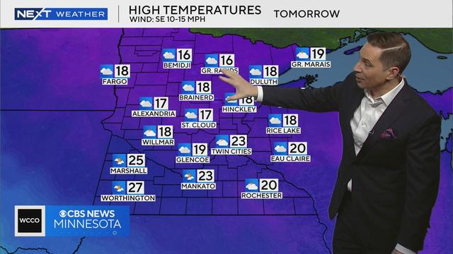
WCCO meteorologist Mike Augustyniak says there will be some sunshine Saturday, but temps will be a few degrees below average.
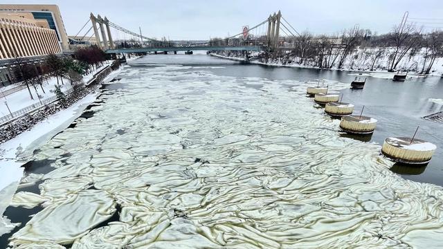
Frazil ice has been spotted in Minnesota following Thursday's winter storm. But what is frazil ice?
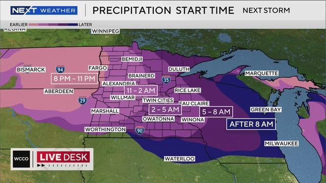
A potentially impactful snowstorm is heading for Minnesota late Wednesday, with plowable snow in areas across the state.
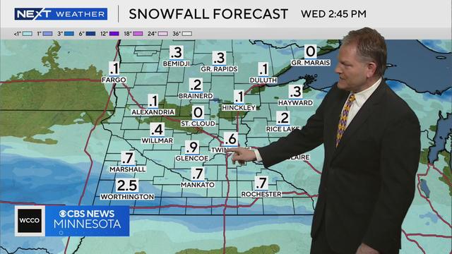
WCCO meteorologist Chris Shaffer says parts of southern Minnesota could see over half an inch of snow on Wednesday.
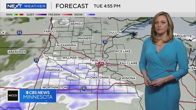
Meteorologist Lisa Meadows says parts of Minnesota could see some snow flurries on Tuesday.

Saturday's winter weather caused several crashes and spinouts throughout the state, according to the Minnesota State Patrol.
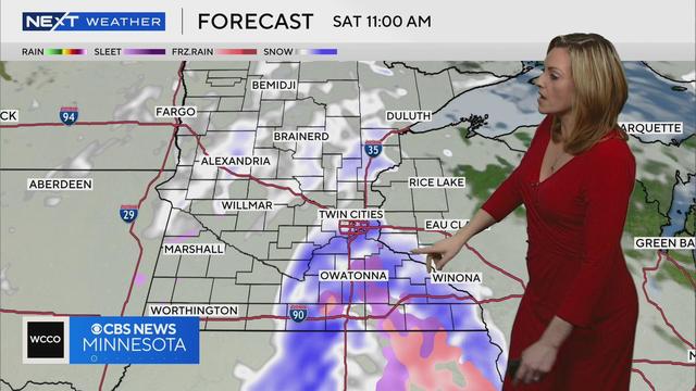
Meteorologist Lisa Meadows says ice and snow will likely cause some slick road conditions Saturday.
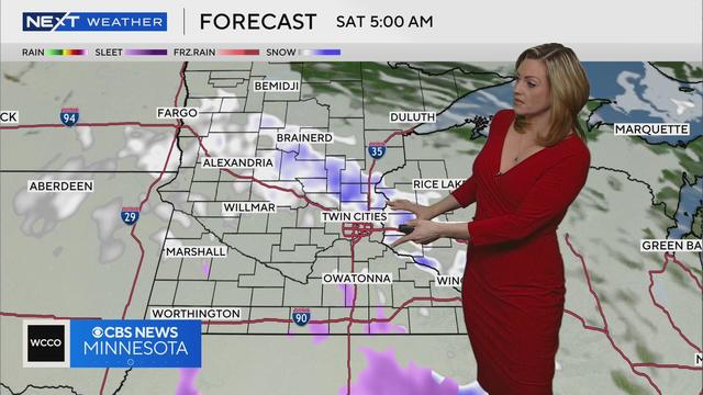
WCCO meteorologist Lisa Meadows says the roads may be icy Saturday with snow and sleet in the forecast overnight.
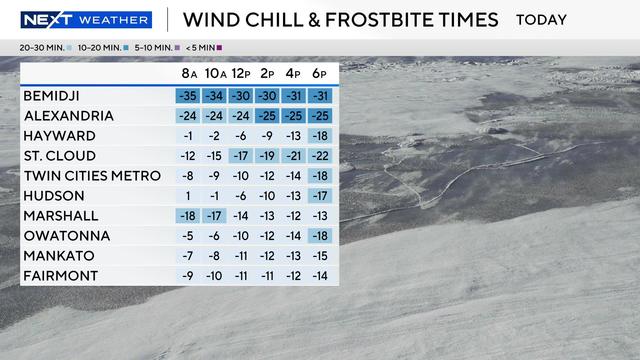
Cold weather advisories are in effect for northern Minnesota from Wednesday evening through Thursday morning for dangerous wind chills around minus 35 degrees.

A strong cold front is headed for Minnesota, bringing light snow in time for the Wednesday morning commute.
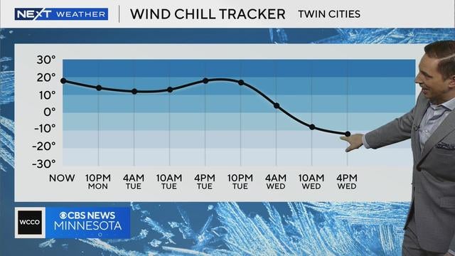
The Twin Cities will be mostly cloudy and windy on Monday evening, with temperatures falling back to around 20 degrees.
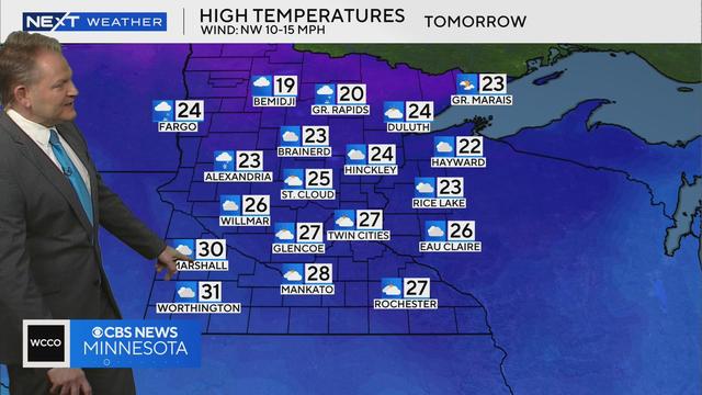
Meteorologist Chris Shaffer says high temperatures will be in the 20s and 30s across Minnesota on Tuesday before a significant cooldown later in the week.

Meteorologist Lisa Meadows says another blast of cold air will hit Minnesota this week.
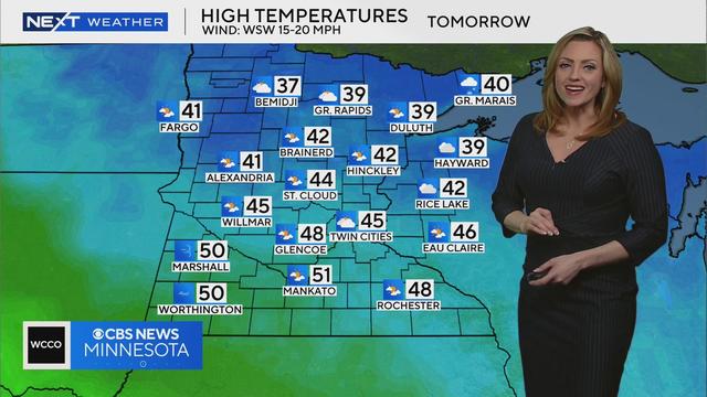
WCCO meteorologist Lisa Meadows says high temperatures will be in the 40s tomorrow in parts of Minnesota before another round of forecasted snow.
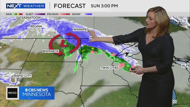
WCCO meteorologist Lisa Meadows says another round of snow is expected to hit Minnesota between Sunday afternoon and Monday.
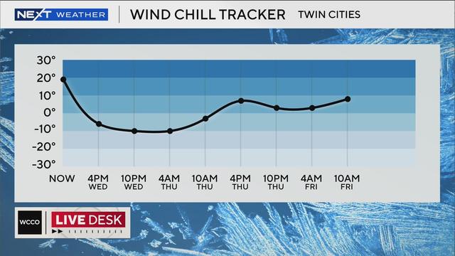
An arctic cold front is pushing into Minnesota on Wednesday, along with wind speeds of up to 50 mph.