NEXT Weather Alert in Minnesota late Sunday, early Monday from severe storm threat


Sunday and Monday are both NEXT Weather Alert days in southern Minnesota, including the Twin Cities, due to the elevated threat of severe weather.
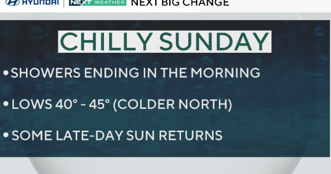
After some showers early Sunday, the metro will get a break in the afternoon through the early evening, with highs in the low 60s.

Storm chances increase on Sunday night, with the National Weather Service saying it will be most active Monday between 3 p.m. and 9 p.m.
There is a moderate threat (4 on a scale of 5) of all modes of severe weather in the metro, southeastern Minnesota, western Wisconsin and a large swath of Iowa.
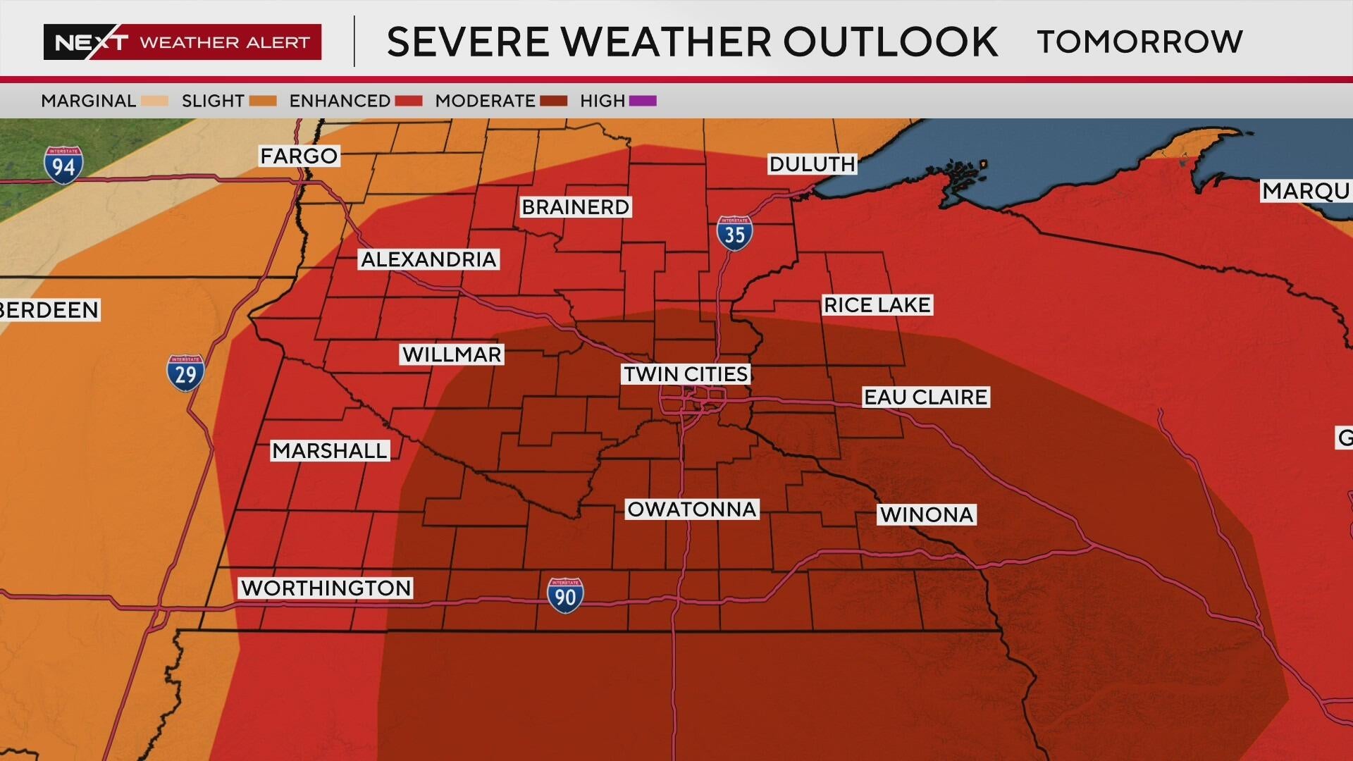
The rest of Minnesota will be under an enhanced threat (3 on a scale of 5) on Monday.
Tuesday will be dry with a high around 60 degrees, and highs will be mainly in the upper 60s to near 70 by next weekend. The metro's next rain chance is Thursday.
Find more information from the WCCO NEXT Weather Team on severe weather alerts and severe thunderstorms, as well as the dangers of flooding and extreme heat.