North Texans to face near-record heat this weekend, followed by a cool down next week
The Red River Rivalry will be toasty with sunny skies, breezy southwesterly winds, and highs in the mid-90s.
Watch CBS News
The Red River Rivalry will be toasty with sunny skies, breezy southwesterly winds, and highs in the mid-90s.

A cold front arrives Monday, dropping highs into the 70s for midweek.

North Texans are in for a scorching weekend with high temperatures soaring to 95 degrees, followed by a much-needed cool down early next week.

North Texas isn't done with the warmer-than-average temperatures. There is near-record heat ahead this weekend.

A disturbance will track through Oklahoma overnight and bring some clouds along the Red River to start our Thursday.
The Great Galveston Hurricane is known as the deadliest weather disaster in United States history, killing at least 8,000 people, with some estimates as high as 12,000 people.

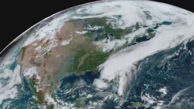
As of 10 a.m. Wednesday, Hurricane Milton remains a Category 4 storm.

Dry air remains in place Wednesday keeping skies sunny and humidity low.

As Hurricane Milton intensified on its path toward Florida's Gulf Coast, the strength of the system increased the severity of the storm surge forecast.

Tuesday morning was beautiful across North Texas with dew point temperatures in the 40s and 50s with clear skies.

Drier air will be in place Tuesday morning, with temperatures in the upper 50s and lower 60s across the area.
High temperatures will cool down to the mid-80s for Tuesday and Wednesday.

North Texas continues to have above-normal temperatures this week ahead. There is no rain in the forecast over the next 7 days.

After a weekend of sunshine and above normal temperatures, North Texas will experience a drop in temperatures next week.

Given the amount of time Milton is expected to spend over the open, warm Gulf waters, it is not a stretch to anticipate that it might reach Category 4 strength or higher before landfall.

Hurricane Helene reached Category 4 status before landfall. Milton will have more time over the Gulf if the NHC's current track holds.
North Texans will feel little day-to-day change in the forecast this weekend.

A weak cold front will drop temperatures by 5-10 degrees, bringing more dry air to the region early Monday.

While the weekend brings warm highs near 93°F and no rain, a slight temperature drop midweek could finally hint at fall vibes.

Friday morning will be cool. Friday afternoon will be a bit warm.

Thursday morning was more mild across North Texas, but the high temperature will remain above average.

The CBS News Texas Weather team is urging North Texas residents to be aware of increasing humidity and air quality alerts this week.

Tropical development is now unlikely in the Gulf following major Hurricane Helene.
Temperatures on Wednesday will warm up to near 90 degrees.

The breezy northerly winds are behind a dry cold front, that will keep our humidity in check Wednesday.