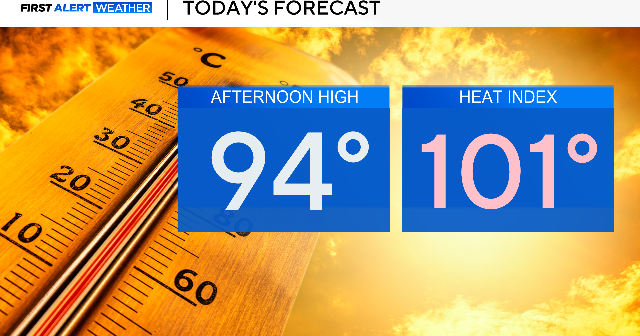
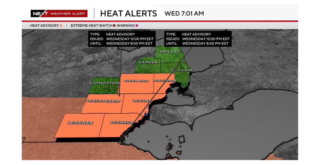
Hot, humid day ahead with feels-like temperatures in the triple-digits across North Texas


The hot and humid weather continues through Thursday with afternoon heat index values between 100° and 105°.
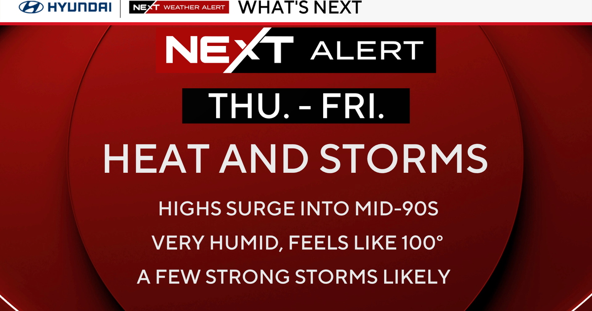
A pattern change begins late this week as a weakening ridge and an approaching front increase storm chances Friday through the weekend. While widespread severe weather is not expected, periods of heavy rain, frequent lightning, and locally gusty winds could impact outdoor plans.
Warm, muggy nights and days ahead
Warm and muggy conditions continue with temperatures slowly falling through the 80s and into the mid 70s overnight. South winds remain breezy at times. Most of North Texas stays dry, although an isolated shower cannot be ruled out well south and east of the metroplex.
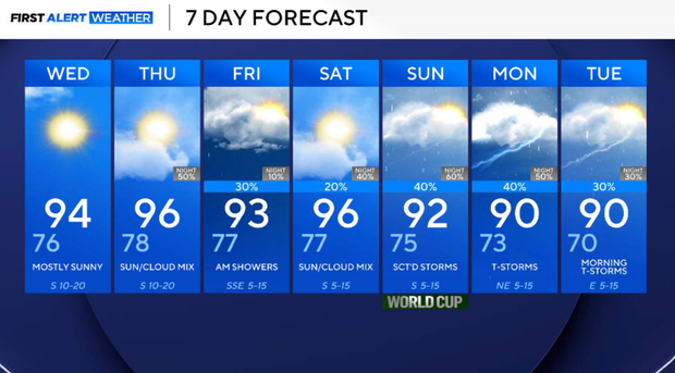
Another hot and humid day is expected on Wednesday with highs in the low to mid 90s. Heat index values will approach 100° to 103° during the afternoon. Mostly sunny, with a south wind 10 to 15 mph, with gusts as high as 25 mph.
Thursday, there will be little change in the overall pattern. Morning clouds give way to afternoon sunshine, with highs in the mid-90s. Humidity remains elevated, and heat index values may once again reach near 100° to 105°. Most locations stay dry during the day.
Friday, a weakening ridge and an approaching front will allow scattered showers and thunderstorms to develop. Storm chances will be highest north of I-20 and near the Red River.
Coverage will not be widespread, but any storm could produce lightning, brief heavy rain, and gusty winds. Highs remain in the low to mid 90s.
Saturday will have plenty of dry hours, but we can't rule out a few isolated showers or a thunderstorm. Current rain chances remain around 20% across North Texas.
Sunday currently appears to be the wetter day of the weekend, with storm coverage increasing area-wide as additional disturbances move into the region. Heavy downpours, lightning, and localized flooding in poor drainage areas will be the primary concerns.
Looking ahead, the active pattern may continue into early next week with additional opportunities for showers and thunderstorms. Some locations could see multiple rounds of rainfall. Temperatures should remain near seasonal averages with highs mainly in the lower to middle 90s.