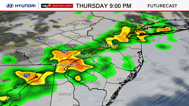
Severe thunderstorm watch issued for entire Philadelphia region Thursday night
A severe thunderstorm watch is in effect for the entire Philadelphia region through midnight Thursday.
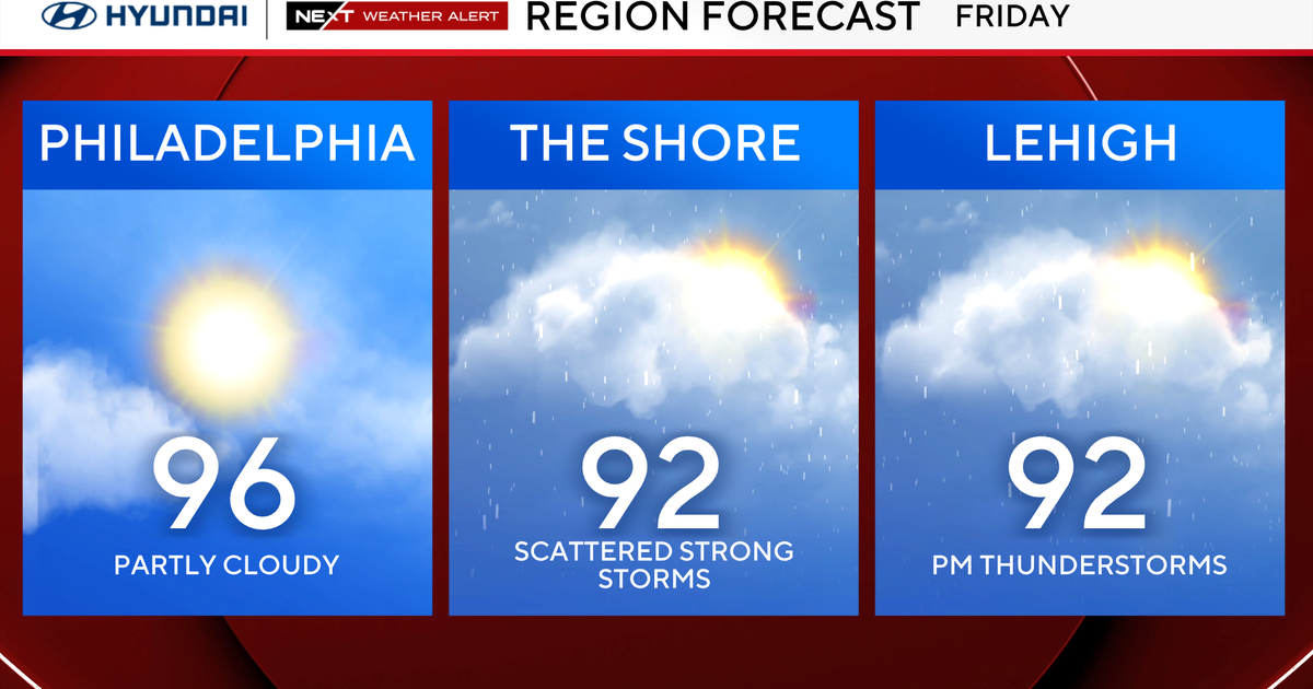
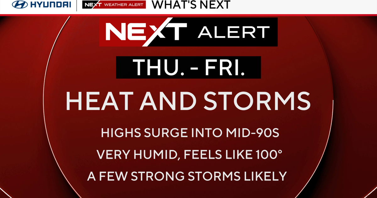
Thursday's weather is similar to Wednesday's, but it's hotter and more humid, and there's a greater risk of severe storms.
The storms on Thursday could bring gusty winds and intense downpours. We've issued a NEXT Weather Alert for Thursday and Friday for intense heat and humidity and these storms.
NEXT big weather changes
The humidity has become downright oppressive and stays like that through Friday night.
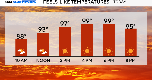
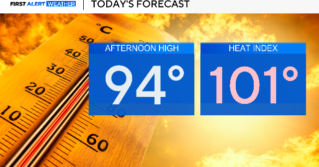
In addition, the temps are back in the mid-90s Thursday and Friday, bringing the feels-like temps to 100 degrees, perhaps higher during the peak heating of the day. The region will be under a heat advisory on Thursday and Friday due to the dangerous heat.
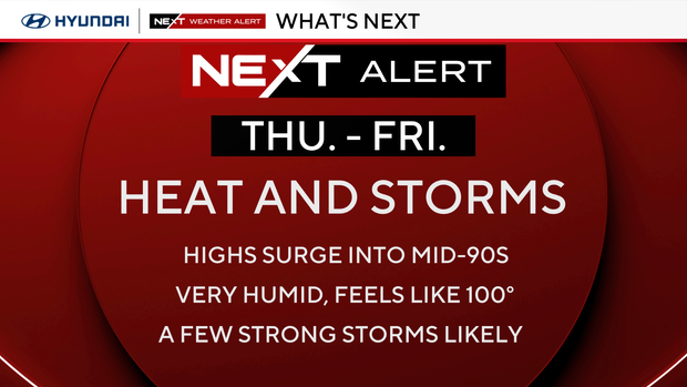
As for storms, we have a level 2 severe risk both Thursday and Friday, which means scattered severe storms are possible. The timing of the storms will be in the evening, even into the late evening hours.
Keep your app handy and a way to receive weather information when the storms hit. Your NEXT Weather Team is constantly monitoring and will keep you posted.
The 90s will be around through the weekend, but there will be a considerable difference in humidity, which will make it feel much cooler than the prior few days. It will be a GREAT WEEKEND for pools, rivers, water parks, and the beach. Make your plans now for this early taste of mid-summer
FYI: Summer officially begins Sunday, June 21, at 4:24 a.m., which is also Father's Day, which means the longest day of the year just became Dad's day to shine a little longer.
Here's your 7-day forecast:
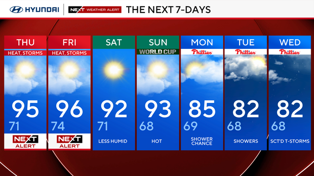
Thursday: NEXT Weather Alert. High 95, low 71.
Friday: NEXT Weather Alert. High 96, low 74.
Saturday: Less humid. High 92, low 71.
Sunday: Hot for FIFA World Cup. High 93, low 68.
Monday: Showers. High 85, low 69.
Tuesday: Showers. High 82, low 68.
Wednesday: Scattered thunderstorms. High 87, low 68.