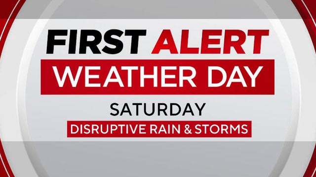
First Alert Weather Day brings storms Saturday before freezing temps
North Texas faces rain, wind and afternoon storms ahead of a sharp temperature drop that brings the coldest air of the season by Sunday.
Watch CBS News
North Texas faces rain, wind and afternoon storms ahead of a sharp temperature drop that brings the coldest air of the season by Sunday.
Temperatures on Wednesday morning were colder as a cold front moved through North Texas.
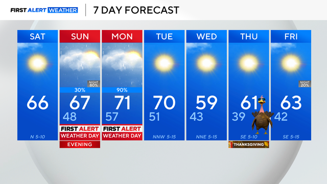
The next big storm system is expected to move through North Texas overnight Sunday, bringing heavy rain.

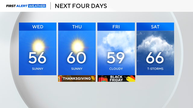
A front will move through Friday night, bringing drier and cooler air. Temperatures will be in the low 50s on Saturday morning.
Isolated strong to severe storms will be possible with a very small chance for an isolated tornado.
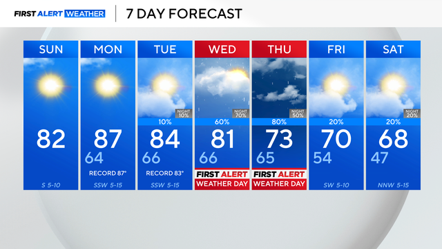
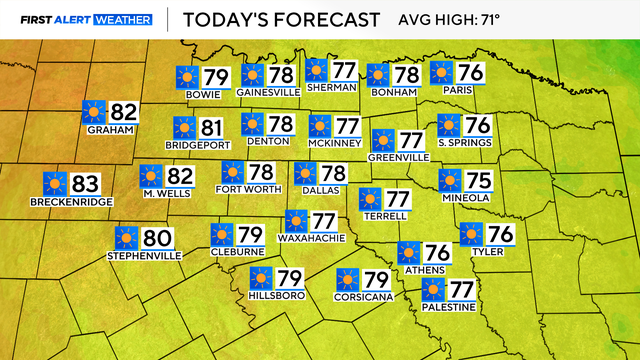
Due to a ridge of high pressure, the above-average temperatures are here to stay over the next few days.

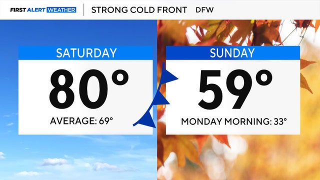
The typical high temperature for this time of year is 67 degrees, but the high on Saturday hit a record 89 degrees.
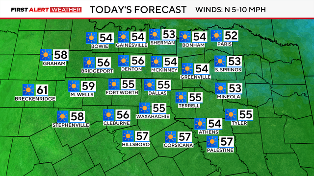
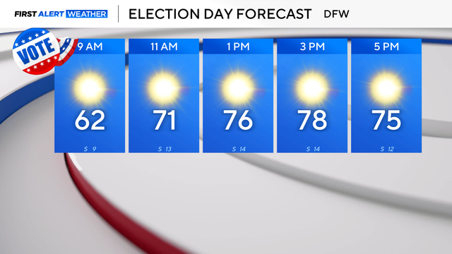
A beautiful day is ahead in North Texas with sunny skies and temperatures warming into the upper 70s.
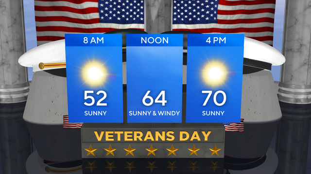
Veterans Day is off to a chilly start in North Texas with temperatures in the 40s and wind chills in the 30s.
There will be plenty of sunshine on Monday with a high temperature in the mid-50s, sitting well below average.
There will be plenty of sunshine, but the northerly winds will gust up to 40 mph, making it feel very chilly throughout the day.
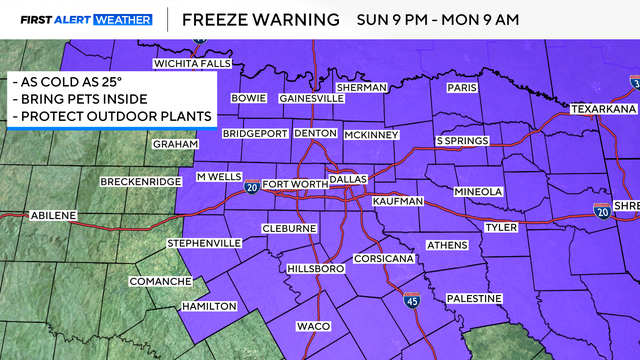
A freeze watch is now in effect starting at 9 p.m. Sunday through 9 a.m. on Tuesday.

High pressure remains in control, so sunny skies and dry conditions are the rule for the next few days.
The warmer-than-average trend won't last too much longer as two cold fronts will move through this weekend.
Don't let the cool morning fool you – afternoon high temperatures will reach the upper 70s. Cities to the west of I-35 could reach the 80s.