Extreme cold warning remains in effect for North Texas; roads remain icy
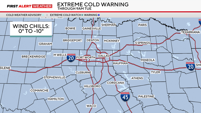
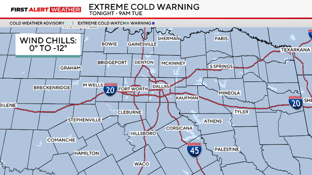
An extreme cold warning is in effect through Tuesday morning due to wind chills from 0 to -10 degrees covering the region.
Watch CBS News
An extreme cold warning is in effect through Tuesday morning due to wind chills from 0 to -10 degrees covering the region.
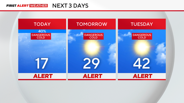
Weather Alerts are in place through Tuesday due to dangerously cold temperatures and icy roads at times.
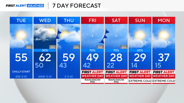
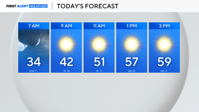
Saturday began with rain, sleet and snow in parts of North Texas, with temperatures falling into the low 30s by 3 a.m.
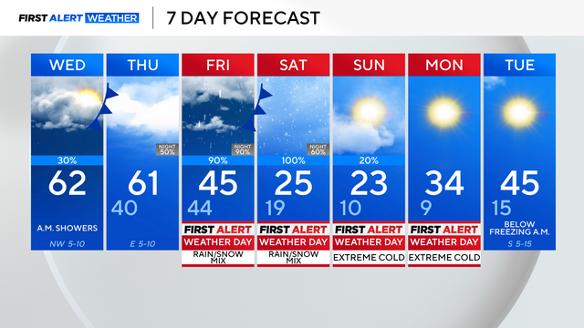
After Wednesday, all eyes are on our winter system.
Even though it's still too early to discuss rain, sleet and ice totals, here's a current outlook of the next system.
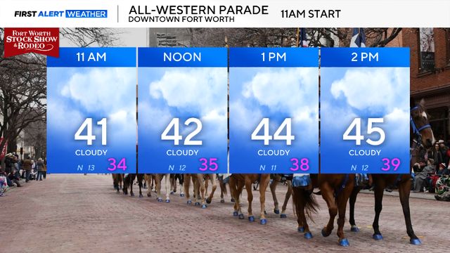
You'll need to grab a jacket heading out the door; temperatures will rebound in the afternoon, but most of the day will be chilly.
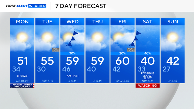
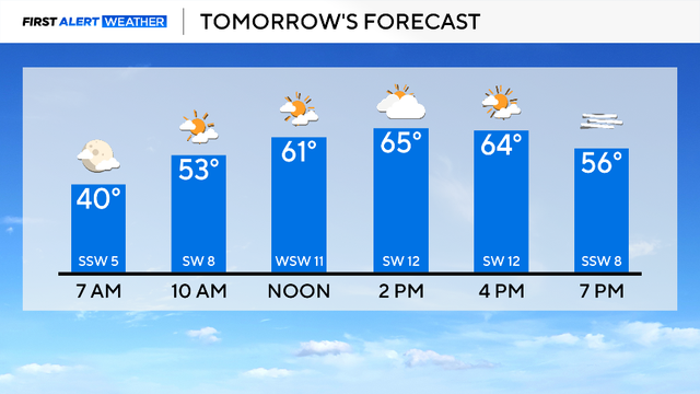
Sunday, the coldest air of the season is expected in the morning.
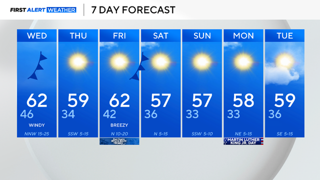
Throughout the day, highs rise into the mid-60s with the help of southwest winds.
After cold starts in the 30s, North Texas temperatures are rebounding into the 60s and are expected to stay warmer than average this week.
Winds from the north will stay around 5 to 10 mph, causing the feels-like temperatures to plummet several degrees.
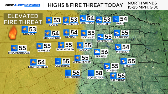
A cold front has brought seasonal, chilly temperatures and elevated fire risks to North Texas for the weekend, with a warming trend beginning Monday.

On Wednesday evening, a cold front will build from the west which has the potential to bring showers and storms.

Through the day, expect partly cloudy skies with temperatures rising into the mid-70s.

Temperatures start in the 40s and 50s on Monday, with mild highs rising into the mid-70s by afternoon.
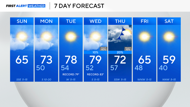
Highs are forecasted to be in the mid-60s, sitting around 10 degrees above average.