
Severe storms surge across Maryland Friday evening
Severe weather brought flash flooding and numerous Tornado Watches to communities across central Maryland on Friday night.
Watch CBS News

Severe weather brought flash flooding and numerous Tornado Watches to communities across central Maryland on Friday night.
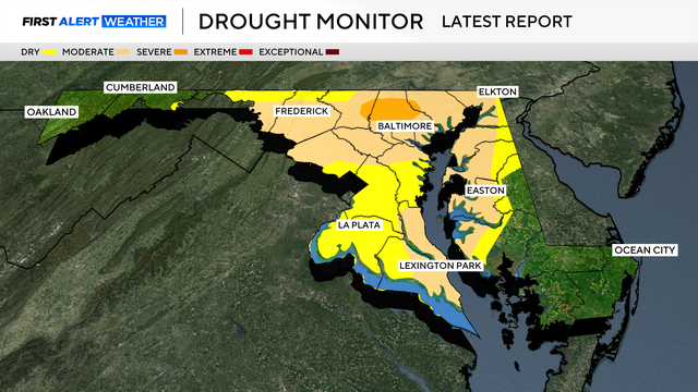
Drought conditions in Maryland have improved after several rounds of wet weather in May.
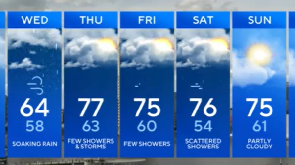
Rain chances climb late Tuesday and remain elevated through the rest of the week.
Sprinkles are possible Sunday night, into early Monday morning.

An EF-1 tornado with wind gusts of 110 mph caused damage in Baltimore and Dundalk during Friday's severe storms, according to National Weather Service surveyors.

Wet weather is expected Wednesday and Thursday.

Several rounds of rain and storms will sweep through during the workweek.

The weather on Mother's Day weekend is expected to be beautiful in Maryland.

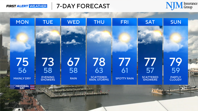
A few severe thunderstorms are possible Monday afternoon and evening.

Plan on a cool Monday morning and pleasant Monday afternoon across the state.

The first day of the workweek won't be a washout.

A warming trend is underway in the First Alert Forecast.