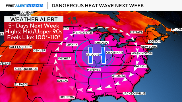
Chicago heat wave could bring triple digit heat index for over 5 days
The Chicago area is facing a dangerous heat wave next week, with humidity pushing temperatures into the triple digits for days and posing a real risk to life and health.
Watch CBS News

The Chicago area is facing a dangerous heat wave next week, with humidity pushing temperatures into the triple digits for days and posing a real risk to life and health.
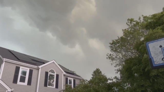
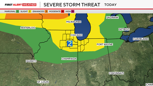
A round of watches and warnings is in effect for parts of the Chicago area, some with the possibility of producing damaging hail and tornadoes.
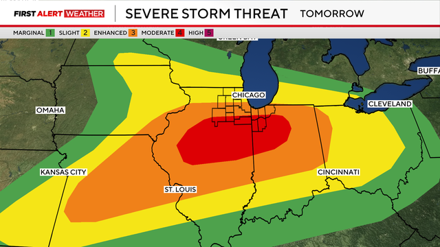
Another tornado outbreak is possible in the Chicago area Wednesday with two more rounds of storms on the way.
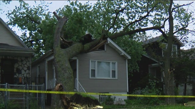
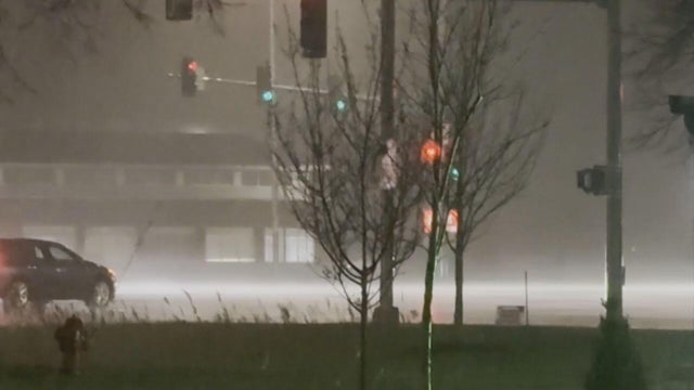
High winds left damage, including downed trees and power lines, leaving hundreds without power on Monday night.
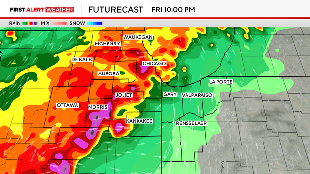
A tornado watch remains in effect for part of northwest Indiana as the threat of tornadoes from two rounds of severe storms has otherwise ended for the Chicago area.
Thunderstorms rumbled through the Chicago area Thursday afternoon amid unseasonably warm and humid weather.
Two rounds of storms that brought heavy rain and wind gusts of up to 70 mph blew through the Chicago area on Thursday.
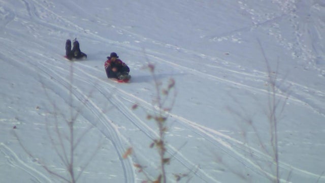
Winter weather slammed the Chicago area early Monday morning, with blizzard warnings in effect for some outlying areas.
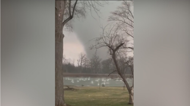
Emergency crews are assessing damage after a tornado touched down, damaging homes in Kankakee, Illinois, amid an outbreak of severe weather.
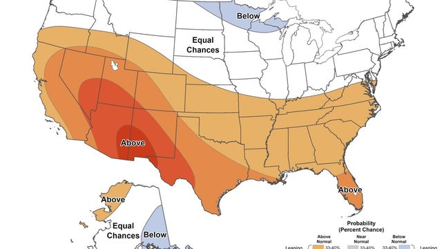
As La Niña continues to fade and we transition toward a more neutral pattern, the atmosphere should become a bit less locked into extremes and a little more typical of a Midwestern spring, which can still bring plenty of ups and downs.
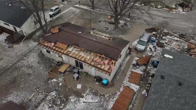
Some homeowners in central Illinois were dealing with damage they didn't expect in December, after a tornado touched down on Sunday amid severe storms.
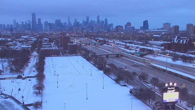
The early-season winter storm that pounded the Chicago area had moved on for most of the area by just before noon Sunday, but persisted in Northwest Indiana.
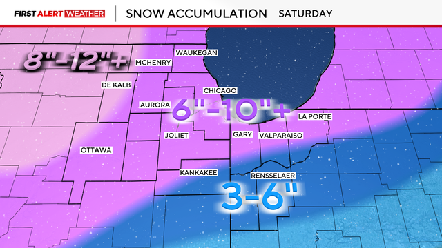
A Winter Storm Watch has been issued starting Friday night for a snowstorm that could drop 10 inches or more of snow across the area this weekend.
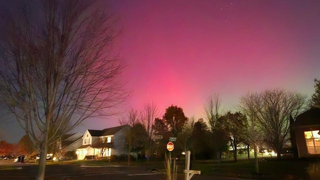
The northern lights were visible Tuesday night across the Chicago area, illuminating the sky with brightly colorful displays due to severe solar storms.
A Winter Storm Warning remains in effect for Northwest Indiana and the northern suburbs while much of the Chicago area has been downgraded to a Winter Weather Advisory.