Strong storms and severe weather could move through the Pittsburgh area on Sunday

Strong storms and severe weather could be moving through the Pittsburgh area on Sunday.
FIRST ALERT: Sunday afternoon and evening for strong to severe storms
AWARE: Seasonable weather arrives starting next week
Saturday is going to be a gorgeous day with mostly sunny skies with highs in the mid-80s and low humidity before severe weather enters the forecast on Sunday.
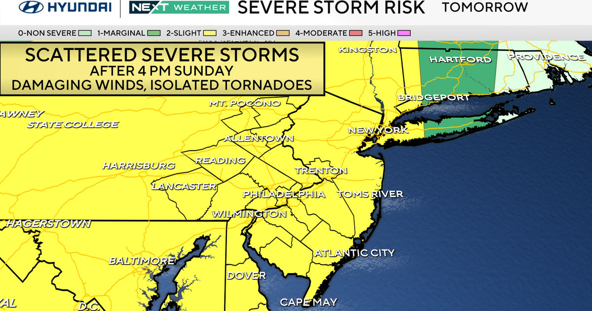
On Sunday, we have the chance for strong to severe thunderstorms in the afternoon and evening after 2 p.m.
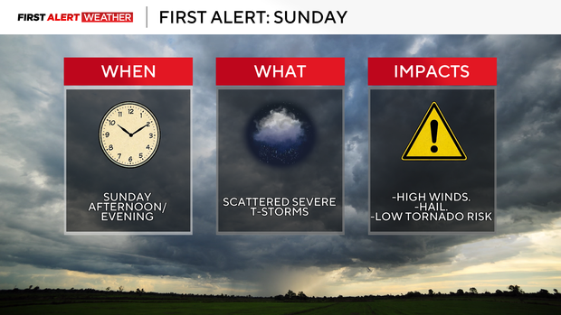
The storms could bring scattered but damaging winds, hail, and an isolated tornado can't be ruled out. If we see more clouds in the morning, it will lower the severe weather threat and if we see more sunshine, it will heighten that risk.
Right now, it's looking like a cloudy start with some isolated showers, but we are still in KDKA First Alert Weather mode with a 'slight risk' for severe weather which is a 2 out of 5. The storms look to move out around 6 p.m. or 7 p.m.
Monday and Tuesday will be our next dry days with partly cloudy skies and seasonable highs in the mid to upper 70s.

On Wednesday the chance of rain returns and Thursday, we are keeping a close eye on the chance for storms.