Thunderstorms, heavy rain arrive in New York City this weekend. Get the First Alert Weather Day forecast.
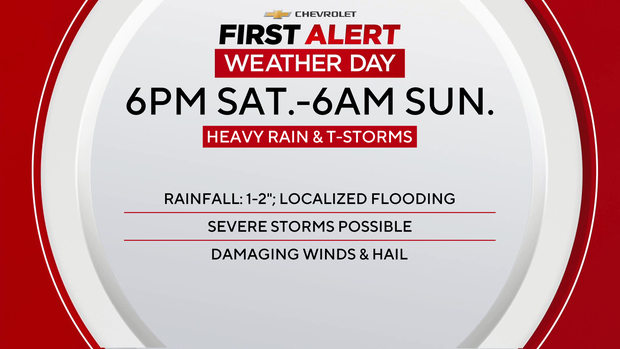
The threat of heavy rain and strong-to-severe thunderstorms has triggered a First Alert Weather Day from Saturday evening through early Sunday morning.
Friday felt more like early July rather than early May, with higher humidity and temps in the mid to upper 80s.
The summery feel will linger into the weekend, but rain chances will be increasing, as well.
For tonight, there's just a slim chance of a shower or storm, as lows don't go lower than the 60s.
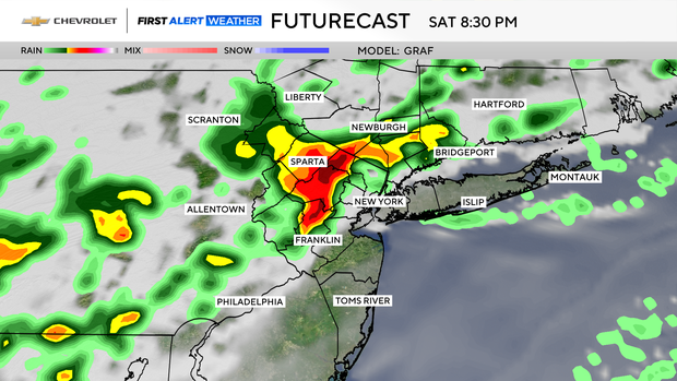
Storms develop Saturday evening
Plenty of sunshine should be in place through Saturday afternoon, which will once again help spike temperatures into the low and mid 80s, with increasing humidity.
However, by the evening hours, thunderstorms start to develop, and some of them may be severe.
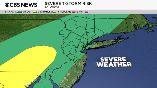
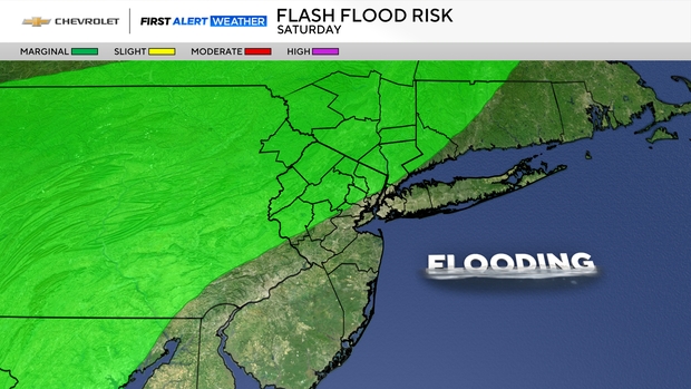
The greatest hazards associated with these storms would be heavy rain that could lead to flooding, damaging winds, and even some hail. Locations to the north and west of the city are where severe storms are most anticipated.
Between the hours of 6 p.m. Saturday through about 6 a.m. Sunday, storms could form at any time, with the window of 8 p.m. until midnight Saturday having the greatest chance of storms.
Lull Sunday before rain returns
A brief lull in activity is likely on Sunday morning before another round of rain and thunderstorms pivots through the region for Sunday afternoon.
The severe threat will be diminished on Sunday though, with highs dropping into the low to mid 70s.
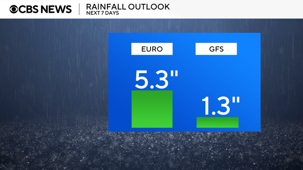
Rain chances will then linger into Monday and beyond, due to a lingering area of low pressure over the Ohio Valley.
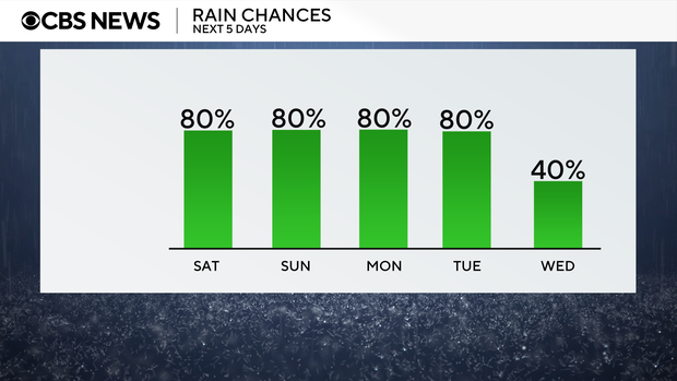
While it won't be raining at all times, by the time everything is said and done, some locations could see several inches of rain.