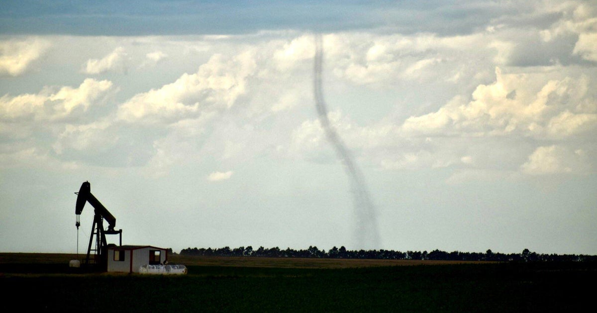
6 tornadoes confirmed in Minnesota, Wisconsin after severe storms


Both Minnesota and Wisconsin were hit by tornadoes during Monday night's severe storms, the National Weather Service confirmed.
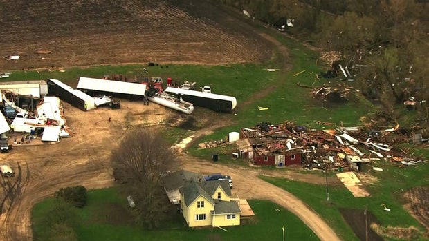
The first hit Kenyon, Minnesota, in Rice County around 5:55 p.m., according to a storm report. The NWS said debris was blown about a mile away and the tornado has a preliminary damage rating of at least EF-1
A WCCO crew saw major damage to farm structures and houses in Kenyon, which is about 60 miles south of Minneapolis.
No lives were lost, and a police officer WCCO spoke with in Kenyon said no one even called 911. But the storm is going to be a very costly cleanup for residents Scott and Jean Marik.
"The machinery and the tractors, and everything for putting in the corn and beans in spring," Marik said. "It's quite a blow when something like this happens to one of our neighbors."
The Mariks said the storm was quick but powerful, and it shook them to their core.
"It just got calm. It was real calm. It was windier than heck then got calm, then we looked across the field and you could see the yellow skies, dark clouds. We thought, 'wow this was the time to get in the basement,' and we did," Marik said.
The people directly affected are not the only ones out surveying the damage. Crews from NWS in Chanhassen are looking at the debris, too. They're taking it to piece together what happened to learn from it and help all of us in the future.
They toured at least three sites on Tuesday, including a commercial building in Kenyon that's now missing a piece of the roof.
"The environment was volatile across all the Upper Midwest. The storms happened in southern Minnesota, north of the Twin Cities towards St. Cloud and into western Wisconsin. That's the part of this whole process we can't control," said NWS meteorologist Joe Strus. "We take what we find here today back to the office, so next time we're in a setup like this maybe we can get the warning out a few minutes earlier. Maybe we can let people know a few more mins ahead of time so they can put their plan into place."
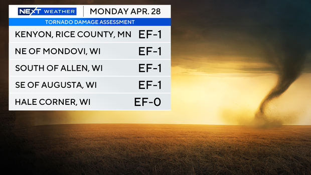
Several tornadoes touched down near Eau Claire, Wisconsin on Monday evening, the agency said. An EF-1 tornado touched down northeast of Mondovi in Buffalo County. It then crossed into Eau Claire County briefly before lifting.
Another EF-1 tornado briefly touched down south of Allen and west of Foster in Eau Claire County, and an additional tornado with at least EF-1 damage occurred south and east of Augusta. The weather service then said a brief EF-0 tornado touched down near Hale Corner.
On Wednesday, the NWS reported a sixth, weak tornado that touched down south of the Twin Cities. The EF-0 tornado touched down in East Morrison, in Rice County.
Crews are still assessing the extent of the damage.
Monday's storms, which started out west and dragged east across Minnesota and into Wisconsin, also caused thousands to lose power. While the Twin Cities mostly avoided anything severe, some damage was reported.
Minnesota sees an average of 50 tornadoes a year, while Wisconsin gets about 23. Most of Minnesota's tornadoes occur in June.
When a tornado warning occurs, residents should head to a basement if possible. If not, put as many walls between you and the storm as possible. Cover your head and remember to bring shoes to protect your feet after the storm.
The forecast for the rest of the week looks much calmer, with cooler temperatures until a weekend warm-up.
Note: The above video first aired on April 29, 2025 before the NWS confirmed the presence of a sixth tornado.