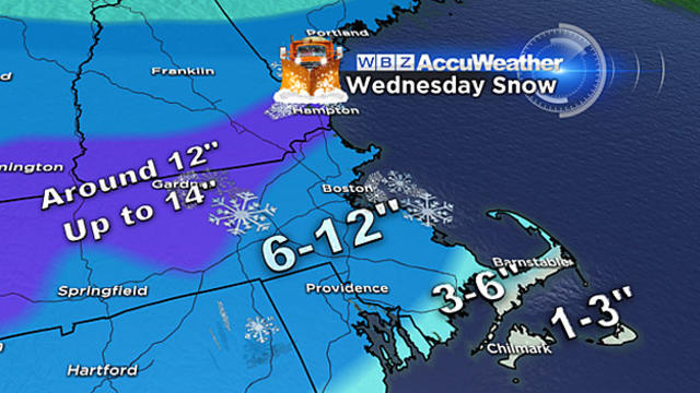
Close To A Foot Of Heavy, Wet Snow Coming Wednesday
Most areas will get 8-to-12 inches of snow Wednesday and several towns will be reporting 9, 10 and 11-inch amounts.
Watch CBS News
Most areas will get 8-to-12 inches of snow Wednesday and several towns will be reporting 9, 10 and 11-inch amounts.
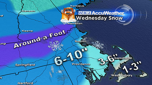
It will encompass all of New England, dump significant amounts of heavy, wet snow and impact both the morning and evening commutes.
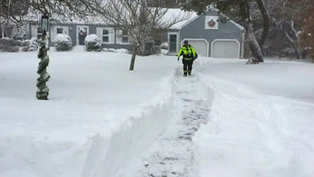
A Duxbury man is alive thanks to a neighbor who plowed out his front walk after he collapsed during last week's nor'easter.

Coastal areas were cleaning up on Saturday after a powerful nor'easter.

A blanket of white provided the Northeast with little relief from teeth-chattering temperatures that forecasters said will rise over the weekend before plunging again.

The National Guard helped rescue several families after high tide Friday afternoon.

Top audio clips from each week, as selected by WBZ News Editor Dave Mager.

Boston received 15.1" of snow over the span of Thursday and Friday just beating out the old #5 storm.

A storm dropped a blanket of light, powdery snow across the Northeast and ushered in frigid temperatures Friday that were unusual even for cities accustomed to blasts of winter weather.
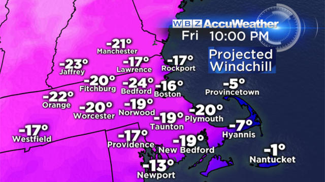
It is extremely cold out, wind chills are dangerously low. The kids may want to wait a day or two to hit the hills with their sleds or build the snowman.
Gov. Deval Patrick said the state appears to have handled the Nor'easter well.
Massport says no flights will be going in or out of the airport between 8:30 p.m. Thursday and noon on Friday.
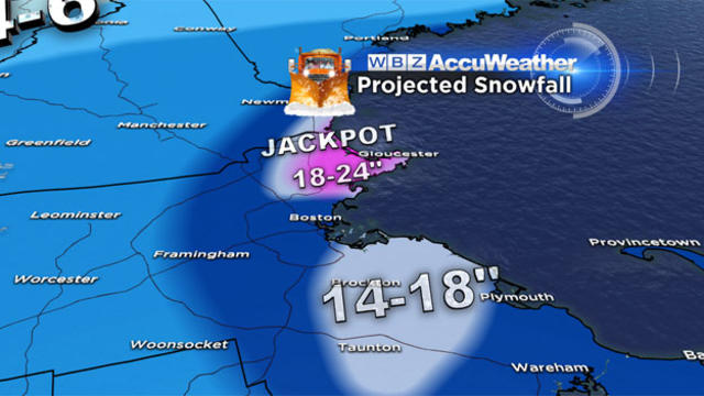
Nor'easter 2014 has arrived. It may take a while to get revved up but once we get there it is going to pack a significant punch.

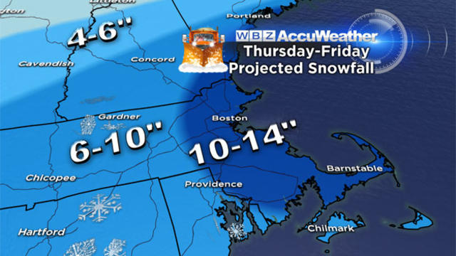
This will be a long duration event with nearly 36 hours of light to moderate snowfall.
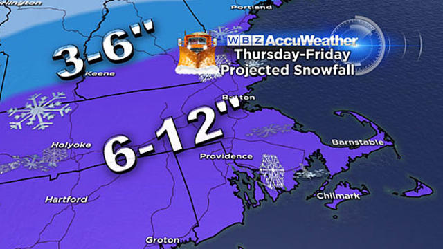
Our first true Nor'easter of the season appears to be on its way for later this week, but some good news as it appears we may skip a worst-case scenario.

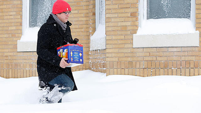
I would urge you pay a little extra attention to the forecast over the next 48 hours and be prepared for a rude welcome back to work and school from Mother Nature.

Snow totals are widely variable throughout the region with just a few inches in some areas all the way up 12-to-24 inches in parts of Worcester County and southeastern Massachusetts.
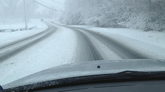
By this evening skies will begin to clear out and winds will be dying down. Consequently, the evening commute won't be as tough as this morning.

The storm will slowly wind down this afternoon as the storm departs to our east.

A fresh layer of several inches of snow will coat the ground and many roads by Friday morning's commute, leading to some tricky and treacherous travel. Snow will continue all morning and finally begin to taper off during Friday afternoon.

The greatest concern with this event will be along the coastline. There will likely be a significant impact for the entire Massachusetts coast with severe beach erosion and flooding.
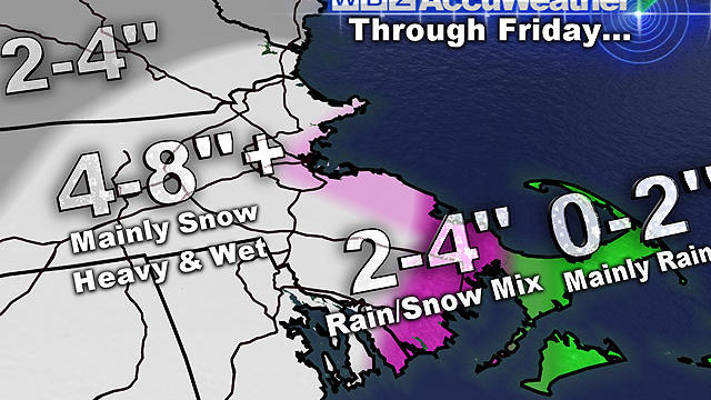
This storm will include a plethora of weather conditions - heavy, wet snow inland, heavy rain for the Cape and Islands, damaging winds, and coastal issues.
The coast will be dealing with a rain-mix throughout this storm with heavy, wet snow falling away from the coast.