North Texas sees storms, hail risk, unsettled conditions through the holiday weekend

Scattered storms will continue Sunday evening before dissipating overnight. Frequent lightning and heavy rain will be the main threats, but a few instances of severe hail and wind are also possible.
An air quality alert is in effect Sunday due to high ozone levels at the surface. It's advised for those with respiratory or heart-related issues to limit outdoor activity this afternoon.
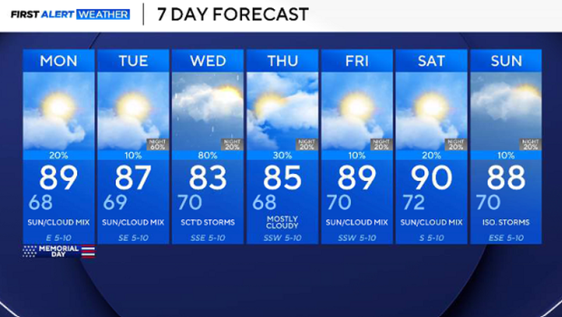
On Memorial Day, there is a lower chance for storms, but it will still remain a possibility. Be sure to keep your eye to the sky during outdoor festivities in the afternoon. Lightning is extremely dangerous. If a storm is moving your way, head to shore and shelter immediately if out on the lake or swimming.
Monday, expect a morning low in the upper 60s with temperatures climbing into the upper 80s by the afternoon. Mostly sunny skies and calm winds are expected.
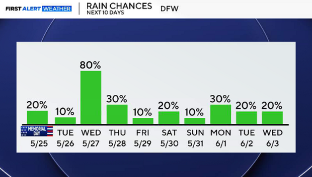
As for the next week, more disturbances will impact North Texas, keeping the weather pattern fairly active. More rain and storms are likely; don't put up the umbrella yet.