
Extreme cold watch issued for entire Pittsburgh starting late Sunday
An extreme cold watch has been issued for the entire Pittsburgh area next week.
Watch CBS News

An extreme cold watch has been issued for the entire Pittsburgh area next week.
A drop in temperatures and snow flurries are still expected this upcoming week in our region.
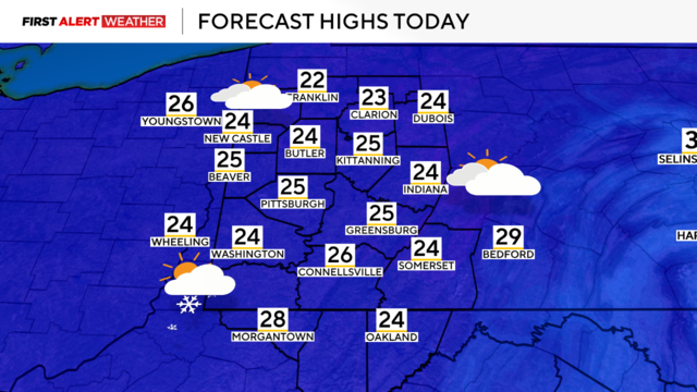
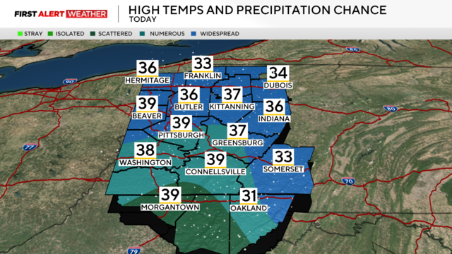
Temperatures will drop going into the next week and more snowfall is expected today.
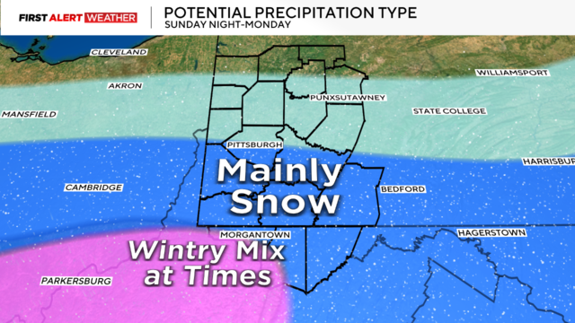
Temperatures will drop a few degrees tonight with a few snow showers lasting into Monday.
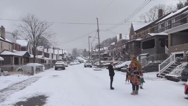
Snow and cold temperatures are still expected today continuing through next week.
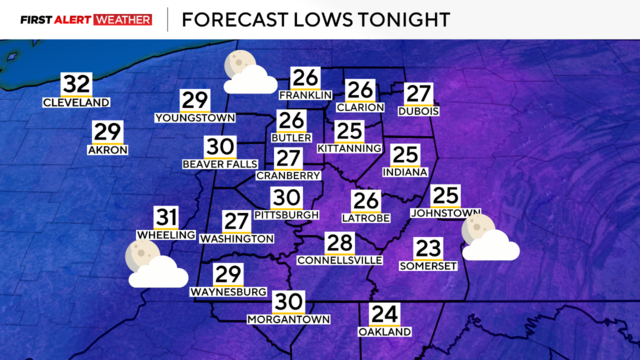
Tonight temperatures are expected to drop into the single digits and teens in some areas accompanied with snow fall.
Some snow showers will continue early Thursday morning and temperatures will reach single digits tonight.
Today we'll see some snow showers before even colder temperatures move in.
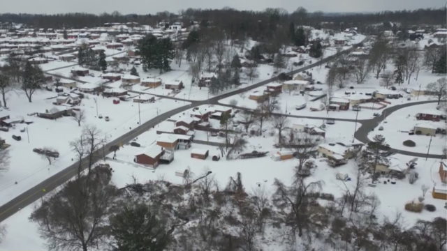
After a day of snow showers, the Pittsburgh area is looking at cold temperatures and some more snow.
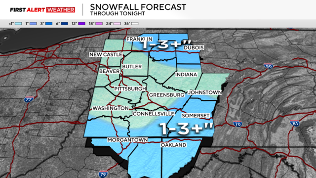
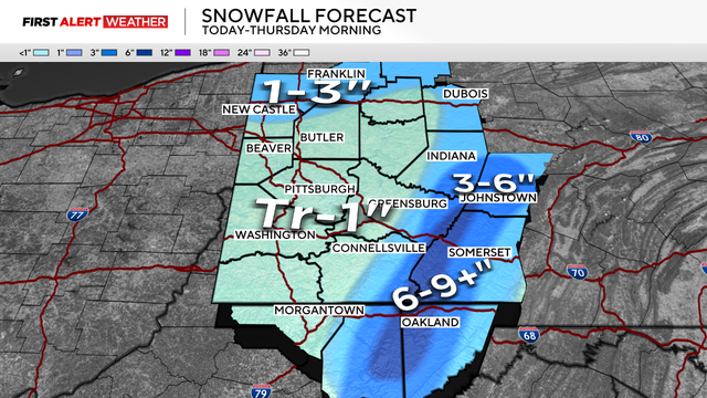
The National Weather Service says it's likely most of the Pittsburgh region will see anywhere from 2" to 5" of snowfall over a 24-hour period starting early Friday.
Scattered snow showers are expected to continue areawide through the midday into the afternoon, evening and overnight hours.
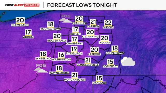
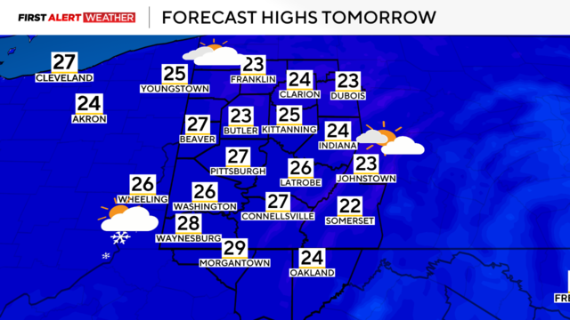
We're in for another cold day on Sunday before we get some relief on Monday.
Temperatures will slowly fall throughout the day and we could see lake-effect snow.
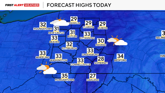
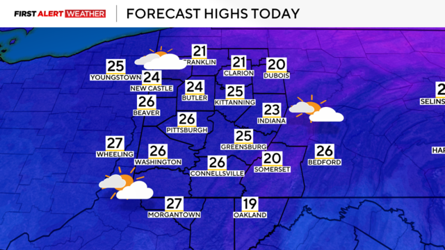
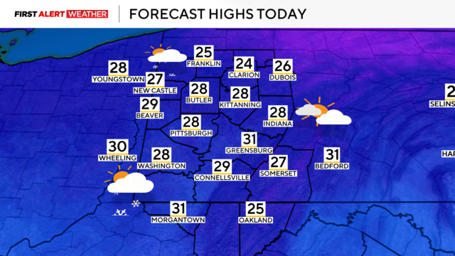
Temperatures begin in the upper-20s on Friday and some areas could see snowfall.

If you're looking for a white Christmas, the large-scale weather pattern may not end up being in Pittsburgh's favor this year.