Lingering snow showers this morning ahead of brief warm up in weather

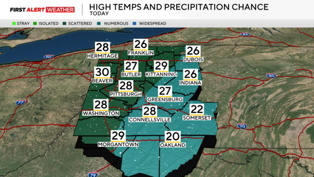
PITTSBURGH (KDKA) - Light to moderate snow moved through all of western Pennsylvania and northern West Virginia late Friday evening into Saturday morning as expected. Through the overnight hours, the greatest snow totals we have received have generally been west and north of Pittsburgh with a localized heavier band that set up from roughly Beaver, northeast Mercer and Venango Counties. Snowfall totals generally ranged between 2-4 inches.
WEATHER LINKS:
Current Conditions | School Closings & Delays | Submit Your Weather Photos
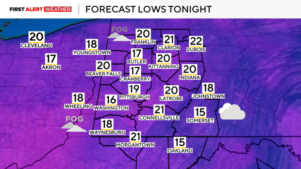
Today, expect low clouds to persist along with some areas of steady light to moderate snow through middle of the day. By afternoon, the disturbance producing this band of snow will have moved east of our region which should lead to the steady snow departing and some lingering flurries this afternoon and evening. Temperatures are expected to peak in the upper 20s to low 30s for highs today. Later this evening and especially during the overnight, some patchy dense fog may develop in spots, but skies will remain mostly cloudy to overcast with temperatures falling into the upper teens to near 20 degrees by Sunday morning. There may also be a few lingering flurries across our northern and northeast counties as well.
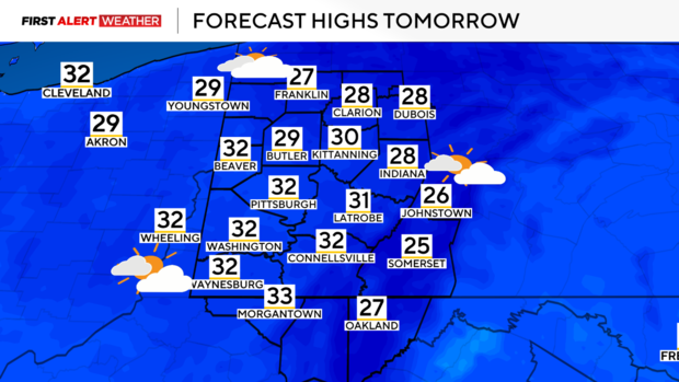
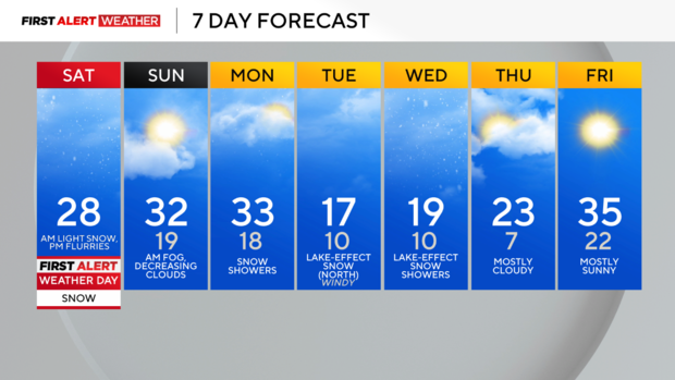
Clearing skies are expected by Sunday afternoon as a short-lived region of high pressure settles in. Another quick-hitting disturbance accompanied with a cold front will produce more snow showers beginning early Monday morning lasting through the afternoon hours.
This will followed by several days of weak disturbances and very cold air flowing aloft a relatively ice-free Lake Huron and Lake Erie which will result in more sporadic chances of lake-effect snow and cloudy skies into the middle of next week. On Tuesday, winds aloft should be more westerly which should keep most of the lake effect snow concentrated over our northern counties. Tuesday night into Wednesday morning, the bands may shift farther south into the region which could bring a couple bands of light, accumulating snow into the Pittsburgh metro area.
Highs will be in the upper teens to low 20s with lows in the single digits to low teens. There are continued signs that point towards a rebound in temperatures by the end of the week into the following weekend.
Stay up to date with the KDKA Mobile App – which you can download here!


