Still no major snow or cold in sight, but rain returns late Wednesday
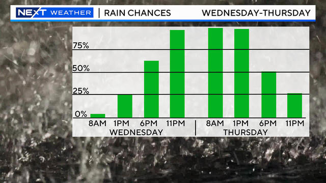
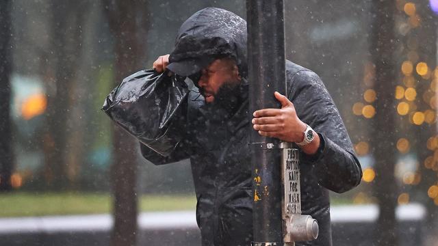
There is still no major snow or cold in sight, but our next rainstorm is set to arrive late Wednesday and continue into Thursday.
Watch CBS News
There is still no major snow or cold in sight, but our next rainstorm is set to arrive late Wednesday and continue into Thursday.

The weather is looking great for the holiday this year! In fact, temperatures will be about double what they were last Christmas!
You likely don't need a meteorologist to tell you that Monday was a rather unusual weather day for mid-December.
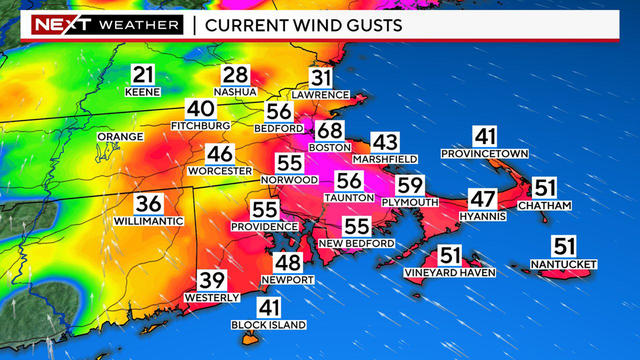
This is, once again, a very large storm with impacts up and down the East Coast.
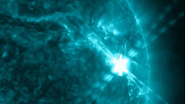
The solar flare is likely the most powerful since 2017.

Get ready for the BEST meteor shower of the year! The Geminids can produce up to 120 meteors per hour.

Here are the communities that had the most rain, according to the National Weather Service and WBZ-TV weather watchers.

There's a flood watch across Massachusetts as very heavy downpours continue Monday morning, but the sun returns this afternoon.

Some snow flakes will fly early Wednesday morning, but it won't be a major weather system.

This will be a rainstorm for everyone in southern New England. Snowfall will be confined to the north.

Welcome to December. November in Massachusetts was dry and chilly, but does that change the winter forecast?

We may have a somewhat rare and unique opportunity to see the northern lights in parts of New England.

If you're traveling for Thanksgiving, the weather for Monday and Tuesday looks a lot better than Wednesday.

We will not be setting any new weather records this Halloween and we don't have any major storms in the forecast.

We have an absolutely gorgeous week of weather ahead, perhaps the best 7 day forecast we have had in months.