Still no major snow or cold in sight for Massachusetts, but rain returns late Wednesday
BOSTON - There is yet another rainstorm headed our way. This one is set to arrive Wednesday evening and continue into Thursday.
At this point, the WBZ-TV Weather Team is holding off on issuing a NEXT Weather Alert as this storm looks to be much less impactful than the last few.
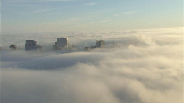
Backing up a bit, the low clouds and fog have been quite persistent the last few days. There will be some burning off during the day on Tuesday, but we expect it to fill back in quickly again at night.
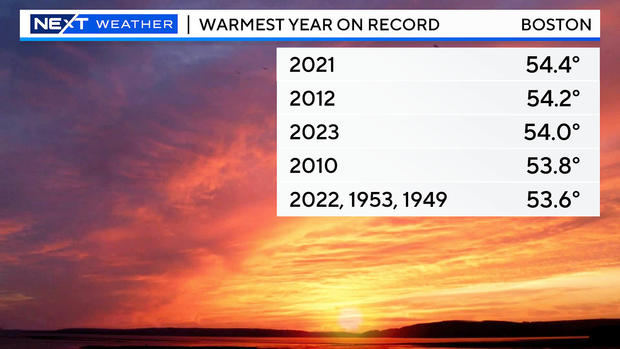
Temperatures will remain mild Tuesday and Wednesday with high temperatures near or slightly above 50 degrees. That's been the story this December (and really this year). With less than a week to go, it looks like Boston will finish with a top 5 warmest December and year on record.
As for the rain, clouds will thicken during the day Wednesday and rain will arrive from west to east late in the day. The heaviest and steadiest rain will fall Wednesday night through Thursday morning and afternoon. Unfortunately, we will be left with lingering showers through at least Friday, perhaps into Saturday as well with light rain showers in eastern Massachusetts and some rain and snow showers inland.
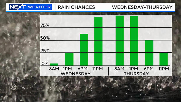
We expect around an inch or so of rain through Thursday, perhaps a bit more south of the Mass Pike and somewhat less to the north and west.
Winds could get a bit gusty later on Thursday, especially in eastern Mass. There is potential for 20-to-40 mph gusts out of the east-northeast. Again, both rain and wind will be borderline alert-worthy, so we will continue to monitor trends in the models.
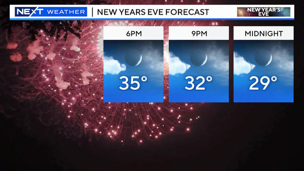
Looking further ahead to the holiday weekend, we will be drying out on Sunday and temperatures will also be cooling off. Readings will fall through the 30s and into the 20s Sunday night. Highs will be stuck in the 30s for the most part on New Year's Day Monday.
There is still no major snow or cold in sight!


