How rare was damaging December storm in Massachusetts?
BOSTON – You likely don't need a meteorologist to tell you that Monday was a rather unusual weather day for mid-December.
The sheer amount of rain and wind does seem quite atypical for December, but just how rare was it? And, is this a sign of climate change or perhaps a side effect of El Nino? Let's take a deeper dive.
Monday was a record setting day for many cities in southern New England. Boston set new records for...
- Highest max temperature: 63 degrees
- Highest minimum temperature: 45 degrees
- Average daily temperature: 54 degrees
- Daily rainfall: 1.68 inches
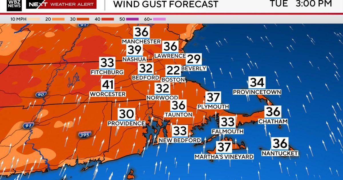
There were reported wind gusts of 70 mph at Union Wharf in Boston, 68 mph at Logan Airport and 67 mph at Northeastern University.
The National Weather Service tells us that these were the strongest (non-thunderstorm) winds in Boston in 10 years, dating back to February 8, 2013!
Blue Hill Observatory had a similar, record-setting day. Observer Matt Douglas told WBZ that Monday's winds topped out at 90 mph. This was the highest recorded wind gust atop Blue Hill since January 27, 1996!
The rainfall reports from around the area were equally as staggering.
While most towns reported between 2-4" of water, there were several reports between 4-6" in parts of western MA, Connecticut and Rhode Island! This coming just 1 week after similar amounts of rain were recorded over the same areas.
Just 19 days into December, many towns already have 2-3 times the normal amount of rainfall for the entire month.
Check out some of these December rainfall totals:
- Coventry, RI: 9.17"
- Milford, MA: 8.89"
- Northbridge, MA: 8.86"
- Storrs, CT: 8.61"
So this begs the question...what the heck is going on?
More of the same in 2023
Let's face it, this has been a miserably wet year. Remember way back in spring? It seemed to rain just about every weekend. Spring sports like soccer and baseball were constantly getting postponed or canceled.
We snuck in a nice May and a lovely Memorial Day weekend and then went right back into the rainy pattern for most of the summer and fall. Weekend after miserable weekend, it rained. Boston and Worcester both had their 2nd wettest summers on record with more than 20" of rainfall in June-July-August.
So, I guess you could say, what we are seeing now in December is just more of the same.
Is this due to El Niño or climate change?
It is always hard to attribute one storm, one season or even one crazy year to climate change. But, there is no denying that this has been one of the warmest years on record over land and sea.
Warmer air holds more moisture and therefore, put simply, when it rains, it pours. Add a strong El Niño on top of this and strange/rare weather events are bound to occur.
Shouldn't it be cold and snowy in December?
Ahhh, how soon you forget. While Monday's storm was quite unusual, on the face of things, this really isn't anything new for December, at least not in recent times.
Looking back at the last few years, we see similar patterns...
December 2022: We had two heavy rainfall events (December 7-8 and 16-17), only 1.0 inch of snow for the month and to top it off, we hit a record high 63 degrees on December 30.
December 2021: We hit 60 degrees six times, had a significant rain event on December 18-19 and only recorded 0.4" of snow for the month.
December 2020: A crazy month. The first week was very warm with two rain storms. We got a whopper of a snowstorm on December 17, dropping 12.7 inches of snow in Boston, only for it all to be washed away by several mild days leading up to Christmas. And, Christmas Day was 60 degrees with a another soaking rain storm!
I could go on, but I think you get the idea. Those Decembers you remember from your youth are long gone. Sure, we can still get a decent snow storm or two but, more often than not, it doesn't stick around long enough for a White Christmas.
What if the rain had been snow?
Lastly, if I had a dollar for each time somebody asked me "If all this rain were snow..."
My answer is typically something along the lines of, "It kinda doesn't work like that..."
You could just take the average liquid: snow ratio which says 1 inch of rain equals 10 inches of snow. By that measure, southern New England would currently be blanketed by anywhere between 30-60 inches of snow from Monday and as much as 90 inches of snow this month. But that is not realistic.
The two storms we have had this month have been "inside runners," moving well to the west of our area, drawing up tropical moisture all the way from the Gulf of Mexico. Those would have been rainstorms in any year, regardless of climate change, El Niño or anything else.
For these storms to have been snow, the atmospheric setup would have had to be completely different. Most importantly, temperatures would have been some 30 degrees colder, and, as stated above, colder air holds a lot less moisture.
If you caught our winter forecast back in November, this was basically what we expected. December was forecast to be wet and mild and we figured that winter had a much better shot at arriving sometime around of after MLK day. At this point, there is no reason to stray from that forecast. Much like the last several years, there will be no White Christmas this year but, let's not count out winter just yet!
