Powerful rain and wind storm impacting Massachusetts to start work week
BOSTON - Tough way to start the week! The WBZ Weather Team is continuing the NEXT Weather Alert through Monday afternoon as heavy rain and strong winds continue to batter southern New England.
The peak of the storm will continue through about mid afternoon.
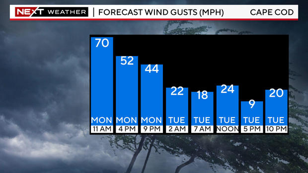
Storm brings strong wind gusts
Peak wind gusts continue to be very impressive. 84 mph atop Blue Hill is a new record for the date.
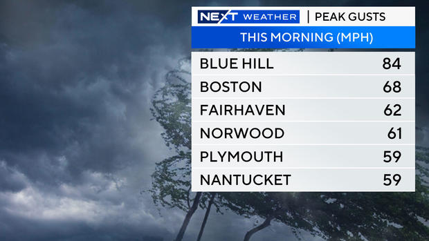
Boston had a gust to 68 mph right around 10:53 a.m. and Logan Airport was in a temporary ground stop.
The winds will start to come off their peak this afternoon and gradually decrease through the evening.
As of about noon on Monday, about 200,000 customers are without power and we have received dozens of reports of downed trees and power lines through the region.
How much rain will the storm bring?
Rainfall amounts are also rapidly increasing. As of midday Monday, most of the area had between 1.5" and 3.5".
Peak rainfall totals are located in parts of southern Worcester county and northern Rhode Island. More than 4" of rain has fallen in that area.
There will be a few final areas of downpours, the last of which will come through between 2-4 p.m. Monday afternoon.
Thereafter, the rain will become much lighter and showery.
Flooding and coastal concerns
Coastal flooding remains a concern, particularly in parts of Narragansett Bay and Buzzards Bay.
The flooding in the Fox Point/Providence area around midday is projected to be the highest since last December's storm and perhaps rival that of Hurricane Bob back in 1991.
Minor flooding with pockets of moderate coastal flooding is expected up and down Buzzards Bay through about 2 p.m.
Farther up the coast, there will be some minor splashover and coastal flooding along parts of the North Shore including Gloucester.
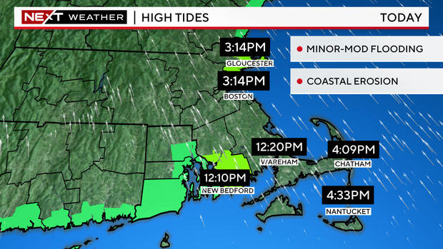
The timing of that is a bit later, between 3-4 p.m.
River flooding is also a growing concern. In fact, a river flood warning was issued for the North Nashua river in Fitchburg, which is forecast to crest in minor flood stage later today.
On final note ... both Boston and Worcester hit record high temperatures Monday morning! It is rare enough to hit 60 degrees in December, but doing it in the morning hours is even crazier!
Thankfully, there will be plenty of time to recover after this storm passes Monday night.
There is no significant storminess in the forecast for the rest of the week. Travel conditions look great right through the holiday weekend.
Stay with WBZ-TV, WBZ.com and CBS News Boston all day long. We will provide frequent updates each and every hour.


