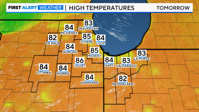
Highs in the 70s with sunny skies in Chicago
After another cool, crisp morning on Thursday, south winds will drastically warm temperatures later this week.
Watch CBS News

After another cool, crisp morning on Thursday, south winds will drastically warm temperatures later this week.

For the Air and Water show, we will enjoy breezy winds and pleasant temperatures this weekend.
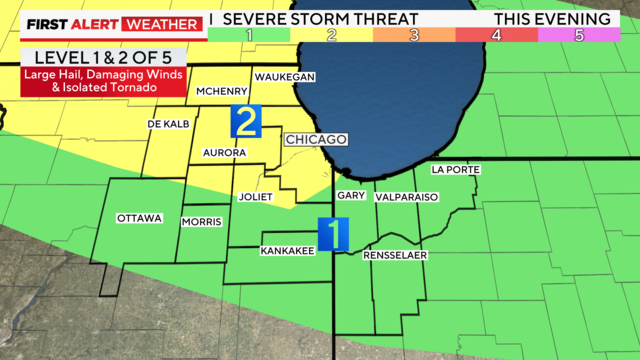
Following widespread thunderstorms Monday morning that dropped quarter-size hail in Highland Park and Edgewater, scattered strong to severe thunderstorms redevelop in the area Monday evening.
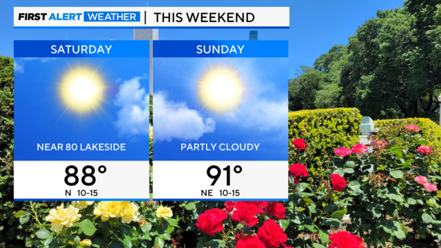
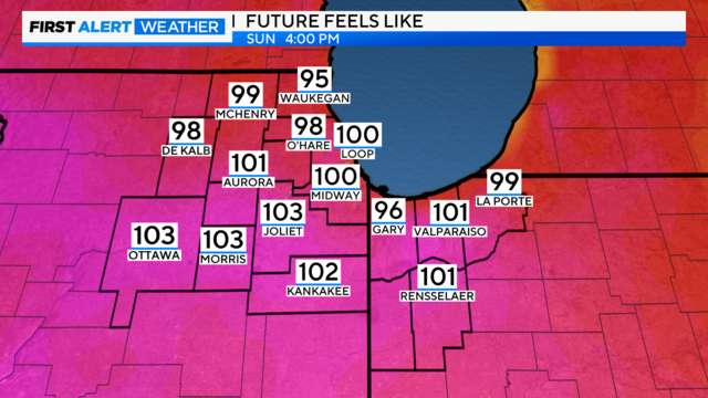
Concert-goers at Lollapalooza will be milder, especially on Saturday, with lake breezes keeping afternoon highs near 80.
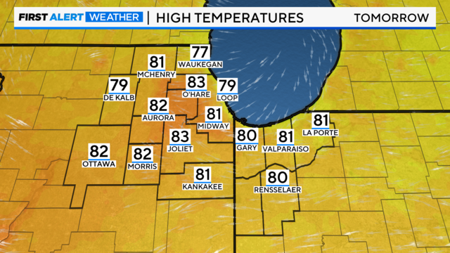
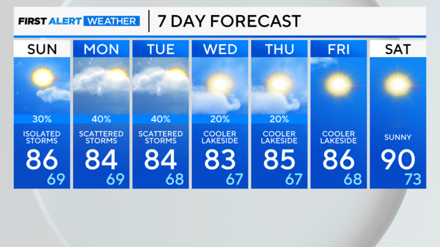
Thursday's high temperatures will be near 80 degrees.
Though no severe weather was seen, heavy downpours soaked the area—and cloud-to-ground lightning was a concern.
A few storms could produce downpours and gusty winds. Cloud-to-ground lightning will also be a concern with these storms.
Temperatures warm a bit, and light southerly winds are returning this weekend.
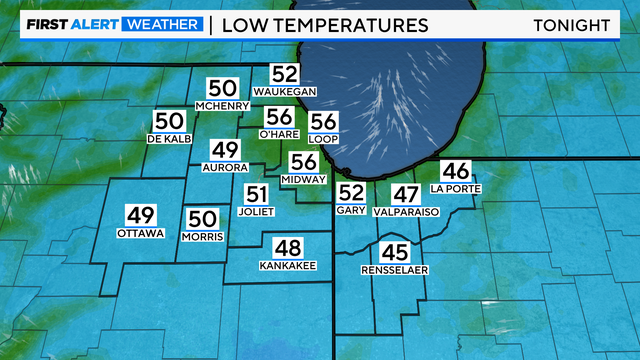
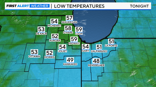
Nighttime lows will be the coolest since Jul. 1, with some rural areas dropping to nearly 50 degrees on Thursday and Friday mornings.
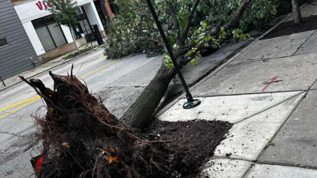
A total of 32 confirmed tornadoes hit July 15 alone, while 9 more were confirmed during the July 14 storm.
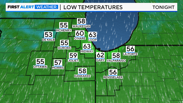
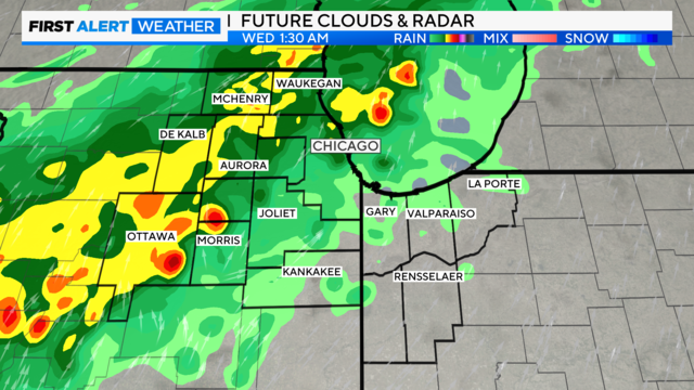
Winds relax this evening as additional showers and thunderstorms develop, mainly southwest of Chicago.
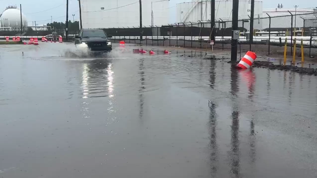
Across the region, many drivers took the risk amid the heavy downpours.
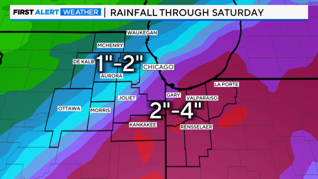
Tropical moisture is already streaming into the Great Lakes region ahead of the system, fueling scattered thunderstorms Monday afternoon and evening, some with torrential rain.
Conditions will be mostly dry for the rest of the day, but pop up showers are possible through sunset.
Rain and a few rumbles of thunder are likely, but we are not forecasting a severe weather threat locally.