Dry conditions continue until mid-next week with hot temperatures looming in Pittsburgh

We continue to remain in an inactive and stagnant weather pattern across most of the Upper Ohio Valley as a strong ridge of high pressure aloft and at the surface continues to dominate our large-scale pattern.
WEATHER LINKS:
Current Conditions | School Closings & Delays | Submit Your Weather Photos
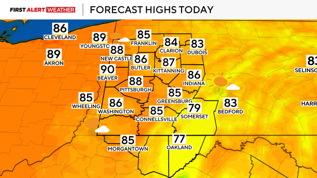
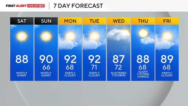
Each day through the next few days will progressively get hotter as the high slowly moves east and southwest winds at the ground and lower atmosphere gradually bring in warmer air to our region. Highs today will reach the mid to upper 80s for most of our area.
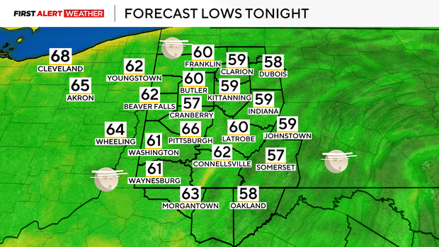
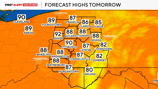
A stretch of low 90s appears likely starting Sunday through next Tuesday with heat indices in the mid to upper 90s. Skies should be mostly clear today and tomorrow, outside of a little remnant haze and wildfire smoke. More clouds may appear by Monday and Tuesday as moisture levels gradually increase.
The next front to keep an eye on still has its eyes set on us by Wednesday. Some isolated storms may occur as early as Tuesday evening and night, with better chances during the morning to midday hours of Wednesday. There is some uncertainty as to whether the front will get hung up just south of our area on Thursday, which would keep low storm chances ongoing or completely clear the area.
Either way, we will likely not get a good surge of cooler air, and temperatures will remain above normal for the entire forecast period over the next week.
Stay up to date with the KDKA Mobile App – which you can download here!