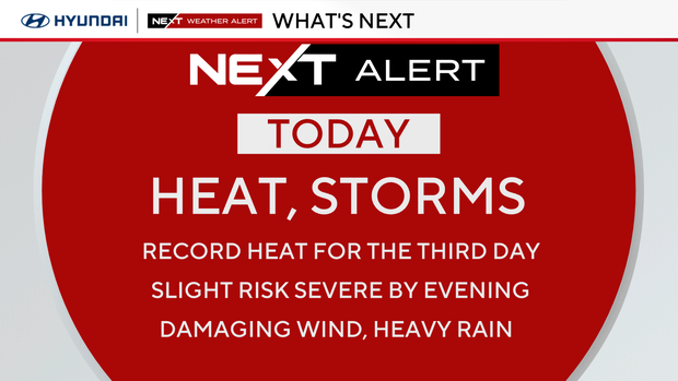
Storms hit Philadelphia Wednesday as region has another day of record-high temperatures amid heat wave

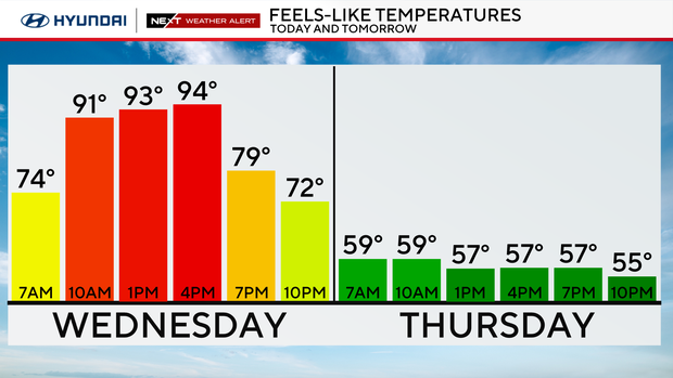
After the hottest May day ever recorded in Philadelphia's history, the extreme heat continued Wednesday with record highs in the mid-upper 90s.
A severe thunderstorm watch for the entire Philadelphia region is no longer in effect. The greatest impact is likely to be damaging winds, but large hail is also possible. The tornado threat is low but cannot be ruled out.
A flash flood warning issued for parts of Pennsylvania and South Jersey is also no longer in effect.
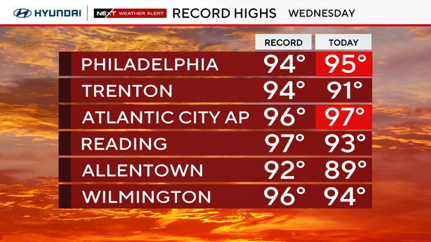
On Wednesday, we set two record-high temperatures in the area, in Philadelphia and Atlantic City. Philadelphia's high so far is 95 degrees (the old record was 94). Atlantic City Airport's high so far is 97 degrees; the record was 96.
That means this is not only an official heat wave but three straight days of records. That's a pretty historic heat event.
The NEXT big change brings storms, cooler temps
Due to the heat, 57 School District of Philadelphia schools moved to virtual learning Wednesday.
A cold front moved in Wednesday night and brought a staggering change with periods of rain, a raw east wind and temperatures hovering in the upper 50s through Thursday.
The storms Wednesday night caused damage in Montgomery and Chester counties. The Red Cross says it's helping six people from two families because of the damage.
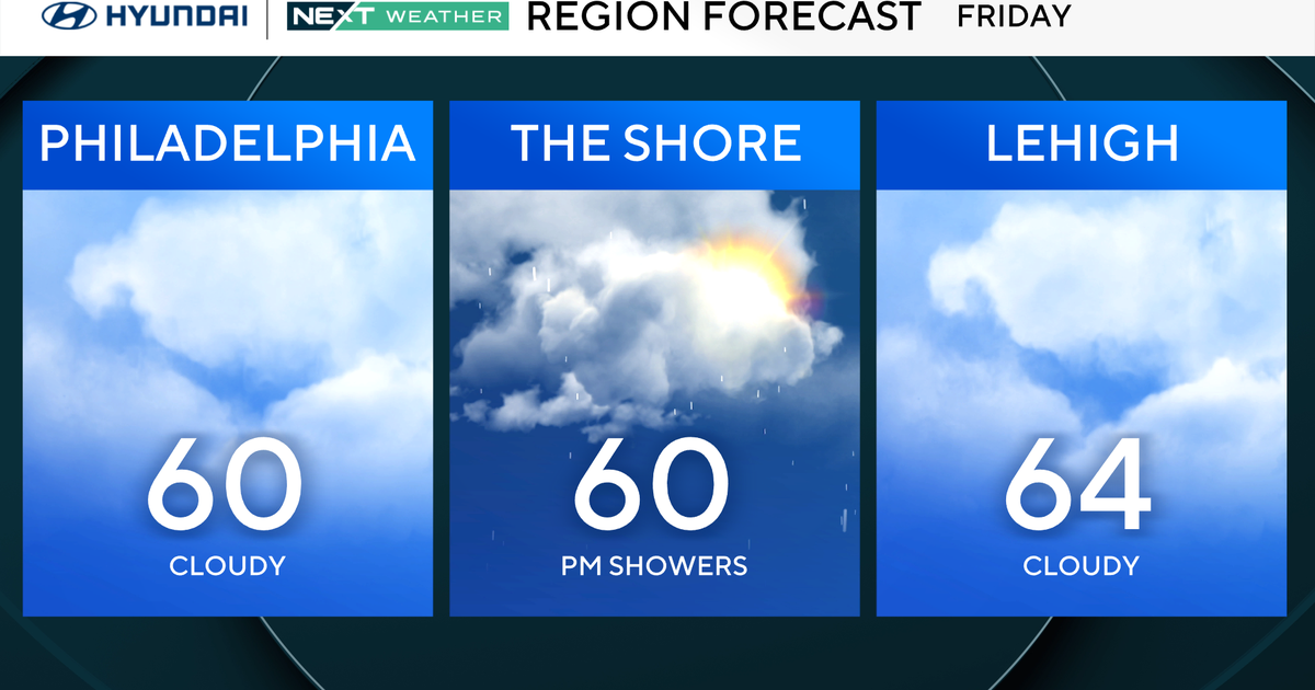
Friday may clear out and bring some sunshine, though it stays on the cooler side.
Memorial Day Weekend forecast looks cloudy, chilly and wet
Forecast models are falling more in line with what may occur over the weekend, and to be honest, it's not looking good.
Saturday will likely be cloudy, chilly and wet. Sunday will be a bit warmer, a bit less wet, but still way below normal for this time of year.
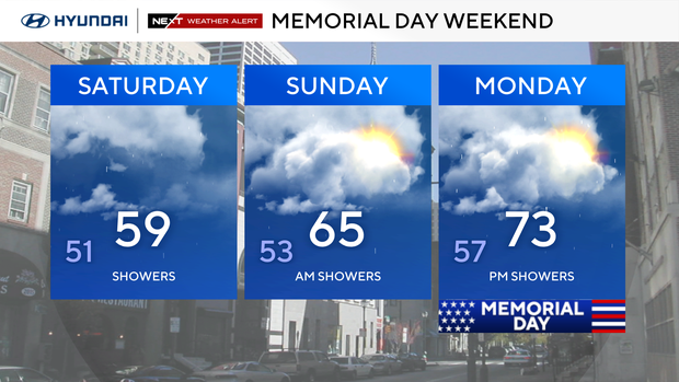
While Monday doesn't look ideal, it does appear nicer and warmer than the weekend days, but we are not going to be rain-free. Make your backup plans now if you have something set for outside.
Here's your 7-day forecast:
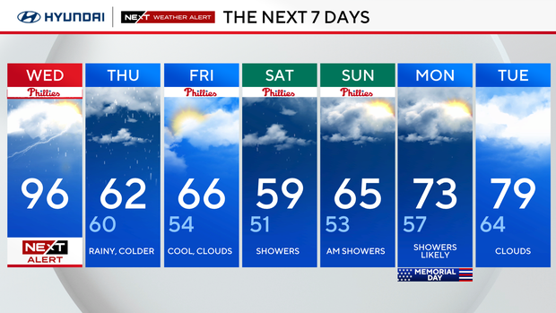
Wednesday: NEXT Weather Alert for heat and storms. High 96.
Thursday: Rainy and colder. High 62, low 60.
Friday: Clouds and cooler. High 66, low 54.
Saturday: Showers. High 59, low 51.
Sunday: AM showers. High 65 low 53.
Monday: Showers likely. High 73, low 57.
Tuesday: Clouds. High 79, low 64.