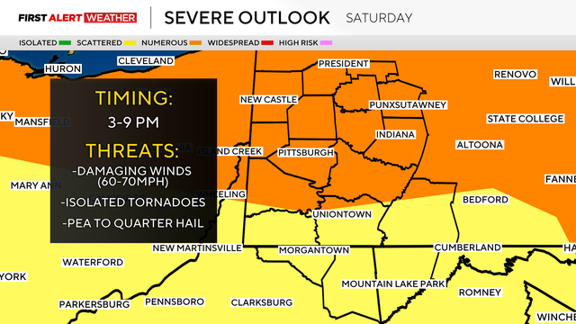
Strong storms move through Pittsburgh region Saturday
The wildfire smoke is moving on, but strong storms are possible this afternoon in Pittsburgh.
Watch CBS News

The wildfire smoke is moving on, but strong storms are possible this afternoon in Pittsburgh.
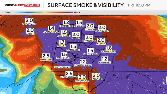
Wildfire smoke is blanketing western Pennsylvania, though the area is expected to get a break soon.

Parts of our area received very heavy rainfall with strong to severe thunderstorms for the third day in a row.
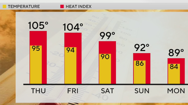
Thursday is expected to be the hottest day of the week with temperatures expected to reach 95 degrees.

The last time Pittsburgh hit 100 degrees was in 1995.

The hottest daytime temperatures of the week are expected on Wednesday and Thursday.
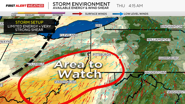
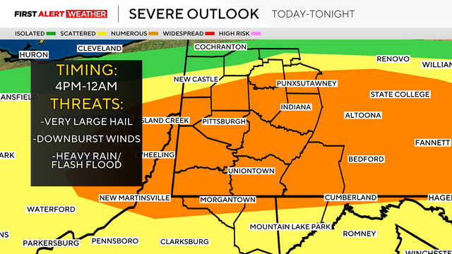
Severe weather, including the potential for a tornado, is possible in the early morning hours of Thursday for parts of the Pittsburgh area.

Not only are there severe weather chances today in Pittsburgh, but it will also be hot and humid.
Scattered showers and storms are possible this weekend in Pittsburgh, but warmer temperatures are coming with them.
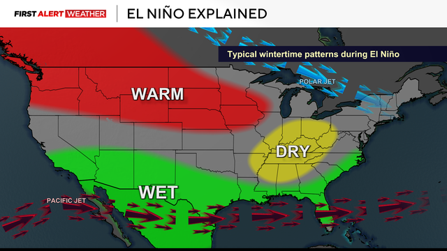
An El Niño is expected to take shape this summer and potentially become very powerful by fall into winter.

There's a slight chance for severe weather this afternoon and evening for the Pirates home opener.

Warmer temperatures with some humidity will end the week as isolated and scattered storm chances remain in Pittsburgh.

After an active overnight with strong to severe storms, we are left with heavy downpours throughout the morning commute and into the afternoon/evening.
The threat of strong storms in Pittsburgh moves on Sunday evening. Heavy winds and rain are possible.
The winds will pick up today as temperatures climb into the 70s.