Snow returns to NYC area Sunday. Maps show how much to expect and when.
Accumulating snow will return to the New York City area Sunday evening into Monday morning.
Because snowfall could be heavy at times and the Monday morning commute could be affected, the CBS News New York First Alert Weather Team has issued a First Alert Weather Day.
Sunday forecast for NYC
Snow moved into the region by around 9 p.m. and could last into Monday morning.
Unlike the snowstorm three weeks ago, this one is not expected to be nearly as impactful. The system will be a relatively quick mover, with clearing skies likely by the afternoon of Presidents' Day.
When will it snow in NYC?
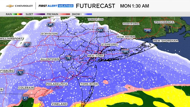
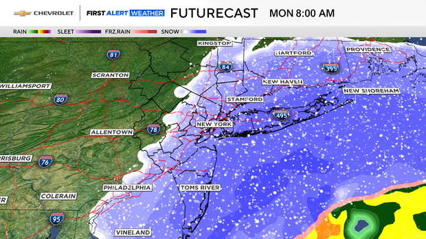
Here's a current timeline of the system's movement:
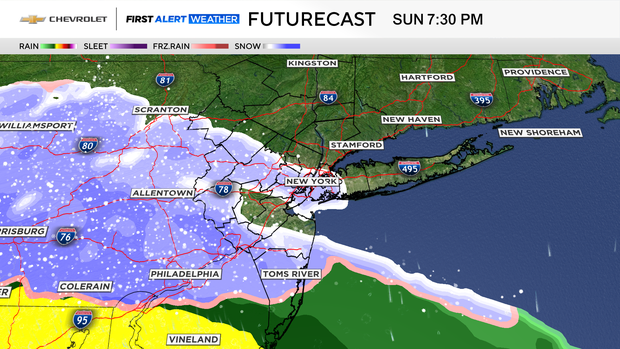
9 p.m. Sunday - 5 a.m. Monday: As colder air gets drawn into the system, the freezing line shifts southward, changing any remaining mixing to all snow. During this timeframe, snow may be moderate to perhaps even heavy at times.
5-9 a.m. Monday: The storm starts winding down, and the snow ends from west to east. In general, a 1-3-inch snowfall is expected, with lesser amounts north of the city, and higher amounts south and east of the city.
How much snow to expect in NYC area
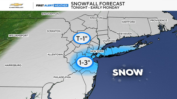
- NYC: 1-3 inches
- Long Island: 1-3 inches. Highest totals likely on the South Shore.
- Central Jersey and Jersey Shore: 1-3 inches
- Northern New Jersey, Lower Hudson Valley, and Connecticut: Trace-1 inch
- Upper Hudson Valley and far Northwestern New Jersey: Trace-1 inch