Showers and storms possible in Southeast Michigan Friday night

The quiet weather we've seen so far in June comes to an end Friday, with showers and storms in the forecast for Friday night and Saturday.

The National Weather Service has placed the area along and west of I-75 under a marginal (1 out of 5) risk for strong to severe storms Friday evening into the overnight.
A cluster of thunderstorms that was moving out of northern Missouri this morning may re-intensify as it moves into southern Michigan during the afternoon and evening. Isolated storms will be capable of producing wind gusts of 40 to 60 mph. Hail is also a threat.
Showers and storms could start as early as 3 p.m., with the most likely period between 6 p.m. and midnight. Scattered showers and isolated storms will continue through much of the overnight hours.
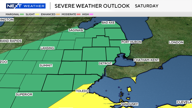
All of southeast Michigan is under a marginal risk for strong to severe storms Saturday afternoon and evening as a cold front moves north to south through the state. The southeast corner of Monroe County is under a slight (2 out of 5) risk. Storms are expected to move through between noon and 5 p.m.
The NEXT Weather team is monitoring this storm system as it gets closer. Have multiple ways to receive warnings and stay weather aware.


