NYC weather starts warm but turns cold this afternoon. Tracking more snow on the way.
NEW YORK -- The weather starts out warm Tuesday around the New York City area, but turns cold and windy by the afternoon.
We're also tracking a wintry mix of snow and rain headed our way later this week.
NYC weather rollercoaster today
After a "balmy" Monday, we have some changes to talk about — including a First Alert Weather Day on Thursday.
Tuesday kicked off in the 40s, which is warmer than our average highs for the day, if you can believe it.
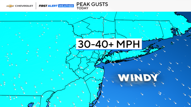
This will be short-lived, however, as a cold front sweeps through the area. This passage will stir up the atmosphere (gusty winds), pull in colder air and drag those temperatures down. In fact, by this afternoon, we'll be talking about wind chills in the 20s.
Tonight is likely our coldest period of the week, as wind chills fall into the teens around the area. Brrr!
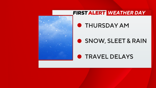
First Alert Weather Day for Thursday morning
Tomorrow is rather benign, as high pressure hangs on. We'll see some high clouds spill in, but the bulk of the area should remain dry. Temperature-wise, you'll need to bundle up, because we're only anticipating highs in the mid 30s, or so.
Late tomorrow night into Thursday is the next period to watch, as we're anticipating a combination of snow, mixed precipitation and rain. That said, a First Alert Weather Day has been issued for Thursday morning.
So, today's key messages: Hold onto your hat this afternoon, bundle up tonight into tomorrow and pack your patience on Thursday.
Stick with our First Alert Weather team for the latest forecast, live radar and weather alerts.