Storm Timeline: Up To 8 Inches Of Snow Expected For Parts Of Our Area From Thursday Storm
By Justin Lewis, CBS2 Meteorologist
Wednesday looks good, but it will be about 15-20 degrees colder than Tuesday (we hit 51). Expect highs in the low to mid 30s with wind chills in the teens/20s.
Wednesday evening's fine with a little snow sneaking into parts of the area overnight. Accumulations by 7 a.m. will range from little to nothing around here with potentially up to .5-1.0" or so, but mainly far west.
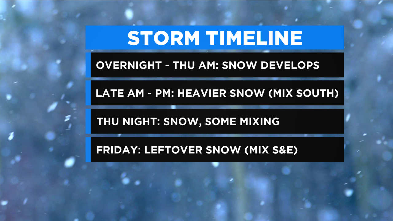
Snow fills in the remainder of Thursday morning with potentially heavier periods of snow moving in late in the morning and into the afternoon. Snow will linger into Thursday evening, but we'll also see that mixing line approach and remain nearby into the overnight hours. A leftover snow/mix is expected on Friday with additional light accumulations possible. When all is said and done we're expecting a substantial part of the area to get 4-8+" with lighter amounts S&E where they'll likely see some mixing.
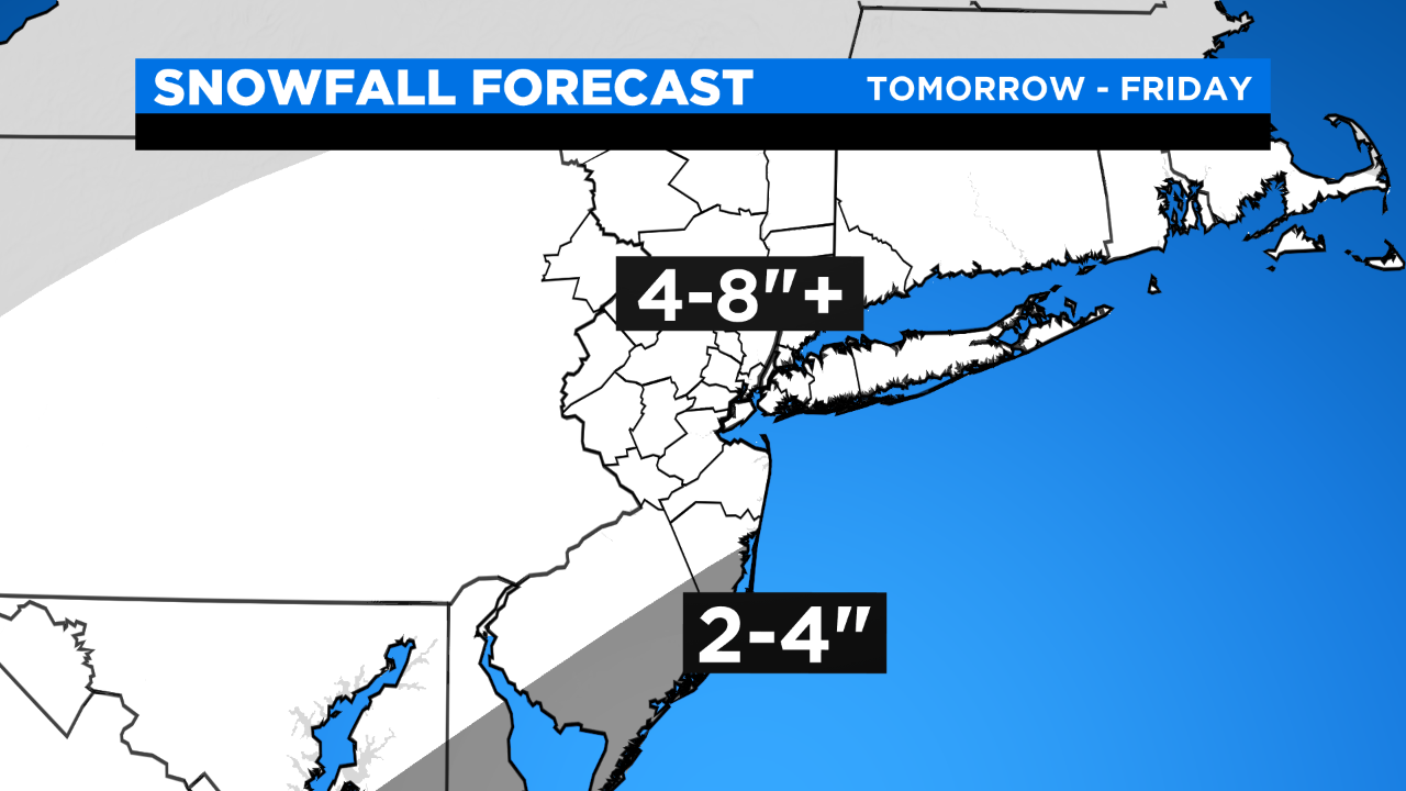
Even as of Wednesday morning there's a bit of a range in the projected snow totals with the NAM putting out 11+" and the RPM only putting out 2" (both attached); the EURO/GFS are a little more in line with our thinking.
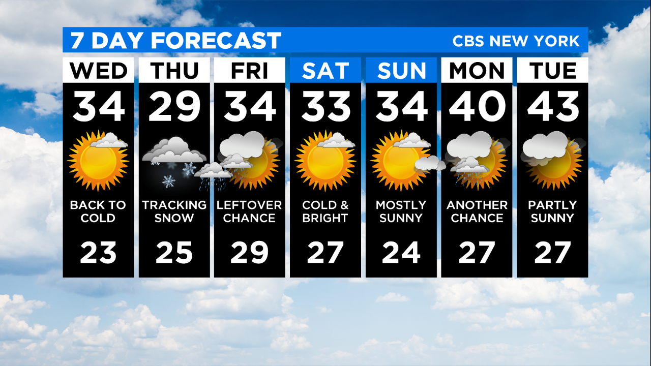
This system will be disruptive because of precipitation/snowfall, it's not a big wind/coastal flooding event.


