First Alert Weather: Red Alert for winter storm that'll bring rain and snow to our area this weekend
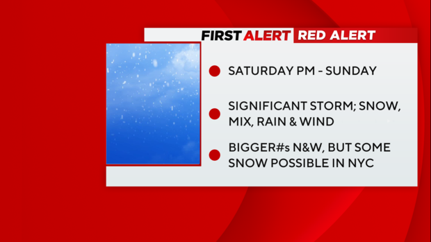
Red Alert remains in place from Saturday afternoon into Sunday due to a significant winter storm overspreading the region.
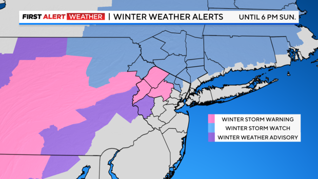
A Winter Storm Warning has been issued for Sussex, Warren, and Morris counties in New Jersey. A Winter Weather Advisory has been issued for Hunterdon County.
A Winter Storm Watch is in place for most other northwestern suburbs through Sunday evening.
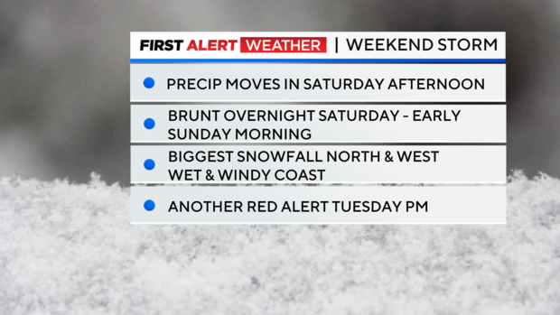
Another Red Alert will go into effect for Tuesday into Wednesday for a storm that will bring heavy rain and wind.
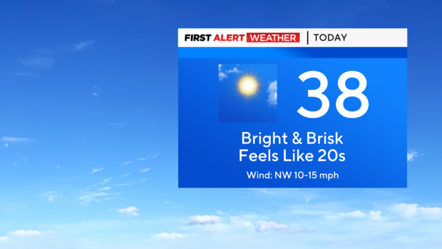
Friday: Sunny and cold. Feels like the 20s. Highs in the mid to upper 30s.
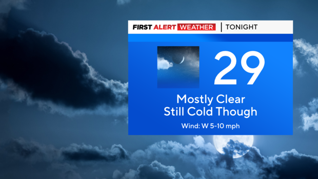
Friday night: Mostly clear and cold. Lows mainly in the 20s.
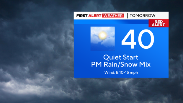
Saturday: A quiet start, but then a wintry mix moves into the region. Highs in the upper 30s to around 40.
Sunday: Wintry mix through early afternoon. Highs in the mid to upper 30s.
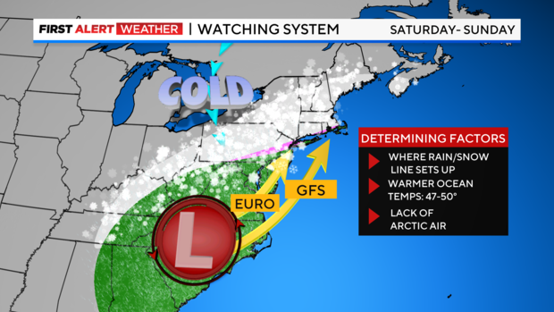
Weekend Storm: Although forecast models have been consistently going back and forth on snow totals for this storm, we now have a better handle on what will play out.
It looks like this system will move into the region on Saturday afternoon and last into Sunday, bringing with it a plethora of precipitation types.
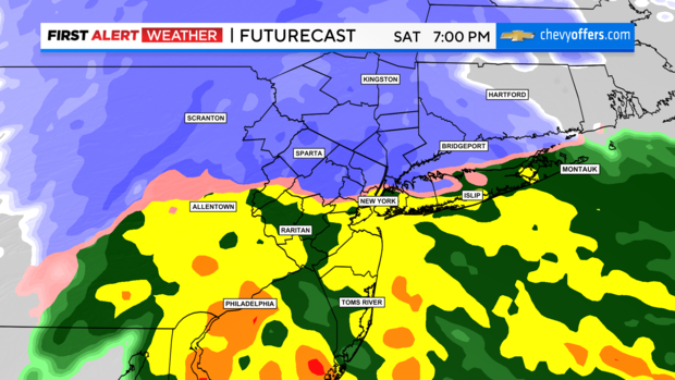
Some portions of our viewing area will see a plowable snowfall, while others may just see rain or a wintry mix.
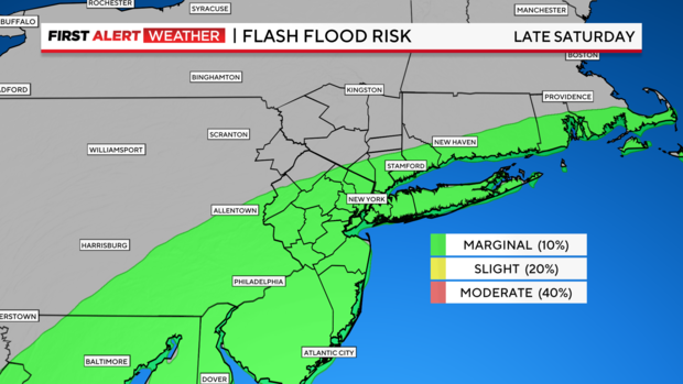
For areas that see more rain, localized flooding is possible.
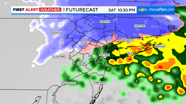
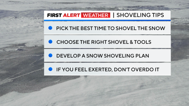
For areas that do see the snow, it will be a heavy, wet snow, so caution will be needed when shoveling.
Gusty winds and coastal flooding are also possible with this storm.
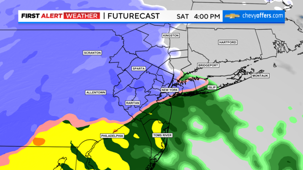
Weekend storm expectations by region
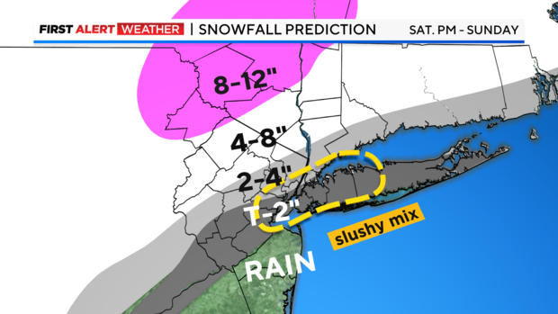
Jersey Shore and Central New Jersey:
Rain or mixed precipitation to start, changing to all rain, then changing to all snow as the storm departs. Final totals: .75-1 inch of rain, coating - 1 inch of snow. Wind gusts up to 50 mph. Coastal flooding and high surf may lead to beach erosion.
Long Island:
Rain or mixed precipitation to start, changing to a mix of rain and snow, then changing to all snow as the storm departs. Final totals: .5-1 inch of rain, coating to 1 inch of snow. Wind gusts up to 50 mph. Coastal flooding and high surf may lead to beach erosion.
NYC:
Snow or mixed precipitation to start, changing to a mix of rain and snow, then possibly all rain for a while, before changing to all snow as the storm departs. Final totals: .5-1 inch of rain, coating-2 inches of snow. The Bronx may see higher snow totals. Wind gusts up to 35 mph.
Hudson Valley, Northern New Jersey:
This is where the highest snow totals are expected. Here, little to no mixing with rain is anticipated. Snow may be heavy at times, amounting from 4-8 inches, with certain spots possibly reaching up to a foot or more. Wind gusts up to 35 mph.
Coastal Connecticut:
Snow to start, changing to a wintry mix, then ending as snow. 2-3 inches of snow is likely. Wind gusts up to 40 mph, with some minor coastal flooding.