First Alert Weather: Red Alert continues for hot, humid conditions and potential afternoon thunderstorms
Alert: Red Alert today because of hazy, hot and humid conditions, as well as iso'd t'storms that have the potential to produce locally heavy rainfall and strong winds.
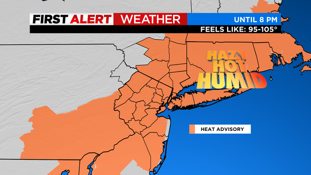
Advisories: Heat Advisory until 8 PM because it will feel like 95-105. High rip current risk along south facing NY beaches.
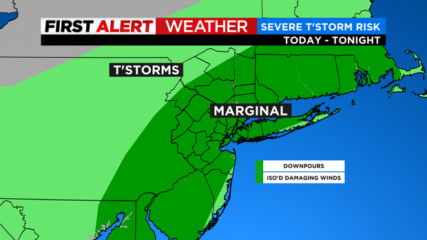
Forecast: Today will be hot and sticky again with scattered showers/t'storms developing after 2 PM. Some of the storms will be capable of producing downpours and even locally damaging winds. As for high temps, they'll be in the low to mid 90s with feels like temps of 95-105. Any leftover shower/t'storm activity will wind down through the evening with generally quiet conditions overnight. The heat and humidity will break tomorrow, but there will be a lingering chance of showers/t'storms. Expect highs in the 80s.
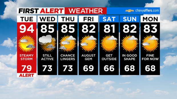
Looking Ahead: There will be a leftover chance of showers/t'storms on Thursday, but mainly in the morning. Expect highs in the 80s once again. As for Friday, it will be mostly sunny with low humidity and highs in the low 80s.