Severe weather chances return to North Texas after devastating storm damage

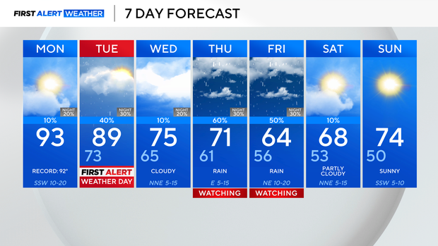
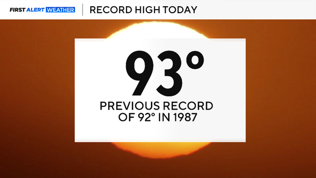
Monday, we broke the daily record high at DFW at 93 degrees, scorching the previous daily record of 92 degrees set in 1987.
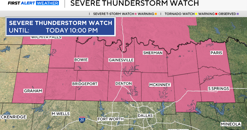
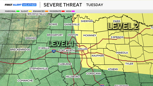
Tuesday will be a First Alert Weather Day due to the potential for strong to severe storms areawide. We have a dryline out to the west and then a cold front that will move through and increase our severe potential. Wind and hail will be the two main threats, along with a low but non-zero tornado risk.
On Wednesday, we'll see temperatures fall into the 70s and continue to cool down through Friday. Periods of rain and storms, with the potential for heavy rain at times, are likely on Thursday and Friday. We will watch for the need for First Alert Weather Days due to disruptive rain. As of now, we dry out just in time for the weekend.