Rain to continue on Monday in the New York City area. Get the First Alert Forecast.
Rounds of rain that hammered the New York City area over the weekend will continue somewhat on Monday.
Heavy rain moved through the region during the early morning hours on Sunday, but the rest of the day was mostly dry. However, the lull in activity won't last long, as yet another period of steady rain, and perhaps even a thunderstorm, will arrive late Sunday night into Monday morning. Most of the area will see just plain rain, but as colder air filters in overnight, our northernmost communities could even see a wintry mix.
Monday's forecast
The bulk of the wet weather should be done by 10 a.m., with additional rounds of showers sporadically occurring throughout the day, especially south and east of New York City.
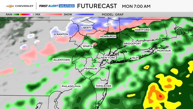
Rainfall totals through Monday evening look to average between a quarter and half an inch, with some locally higher totals. As for snow totals, only around 1 inch of accumulation is likely at the highest elevations north and west. Given the high April sun angle, any accumulations would mainly be on grassy surfaces.
Once the rain finally comes to an end by late Monday evening, a potent cold front will usher in very chilly air, keeping temperatures below normal through most of the week. Along with the chilly air will come gusty winds on Tuesday that could top 40 mph at times, and a wind advisory may be issued.
Highs for Monday through Wednesday will not get out of the 40s, and overnight lows will get to freezing and below a few nights.


