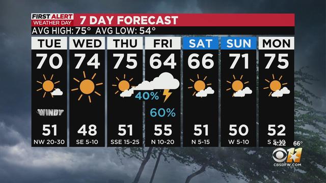
Temperatures to hit uppers 70s before heavy rain moves back in Thursday
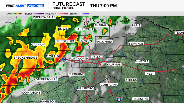
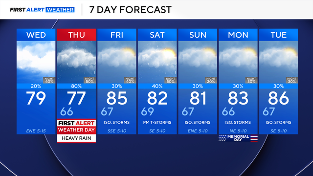
Thursday is a First Alert Weather Day due to the threat of heavy rain and non-severe thunderstorms.
Watch CBS News
Thursday is a First Alert Weather Day due to the threat of heavy rain and non-severe thunderstorms.
The weather will quiet down overnight and cool down on Wednesday, with cloudy skies and highs in the 70s.
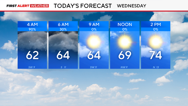
A First Alert Weather Day is in place for Wednesday morning due to the threat of flooding.
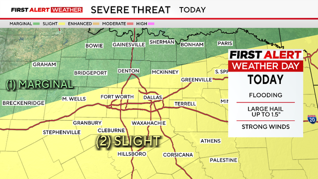
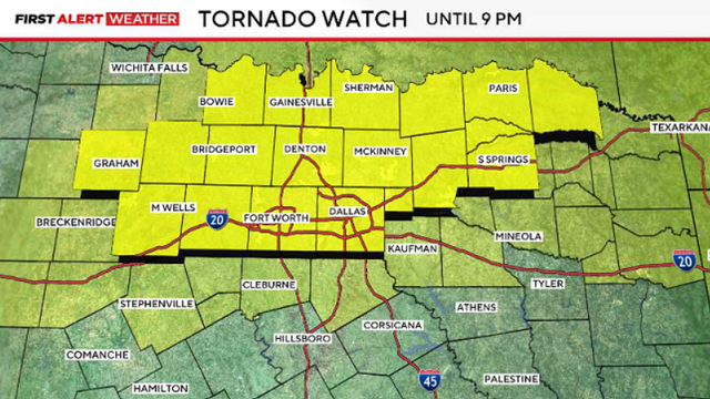
The main risks will be large hail and damaging winds; however, an isolated tornado is still a possibility.

In the late-night hours, damaging winds and flash flooding are the highest risks.

First Alert Weather Days have been issued for Sunday and Monday due to the severe weather threat.
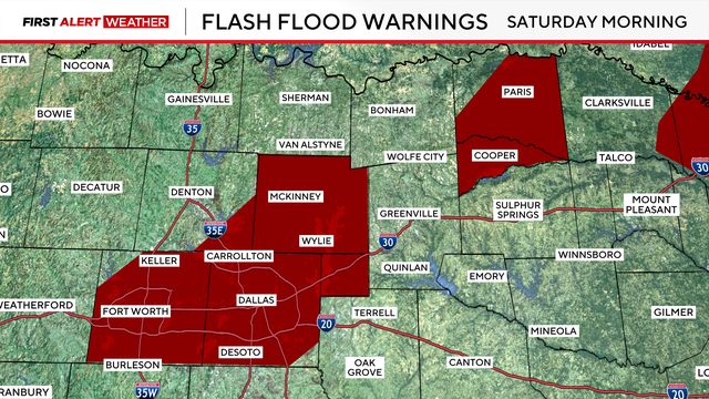
Heavy rains have brought flood and hail threats. The weekend clears up, but expect much colder air to follow.
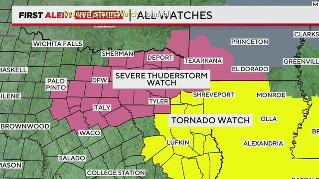
A severe thunderstorm watch remains in effect for Delta, Ellis, Hopkins, Hunt, Johnson, Kaufman, Navarro, Rains, Rockwall and Van Zandt counties until 2 a.m.
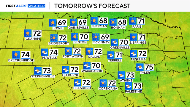
After severe storms with hail and lightning move through North Texas, expect clearing skies and warmer temperatures Saturday afternoon, with highs reaching the mid-60s.
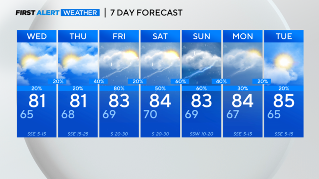
It's storm season in North Texas. CBS News Texas meteorologists are looking at the possibility of severe storms in the metroplex starting Friday afternoon.
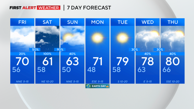
The National Weather Service has issued a Severe Thunderstorm Watch for parts of North Texas through 11 p.m. which includes Dallas and Collin counties.
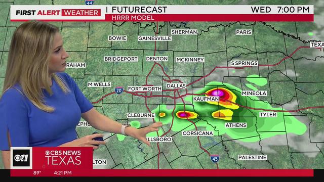
The watch includes the Metroplex. Large to giant hail is possible.
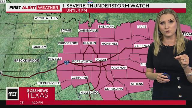
Severe storms are likely for most of North Texas Tuesday.
Counties west of the metroplex are under a severe thunderstorm watch until 9 p.m. Monday.