Mostly cloudy, warm Monday in Philadelphia region
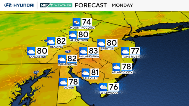
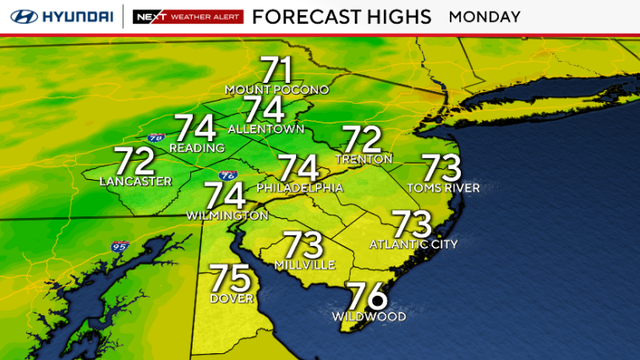
Monday in the Philadelphia region will be pleasant with highs in the 70s and low 80s, a mix of sun and some high clouds drifting in from the south.
Watch CBS News

Monday in the Philadelphia region will be pleasant with highs in the 70s and low 80s, a mix of sun and some high clouds drifting in from the south.
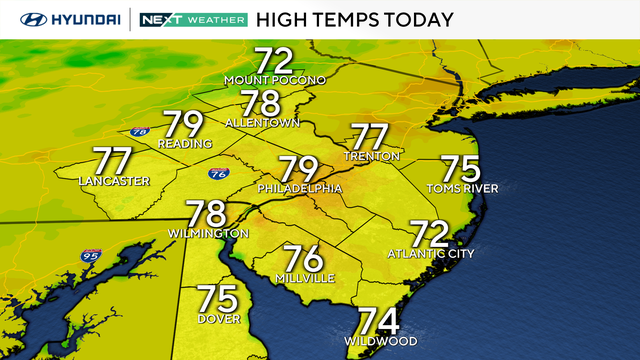
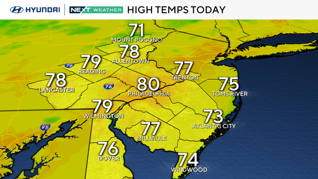
Clouds increase in the Philadelphia area Monday and highs will reach the upper 70s or low 80s.
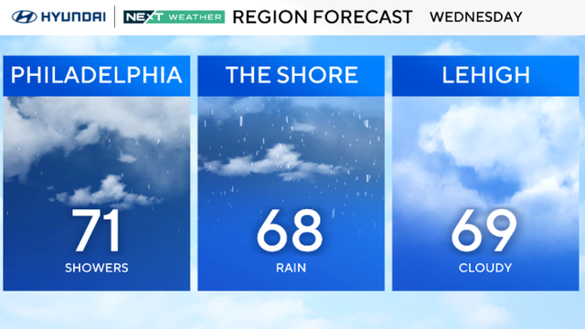
The Philadelphia region will have a chance of rain showers on Wednesday, but no severe weather is expected.
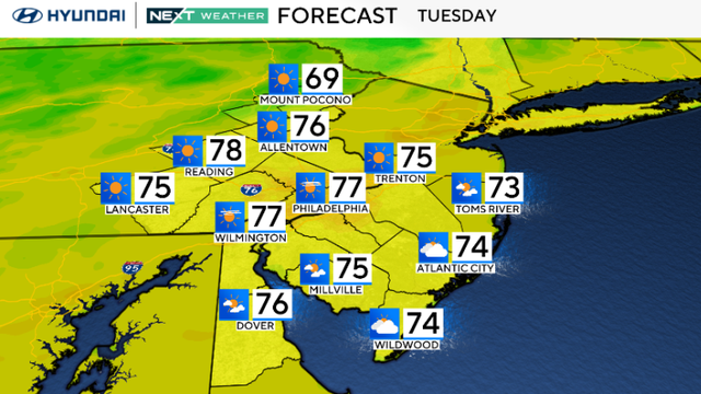
Tuesday stays pleasant with highs in the low to mid 70s in the Philadelphia region.
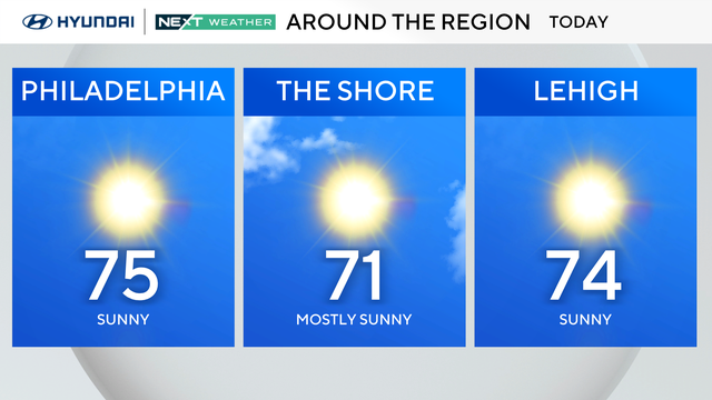
Monday in the Philadelphia region will be a pleasant, crisp day with sunshine and highs in the mid-70s.
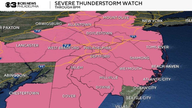
Storms are moving out of the Philadelphia region as a severe thunderstorm watch was in effect Saturday evening.
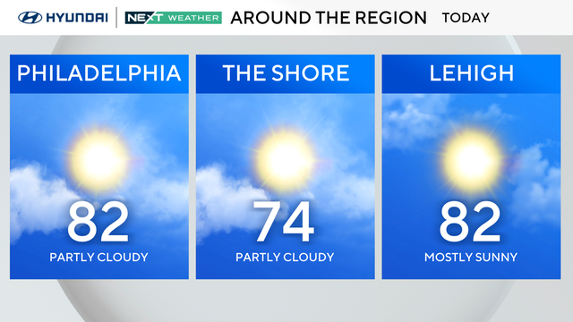
Nice weather continues in the Philadelphia area this week with highs near 80 degrees and lows in the 60s.
The great weather will continue through the middle of the week with low temperatures near 60 degrees and highs near 80 degrees.
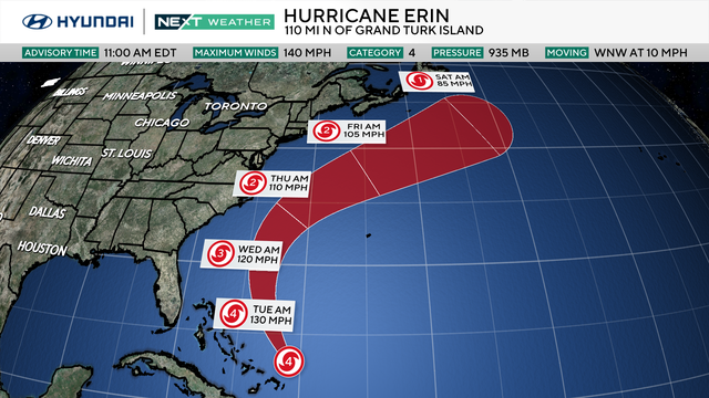
Some beaches in the Delaware Valley have prohibited swimming as a precaution as Hurricane Erin moves closer to the East Coast.
Much cooler air is arriving in the Philadelphia area, bringing temperatures in the 70s for Monday.
A NEXT Weather Alert is in effect on Sunday night as multiple counties in the Philadelphia region are under a flash flood warning due to heavy rain.
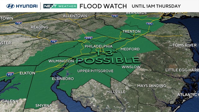
A flood watch is in effect for most of the Philadelphia region through early Thursday morning as heat, humidity and storms make a comeback.
We may make a run for 90 this afternoon, but most spots should top out in the upper 80s.
Sunday will have plenty of sunshine and light southerly breezes. However, several Pennsylvania counties will be under an air quality alert.
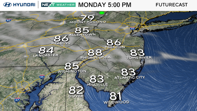
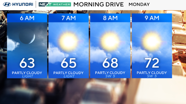
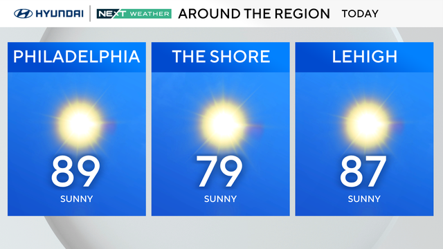
Monday brings sunshine, low humidity and highs in the upper 80s to the Philadelphia area, with a few spots near 90.