
NOAA says it will keep receiving weather data from military satellites
After announcing it would lose access to key weather satellite data, NOAA will retain access, the agency said in a statement.
Watch CBS News

After announcing it would lose access to key weather satellite data, NOAA will retain access, the agency said in a statement.
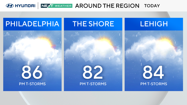
You'll want to keep the umbrella handy, too, because scattered showers and storms develop between 2 p.m. and 4 p.m., moving west to east, and ending before 9 p.m.
Some of the nicest days of the summer so far are in the forecast for Philadelphia this week.
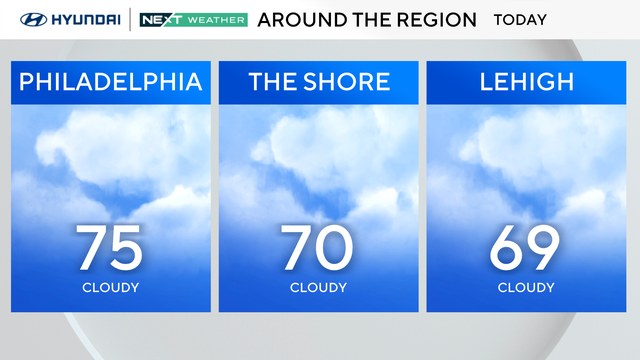
Sunday will give us mixed skies with a trend for much more sunshine than Saturday. We cannot rule out an additional shower or rumble.
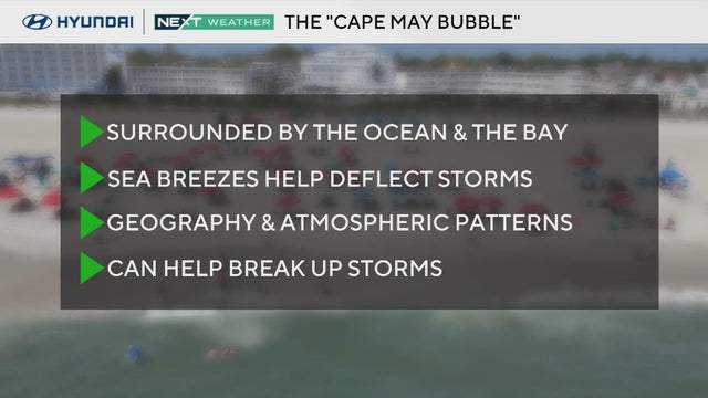
CBS News Philadelphia explains the geography patterns of the mysterious Cape May Bubble.

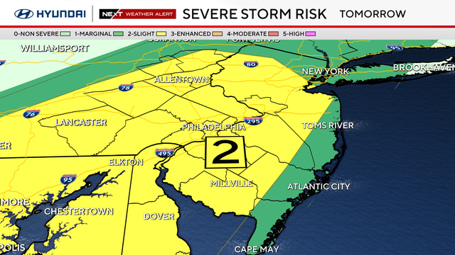
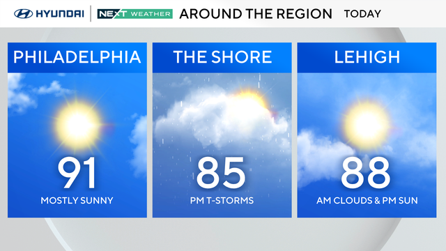
Monday is a NEXT Weather Alert day in the Philadelphia area because of the risk of flash flooding.
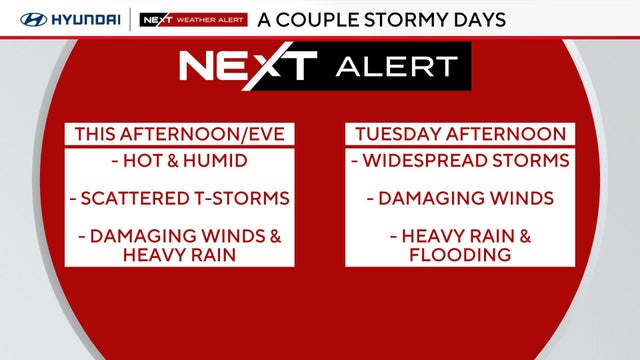
The Philadelphia area can expect hot and humid conditions Sunday with isolated storms possible.
A NEXT Weather Alert is in effect due to the heat and because of the threat of storms Tuesday evening in the Philadelphia region.
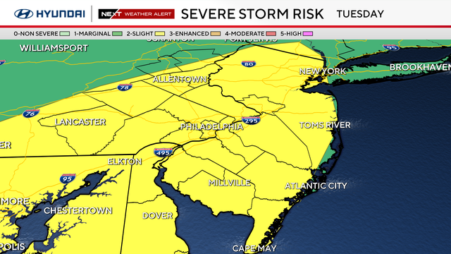
A severe thunderstorm watch is also in effect until 9 p.m. Tuesday for parts of Delaware and South Jersey.
Scattered showers and thunderstorms are moving through the Philadelphia region on Monday.
The weather in Philadelphia on Sunday will be hot but less humid than on Saturday.

The high temperature so far at Philadelphia International Airport reached 99, breaking a record high of 98 set last year.
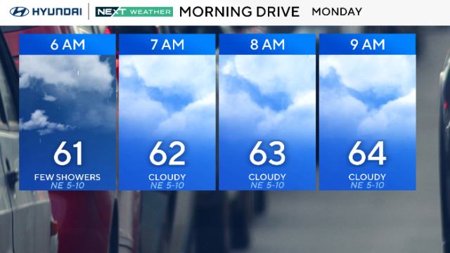
We're kicking off Monday just like the weekend — more clouds, scattered showers and temps stuck in the 60s in the Philadelphia region.
In the Philadelphia area, Monday begins with a chance of just a few scattered showers early followed by a mostly cloudy day.
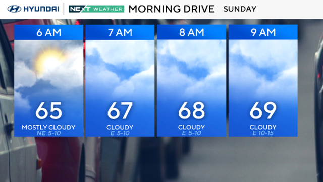
A light, isolated shower is possible Sunday morning, but the bigger chance for heavy rain and scattered thunderstorms is this afternoon around 3-4 p.m.