Tornado warnings reported in Michigan; heat and humidity building


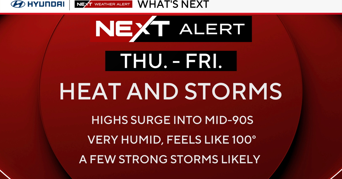
The weather forecasts for Wednesday and Thursday continue to indicate high heat and humidity for Southeast Michigan, including an increased chance of severe weather on Thursday.
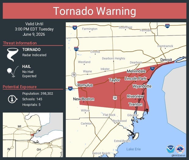
In the meantime, there were multiple tornado warnings issued in Michigan on Tuesday due to rotation detected.
CBS Detroit chief meteorologist Ahmad Bajjey has been tracking those reports.
Watch vs warning
The National Weather Service in Detroit issued the following tornado warnings in Michigan on Tuesday.
- 12:11 p.m. Eastern time for parts of Saginaw and Shiawassee counties.
- 12:30 p.m. Eastern time for part of Saginaw County.
- 1:13 p.m. Eastern time for part of Genesee County.
All of those had cleared by 2 p.m.
Afterwards, there was the following tornado warning:
- 2:20 p.m. Eastern time for part of Wayne County. This one was canceled about 2:48 p.m., a little earlier than expected.
The National Weather Service says a severe weather watch means "be prepared." It is possible that weather will reach severe levels during the time frame specified.
A severe weather warning means "take action," that severe weather conditions have been reported by spotters or can be detected on radar. People are asked to take shelter indoors, away from windows.
A warning can be issued even without a watch in effect.

Looking ahead to Wednesday and Thursday
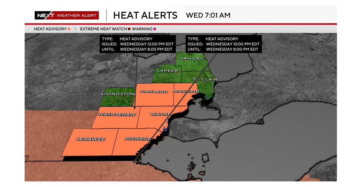
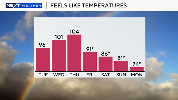
Both Wednesday and Thursday will be NEXT Weather Alert Days because of the heat and storm concerns. The National Weather Service in Detroit has issued a heat advisory for noon to 8 p.m. Wednesday for much of Southeast Michigan.
A NEXT Weather Alert Day means you'll see the CBS News Detroit weather team stepping up their forecasts and announcements about the conditions in the region.
The dangerous conditions will build across Southeast Michigan on Wednesday and Thursday, with afternoon temperatures climbing into the lower and middle 90s. Combined with dew points well into the 60s and lower 70s, heat index values are expected to reach the upper 90s to near 100 degrees or greater, making it feel significantly hotter than the actual air temperature.
Residents should be prepared for potentially hazardous heat conditions, especially during the afternoon and early evening hours when the combination of heat and humidity will be at its peak.
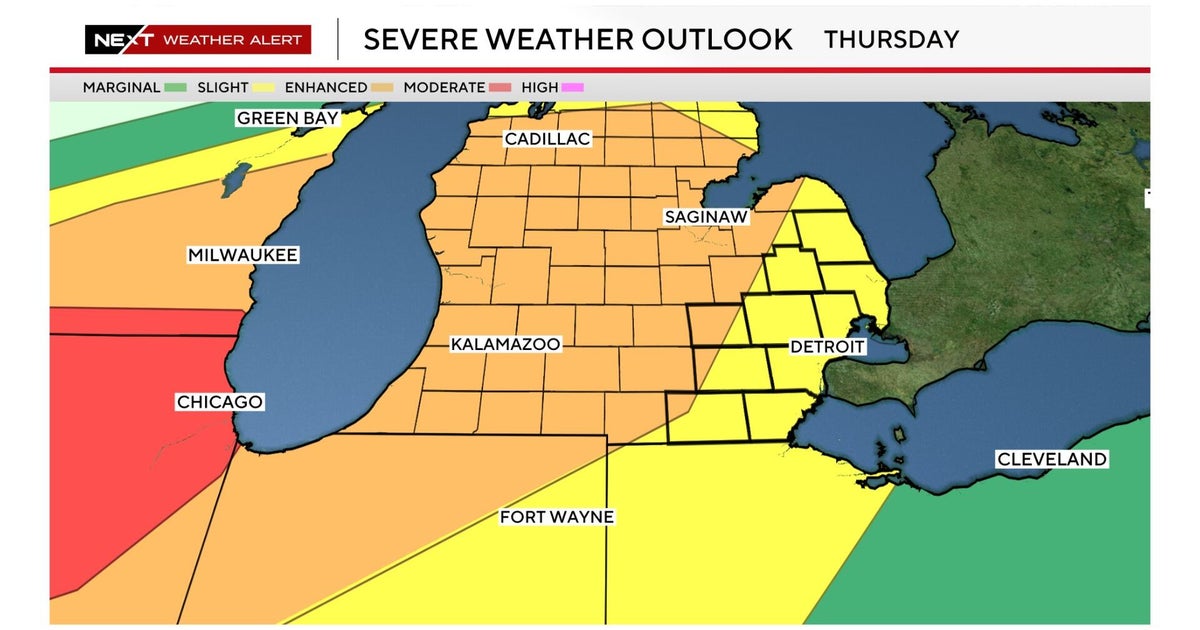
In addition to the heat, the threat for severe thunderstorms will increase during that time frame.
Isolated to scattered storms may develop Wednesday night, but the greater severe weather potential appears to be on Thursday as a strong weather system moves into the Great Lakes.
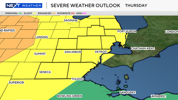
Damaging wind gusts are currently the primary concern, although large hail and an isolated tornado cannot be ruled out depending on how the atmosphere evolves. The combination of intense heat, high humidity, and increasing wind energy aloft will create a favorable environment for strong to severe thunderstorms capable of producing localized damage and heavy rainfall.