3/10 CBS2 Thursday Afternoon Weather Headlines
We'll see more clouds than we did yesterday, but much of the shower activity will remain to our north. As for temps, they'll manage to climb into record-breaking territory again... mid 70's!
Watch CBS News
We'll see more clouds than we did yesterday, but much of the shower activity will remain to our north. As for temps, they'll manage to climb into record-breaking territory again... mid 70's!

The heat is on this afternoon as temperatures soar into record territory -- mid 70's!

Despite the sunny start, clouds will be on the increase into the evening, ahead of a low pressure system.

Outside of the dramatic temperature drop and blustery winds, there's not much else going on -- just some chilly sunshine to enjoy.

A breeze out of the west will make it feel more like the 30s at times, despite highs in the low 40s.

While the thermometer may reach the mid to upper 30s, it will only feel like the upper 20s to around 30° -- stay warm!

Temperatures only hit 17 for the high in NYC, which would tie for record coldest Valentine's Day.

The FDNY warns not to use your stove for heat as it poses a risk for not only fire, but carbon monoxide.

We have a cold stretch ahead of us over the next four days. Starting today, temperatures will not reach the freezing mark in New York City.

Meteorologists and local officials are keeping a close eye on a weather system that could potentially bring heavy snowfall to the Northeast.

People across the Tri-State area bundled up Tuesday as frigid temperatures and wind gusts made it apparent winter has finally arrived.

The cold weather had people digging into their closets for their winter weather gear for the first time this season.

CBS 2's Lonnie Quinn has been out on Super Bowl Boulevard doing the weather forecast the past couple of nights -- and you may have noticed he changed his hat on Wednesday.

After a gusty Saturday, winds up to 25 mph will keep temperatures cool with a high of 64 degrees to finish out the weekend.

Sunday's weather was not anything near what Fall normally feels like, and the warm weather will continue into Columbus Day on Monday.

As the clouds continue to cover the Tri-State region, residents may want to keep an umbrella handy on Sunday.

With a week until the start of spring, temperatures are beginning to feel like spring, rising to the 50s on Sunday in the Tri-State.

The Tri-State was seeing heavy showers on Sunday with the potential for an additional 1 to 2 inches. Rain is expected to continue steadily into the overnight hours before ending after midnight.

The Tri-State will get something on Sunday it hasn't gotten in quite some time: sunshine.
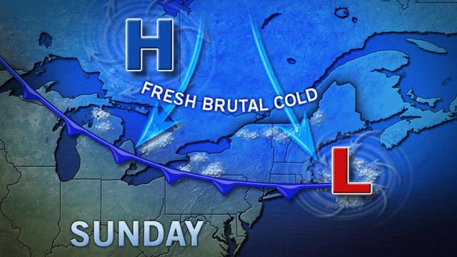
A frigid arctic wind is keeping temperatures anywhere from below 0 to single digits and into the teens as the Tri-State bundles up for the cold.

Tri-State Area residents will be able to get by without the heavy coats at temps hit the 40s and 50s throughout the area. New York City will see a high of 49 degrees and a low of 42—both above average.

Tri-State residents have much to celebrate this New Year's Eve and Day as temperatures will be quite mild with a high of 45 degrees.

The weather isn't warming up anytime soon and there's even a chance of snow for the Tri-State area this weekend.

An early winter snow storm may have missed the Tri-State Area, but that doesn't mean it won't be cold here. CBS 2's John Marshall reports.
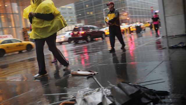
As the rain continues to plague the tri-state area on Sunday, a break is expected around mid-day before the front brings another round of rain in the late afternoon, CBS 2's John Marshall reports.