Winter storm warning issued for NYC, surrounding area ahead of heavy snow, dangerous cold
While the cold will certainly make itself known this weekend, it's the heavy, sprawling snowfall that's gearing up to steal the spotlight across the New York and New Jersey area.
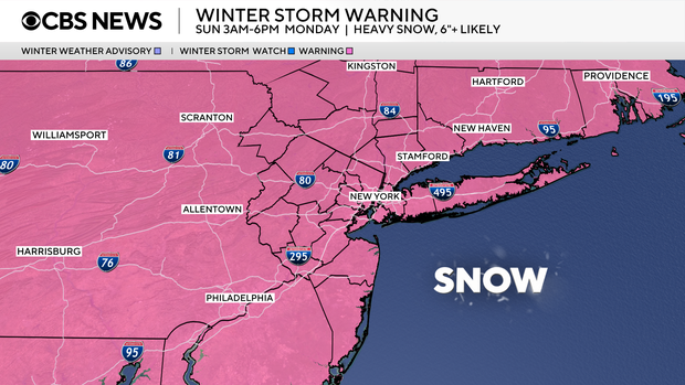
The National Weather Service has issued a winter storm warning for New York City, Long Island, the northern suburbs as well as parts of northeast New Jersey and southern Connecticut starting at 3 a.m. Sunday through 6 p.m. Monday. A cold weather advisory will go into effect for part of the weekend.
Click here for the latest weather watches, warnings and alerts.
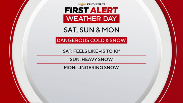
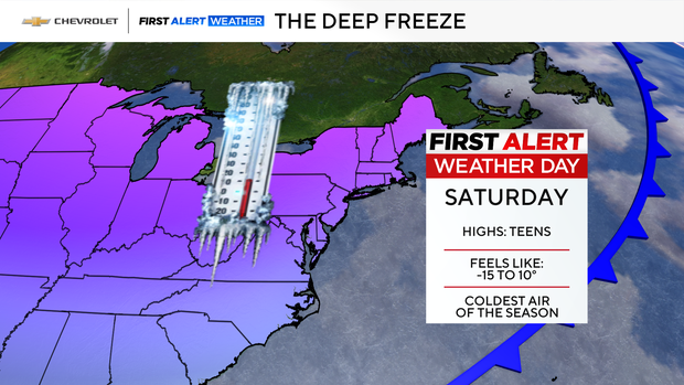
Saturday, Sunday and Monday are First Alert Weather Days due to the impact of the impending storm, and cold.
The system will start in the Southern Plains on Friday before moving across the South and into the East Coast. As the system moves, temperatures will plummet, bringing heavy snow, ice and dangerously cold weather.
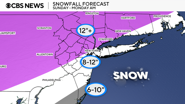
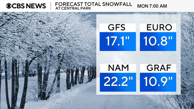
Projected snowfall amounts
New Yorkers could see 6-12 inches of snow from Sunday to Monday.
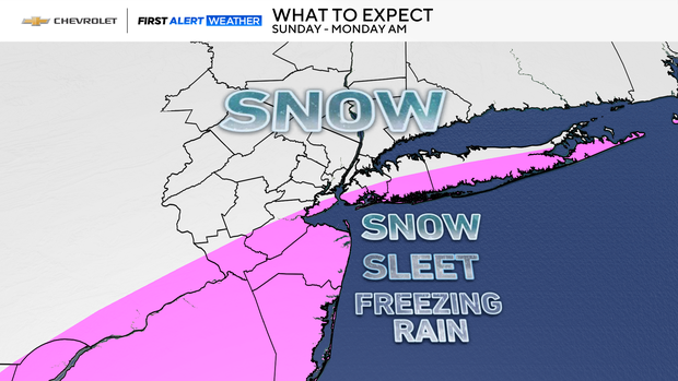
Expect heavy snow in the city and northern suburbs of New York. Expect snow, sleet and freezing rain mainly south and east of the city.
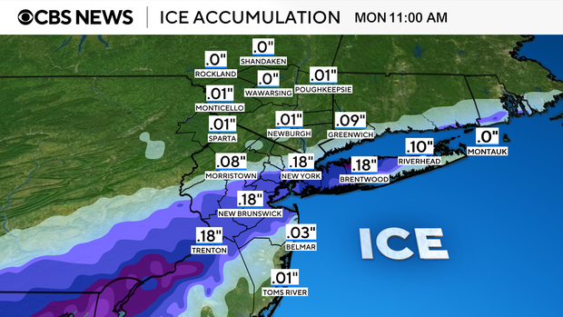
Ice accumulation is a concern due to the extremely cold temperatures and could make for hazardous driving conditions.
As for snow totals, different models continue to show a pretty wide range of possibilities come Monday morning. The NAM is the most aggressive, with 22.2", followed by the GFS with 17.1", and then the GRAF shows 10.9", and the European shows 10.8"
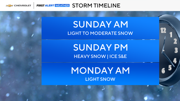
Snowstorm timing
By Sunday morning, the snow machine switches on with light to moderate snowfall, quickly intensifying through lunchtime. And by the afternoon and evening, we're in the thick of it—heavy, steady snow with widespread accumulations.
On Monday morning, expect light snow and some lingering flurries
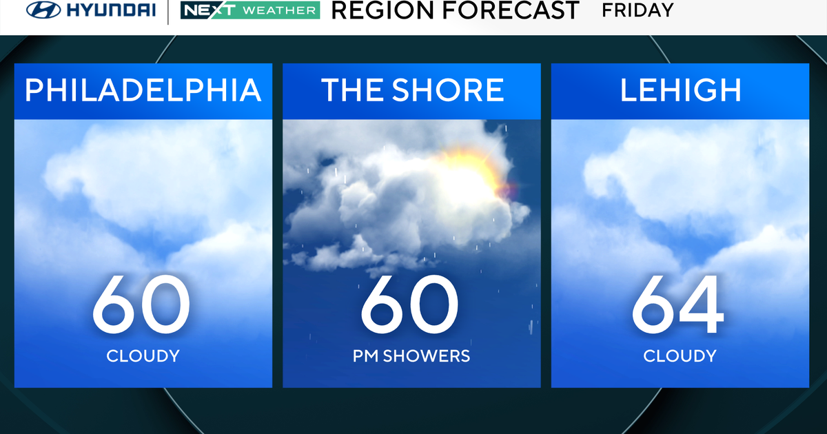
Cold weather advisory takes effect Friday night
It's a frigid and blustery Friday with temperatures that feel like 0° to 15°.
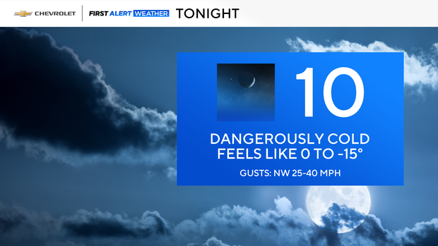
The cold weather advisory starts at 10 p.m. Friday and continues through 10 p.m. Saturday. Temperatures will feel like -5° to -25°.
Bottom line: Bundle up, sure—but more importantly, get the shovels ready. This is shaping up to be a significant, all‑day Sunday snowstorm.